Turn on suggestions
Auto-suggest helps you quickly narrow down your search results by suggesting possible matches as you type.
Cancel
- Home
- :
- All Communities
- :
- Products
- :
- ArcGIS Pro
- :
- ArcGIS Pro Questions
- :
- Geoprocessing: output file paths
Options
- Subscribe to RSS Feed
- Mark Topic as New
- Mark Topic as Read
- Float this Topic for Current User
- Bookmark
- Printer Friendly Page
Geoprocessing: output file paths
798
1
08-07-2024 06:48 AM

08-07-2024
06:48 AM
- Mark as New
- Bookmark
- Subscribe to RSS Feed
- Permalink
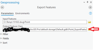
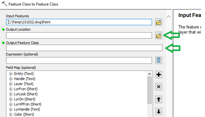
Is there a way to stop the program from providing a default file path in the Output Feature Class? I looked through the Options under Geoprocessing but did not find anything. This default file path is a problem because users (including myself) will accidentally leave the path as is and end up writing the output to the wrong location.
What I don't want:
What I do want:
Paul Lohr
Lohr Geospatial Services, Inc.
Lohr Geospatial Services, Inc.
1 Reply

08-07-2024
07:36 AM
- Mark as New
- Bookmark
- Subscribe to RSS Feed
- Permalink
Try setting the Output Feature Class first then set the Input Features.
