- Home
- :
- All Communities
- :
- Products
- :
- ArcGIS Pro
- :
- ArcGIS Pro Questions
- :
- Failing in using Data Interoperability in PRO to c...
- Subscribe to RSS Feed
- Mark Topic as New
- Mark Topic as Read
- Float this Topic for Current User
- Bookmark
- Subscribe
- Mute
- Printer Friendly Page
Failing in using Data Interoperability in PRO to convert IFC solids into multipatch featureclasses
- Mark as New
- Bookmark
- Subscribe
- Mute
- Subscribe to RSS Feed
- Permalink
I am trying to use the Data Interoperability extension within ArcGIS Pro (1.4.1) to reproduce what I was able to do from within ArcMap: converting a IFC to a ESRI fGDB format. The IFC has solid geometries and I would need to export them as multipatch. I attached the IFC if anybody is interested in helping.
First thing I noted: there is no Quick Import in PRO. With ArcMap, I sued to use the Quick Import with the settings provided in this ESRI post and the translation was succesfull.
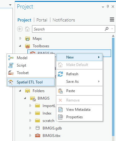
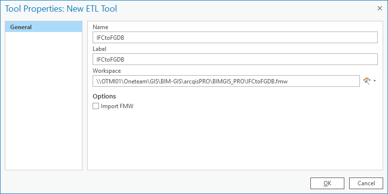
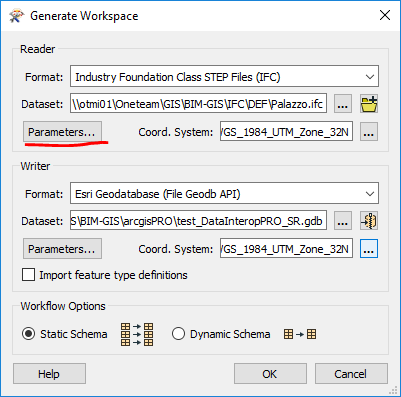
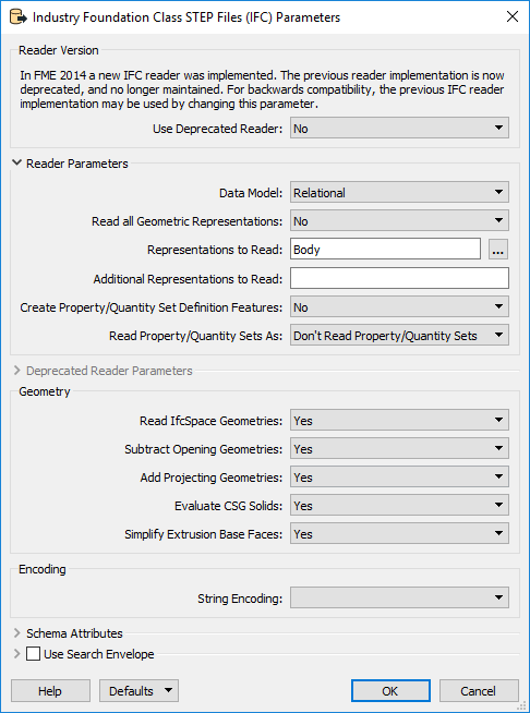
In PRO I tried this workflow with no success (steps, figures, and results):
- Creation of a new ETL Tool from the Project Pane
- Location and Name choice
- Generate Workspace Window settings (Coord. System should be correct, and it worked with the Quick Import in ArcMap)
- IFC parameters settings as in ESRI post.
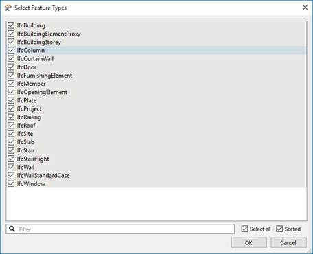
- Choice of the Feature Types (I left everything checked as the default)
- Model execution (through the green RUN button)
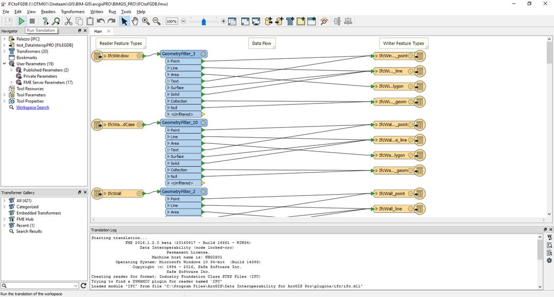
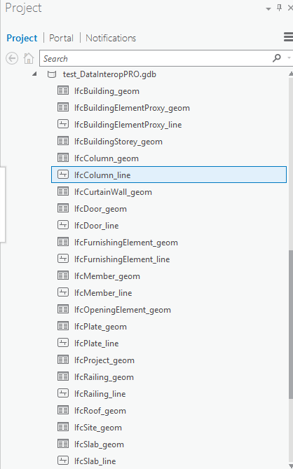
The output is just a bunch of Tables and some empty linear featureclasses. Also, I attached the Translation Log if it might help.
From ArcMap, using the same dataset, same coordinate system, and same IFC parameters as in the linked post, I am able to export multipatch geometries. Unfortunately, ArcMap is not an option right now, and I have to stick with PRO to do this. Any help will be greatly appreciated.
Finally, I attached the zipped GDB derived from this process (test_DataInteropPRO_SR.gdb.zip).
Solved! Go to Solution.
Accepted Solutions
- Mark as New
- Bookmark
- Subscribe
- Mute
- Subscribe to RSS Feed
- Permalink
Hi Alessandro
My apologies for not being specific, the File Geodatabase API writer does not support multipatch writing:
Esri Geodatabase (File Geodatabase API) Quick Facts
Regards
Bruce
- Mark as New
- Bookmark
- Subscribe
- Mute
- Subscribe to RSS Feed
- Permalink
Thanks Bruce for taking the time to test it. Anyway, I will come back to this and possibly mark your answer as correct, but I would need time to see the differences in the settings (I am newbie with FME stuff). What I saw looking at the parameters quickly, is that we used a different output format (you chose GEODATABASE_FILE (ArcObjects) I have FILEGDB). Also, you have two voices under Feature Types under the output which I don't have, namely "PropertySetDefinition" and "QuantitySetDefinition". Again, I'll ome back to this as soon as I can. Thanks for the response, and meanwhile if you could give me some details on what you did it would be very appreciated.
- Mark as New
- Bookmark
- Subscribe
- Mute
- Subscribe to RSS Feed
- Permalink
Hi Alessandro
My apologies for not being specific, the File Geodatabase API writer does not support multipatch writing:
Esri Geodatabase (File Geodatabase API) Quick Facts
Regards
Bruce
- Mark as New
- Bookmark
- Subscribe
- Mute
- Subscribe to RSS Feed
- Permalink
This is great news! Indeed, I tried the exact same procedure I described above, this time choosing "GEODATABASE_FILE (ArcObjects)" as output format instead of "File Geodatabase API". Everything worked just fine! Thank you.