- Home
- :
- All Communities
- :
- Products
- :
- ArcGIS Pro
- :
- ArcGIS Pro Questions
- :
- Re: Exporting to PDF from ArcGIS Pro is producing ...
- Subscribe to RSS Feed
- Mark Topic as New
- Mark Topic as Read
- Float this Topic for Current User
- Bookmark
- Subscribe
- Mute
- Printer Friendly Page
Exporting to PDF from ArcGIS Pro is producing large file sizes
- Mark as New
- Bookmark
- Subscribe
- Mute
- Subscribe to RSS Feed
- Permalink
Hi all,
I've reproduced some of my old map documents in ArcGIS Pro, believing there would be some efficiencies in this. When I export these layouts to PDF, the resulting files are about 5x larger than the same maps exported out of ArcMap (~5MB vs < 1MB). The export options are set-up the same in both Pro and ArcMap and I've also experimented with Resolution (dpi) & Image Quality, to no avail. Even at a 96 dpi and "Fastest" imagey quality, I'm getting 5MB PDF's.
Any thoughts? I've looked all around and cannot find any articles addresses this issue.
Thanks!
- Mark as New
- Bookmark
- Subscribe
- Mute
- Subscribe to RSS Feed
- Permalink
This dialog is great and I really hope you are part of the EAP for the next release!
Output As Image option:
In ArcGIS Pro 2.3, for all vector output formats (EMF, EPS, PDF and SVG), we added a new checkbox option in the export dialog called "output as image". This rasterizes all vector content. It will drastically reduce file size for maps that have very detailed vector content like in the examples provided above but the trade-off is that you will lose capabilities like preserving layer attributes.
Future vector generalization:
We are in the design phase for new the export capabilities in 2.4 so it is difficult for me to confirm exactly how it will work. Currently, in Pro and ArcMap, if all you have is vector content, changing the resolution(dpi) setting will have no effect on output file size. In Pro (post 2.3), this control along with other controls will be reworked to give you the much better control over how vector data is simplified as well as raster data. How the vector simplification algorithms will work and the exact user experience is still part of daily, current discussions here in software development.
I really hope this helps and again, it would be great if you are part of the EAP for the next release.
Jeff
- Mark as New
- Bookmark
- Subscribe
- Mute
- Subscribe to RSS Feed
- Permalink
Jeff,
Will this rasterization option retain the full symbology of existing maps? Is it going to be truly WYSIWYG, except for being rasterized at hopefully high ppi (300+ ppi minimum)?
I ask this, because e.g. the high performance engine driving creation of (raster) tiles for web maps, isn't capable of fully retaining symbology, there are some debilitating limitations. This is actually a bit of a headache, as it seems, even if you explicitly choose to build tiles locally instead of in the cloud, you still loose the ability to fully retain detailed topographic styling. Maybe I have missed it while looking over the options, but it seems ESRI actually currently offers no option at all, not even as a simple flattened single layer rasterized image, to retain full high quality cartographic maps in some form of a web mapping service.
It would be a pain to see similar limitations in a future PDF rasterization output option, with loss of vital symbology. I really hope for a true WYSIWYG solution.
- Mark as New
- Bookmark
- Subscribe
- Mute
- Subscribe to RSS Feed
- Permalink
Hi,
I agree with Marco. A few months ago, I tried to upload a simple rasterized, tiled, on ArcGIS Online as a truly static "Web Map" for my organization and dotted lines were to rendered properly...
On the other hand, all these dotted do export properly in regular .png directly from Pro.
Something is not consistent in the raster exports.
- Mark as New
- Bookmark
- Subscribe
- Mute
- Subscribe to RSS Feed
- Permalink
Symbology in your web maps with the tiled web services wouldn't be the same thing as exporting a rasterized image for vector data in a PDF export of a map (traditional map with a layout). ArcMap already has this ability. This is commonly used when there are a lot of complex vector layers in a map, especially with transparency, and a lot of times are being used collectively as a basemap or are in addition to another basemap (already a raster).
- Mark as New
- Bookmark
- Subscribe
- Mute
- Subscribe to RSS Feed
- Permalink
Hi Jeff,
Thanks for sharing details with us.
To me, it seems essential to find out how certain software, such as Autocad, mentioned above can export smart and small .pdf.
Because rasterizing exports won't necessarily produce smaller file compared to the "smart" .pdf export linked in this discussion. Technically, a simple 24x36 inches map will produce 10,800x7,200= 77,760,000 pixels image, for true colors at 3 bytes/pixel or 24 bit/pixel, will make 233,280,000 bytes, thus 222 MB (if I am not wrong). Fortunately, .png (or .jpg), do use good algorithms to reduce this size... For example, my 24x36 map mentioned earlier exports as 1,765KB in .png vs 2,614KB after performing some simplication before exporting to .pdf. There must be a trade-off, but not necessarily better in raster.
And Jeff, what is the EAP for the next release?
- Mark as New
- Bookmark
- Subscribe
- Mute
- Subscribe to RSS Feed
- Permalink
I'm hoping to see drastically improved compression quality of vector data in PDFs exported from the arcpy.mp library at 2.4. GUI improvements are great. But those of us automating the production of vector PDFs are experiencing some really unwieldy file sizes. Even after using Adobe's tools I'm dealing with file sizes that are 30-50% larger than produced through ArcMap.
A map series containing 3600 PDFs exported through ArcMap DDP/arcpy is 1.88GB. The size of the same map series exported through Pro/mapSeries.ExportToPDF is 5.44GB. This is a big problem.
Thanks for focusing on this Jeff Barrette and Jeremy Wright
- Mark as New
- Bookmark
- Subscribe
- Mute
- Subscribe to RSS Feed
- Permalink
I see you're already on here: https://community.esri.com/ideas/14201
- Mark as New
- Bookmark
- Subscribe
- Mute
- Subscribe to RSS Feed
- Permalink
Hello everyone on this thread. I thought I'd jump in to provide some clarity on this topic.
Bottom line: we definitely want an option to reduce file size while still maintaining the vector data as vector with native transparency.
We weren't able to achieve this goal in time for 2.3, so what will be available at the 2.3 release is a rasterization option "Output as Image" - which provides some relief for file sizes in the case where vector data volume (e.g. number of vertices/segments) is very high and therefore creates very large PDFs.
To clarify some of the myriad concerns brought up on this thread since Jeff's post:
1. There should be no degradation (other than of course any aliasing encountered due to the resolution of rasterization vs pure vector features) with the "output as image" option. Not sure why this is being mentally conflated with Sharing to a Web Map, but that's probably where this misconception comes from.
2. EAP = early adopter program, akin to Beta. If you're in the Beta program you're already aware, if not, ask your Esri rep if you want to participate. We highly value Beta program participation as it provides great feedback for all areas of the software, especially for users with unique workflows or data not easily emulated in test environments.
3. Yes of course we want to do more than the stair-stepped downsampling that was "built in" in ArcMap, as that was the bug we strove to fix in Pro exports in addition to native support for transparency. The "stair-stepping" in ArcMap came "for free" as a result of Microsoft GDI's architecture. Many people reported this "stair-stepping" aliasing as a BUG in ArcMap.
4. Output As Image is of course not the only solution - but we wanted to give our users some option to use to reduce filesize in the interim before the vector option was completed. As Vincent so astutely pointed out, it's not a panacea, it's merely another option to try which will help in cases of extreme volumes of vector data. As an aside: Many users are already creating "raster" PDFs by using Adobe Acrobat's "optimize PDF" feature, which has myriad options beyond a simple rasterization.
I hope this clears up some of the confusion on this thread. Rest assured we are working on improvements to the ArcGIS Pro Graphics Engine and Output Engines at each release, and we appreciate your feedback.
Lastly, keep in mind that the forums here are meant to be a peer-to-peer resource. As such you may not get an immediate response from Esri employees. We take all of your feedback, ideas site upvotes, support incidents and many other factors into account when prioritizing work for each release for our teams of developers, so I always like to say "if you see something say something".
HOW CAN YOU BE SURE YOUR FEEDBACK IS HEARD IN A TIMELY MANNER BY THE APPROPRIATE PARTIES?
- If you want to report behavior that seems to be a bug, contact Esri support.
- you will actually get a "paper trail" or a BUG number that can be referenced in future correspondence
- if your bug has already been reported, your repro cases/information can be added to the information already available, which may help us resolve the issue sooner.
- Your BUG number will show up in the "issues resolved" report in each release's release notes, confirming a resolution.
- If you want to request a new feature, please use ArcGIS Ideas
- This allows community users to support/upvote your idea if they too have the same requirement
- This gives our teams direct feedback on demand for a given enhancement
- This allows you a forum with which to give use cases/reasons for the additional requirement beyond a simple incident report.
- You'll see your "idea" in the "Ideas on the Move" post that Kory Kramer does at each release. For reference, you can take a look at the "ideas" that are implemented, or even those that are moved to "in product plan" for the 2.2 release: https://community.esri.com/community/arcgis-ideas/blog/2018/07/03/arcgis-desktop-ideas-on-the-move-j... and a similar post will be created when ArcGIS Pro 2.3 is released.
Thanks again!
Regards,
Jeremy W.
Esri
- Mark as New
- Bookmark
- Subscribe
- Mute
- Subscribe to RSS Feed
- Permalink
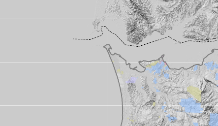
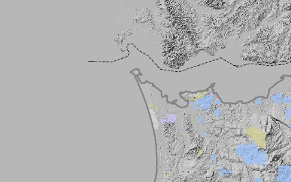
I am still seeing this issue. I have a layout in 10.6 that produces a 52MB file in the PDF version 1.6, from PRO 2.3 the same settings produce a 108MB file which is PDF version 1.7. The more critical concern is that the PRO PDF has some artifacts that make it unacceptable, the higher the DPI the more white lines show up.
PRO 2.3 version:
10.6 version
Any ideas Kory?
- Mark as New
- Bookmark
- Subscribe
- Mute
- Subscribe to RSS Feed
- Permalink
Hi Emmor,
Just to confirm, when you export via the Share-->Export dialog, are you checking the new option called "Ouput as Image"? If your map contains few and relatively non-dense vector layers, it is actually possible this option could produce a larger output. I will ask other team members about the possible source of the white lines.
Jeff