- Home
- :
- All Communities
- :
- Products
- :
- ArcGIS Pro
- :
- ArcGIS Pro Questions
- :
- Create a land-system map from multiple land-cover ...
- Subscribe to RSS Feed
- Mark Topic as New
- Mark Topic as Read
- Float this Topic for Current User
- Bookmark
- Subscribe
- Mute
- Printer Friendly Page
Create a land-system map from multiple land-cover raster
- Mark as New
- Bookmark
- Subscribe
- Mute
- Subscribe to RSS Feed
- Permalink
Hello,
I'm currently working on the creation of a land-system map using ArcGIS, but my GIS knowledge being really limited, I'm asking you, the community, for some help and advice.
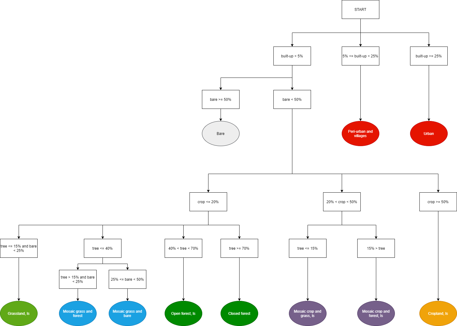
I have 4 different raster (100m resolution) that each correspond to a different land-cover:
- tree cover
- bare cover
- cropland cover
- built-up area
What I want to do is an "if statement" through each raster step by step to get a final land-system map of 11 classes. I don't know if I'm clear but I made a flow chart that describe the process (see the figure). I know exactly what I want to achieve and it looks really simple in theory, but I'm a little bit confused on how to achieve this in practice in ArcGIS. I'm thinking about using the model builder.
Regarding the 4 rasters, I have no idea how to do the "if statement". Should I combine all the 4 rasters together and look at the value of urban, tree, bare and croplands for each pixel ? I tried, but it looks like a pixel cannot have 4 different values and it translate everything in terms of band. Or maybe I can do an 'if statement' by using the 4 rasters independantly...
I will gladly take any advice, thank you in advance !
(I'm using ArcGIS Pro 2.6.0)