- Home
- :
- All Communities
- :
- Products
- :
- ArcGIS Pro
- :
- ArcGIS Pro Questions
- :
- Automate layout production for multiple field valu...
- Subscribe to RSS Feed
- Mark Topic as New
- Mark Topic as Read
- Float this Topic for Current User
- Bookmark
- Subscribe
- Mute
- Printer Friendly Page
Automate layout production for multiple field values using the same template in ArcGIS Pro.
- Mark as New
- Bookmark
- Subscribe
- Mute
- Subscribe to RSS Feed
- Permalink
I am creating bird distribution maps for 133 different species over a defined geographic area. My dataset is a point feature class, where each row in the attribute table is an observation of a particular bird species from a survey, with fields for the species' name, the grid reference and it's breeding status.
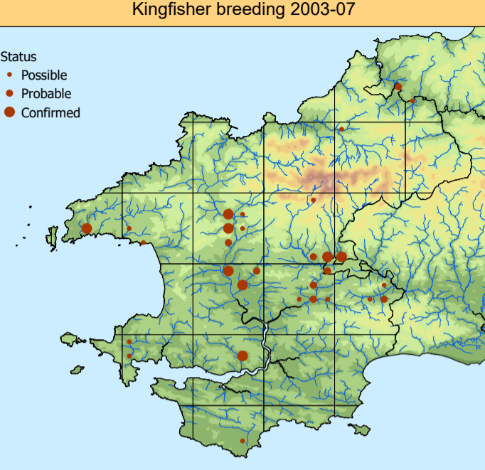
The final map for each species should look something like the one below. The exact same template and extent will be used each time. In the example below I have applied a definition query on my bird observation layer (Species = 'Kingfisher') and applied a Graduated Symbols symbology to the breeding status.
I want to create a layout with the same template and extent showing the corresponding information for each species. There are 133 species and 3 survey periods - I really don't want to have change a definition query and species name in the text box almost 400 times! I figured this should be reasonably straightforward to automate in ArcGIS Pro, as it seems to me like it should be a fairly routine task for GIS users to have to create multiple maps of the same extent showing different features, or different values of a field in a feature class. So I was surprised to find that the Map Series functionality can only be defined by spatial extent, unless I'm missing something.
After spending a long time trawling for solutions it seems like the only way to do achieve what I want is to write a Python script that produces and exports the layout for each value in the 'species' field, and use a dynamic text box to change the name to the species that is filtered each time it does this. This would mean learning Python which I'm completely new to, but I'm happy to do that - I just wanted to check I'm not missing anything obvious first.
If anyone could point me in the right direction as to how to about this, or point me to the best resources for learning what I need to do it, I would be extremely grateful.
Solved! Go to Solution.
- Mark as New
- Bookmark
- Subscribe
- Mute
- Subscribe to RSS Feed
- Permalink
Jeff Bigos's Blog - can you assist Yusef with the Python error he's seeing in this GeoNet thread? Thx!
- « Previous
-
- 1
- 2
- Next »
- « Previous
-
- 1
- 2
- Next »