- Home
- :
- All Communities
- :
- Products
- :
- ArcGIS Pro
- :
- ArcGIS Pro Questions
- :
- ArcPro
- Subscribe to RSS Feed
- Mark Topic as New
- Mark Topic as Read
- Float this Topic for Current User
- Bookmark
- Subscribe
- Mute
- Printer Friendly Page
ArcPro
- Mark as New
- Bookmark
- Subscribe
- Mute
- Subscribe to RSS Feed
- Permalink
Hello!
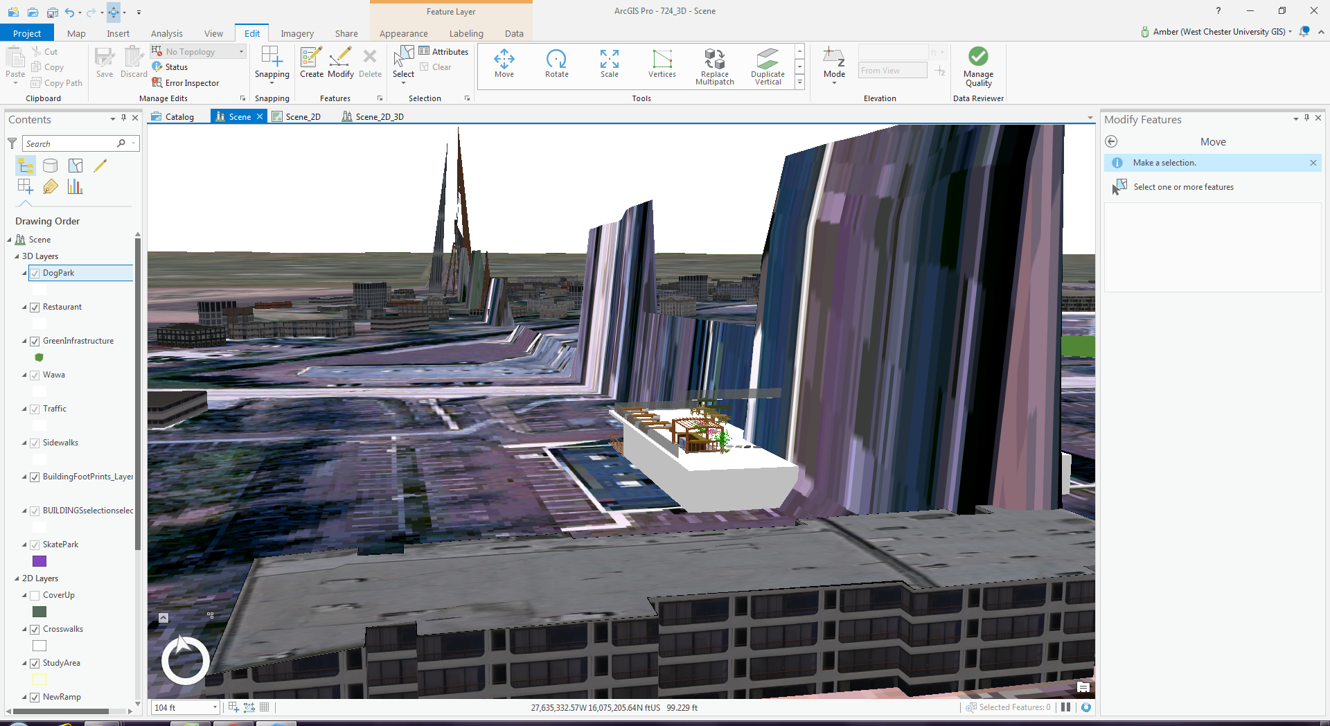
Any help would be greatly appreciated. Fellow students and myself are attempting to recreate an area using ArcPro. When we load the project into the scene there is an issue with the elevation (seen in screenshot below).
When we convert the model from 2D to 3D the world imagery and elevation in ArcGIS Pro creates this staggered or spiked image. From what we can figure out the world imagery and hillshade in ArcGIS Pro creates a seam along this line. When we import a DEM file for the county, it doesn't create the exaggerated elevation that we need. Does anyone have a recommended fix for that besides creating our own elevation. As far as we know it's an ESRI Basemap issue.  Thank you
- Mark as New
- Bookmark
- Subscribe
- Mute
- Subscribe to RSS Feed
- Permalink
Hello Benny,
What region of the world is the spiking happening in? Does the same thing happen with a new project, with a new scene in the same place? How about with a global scene?