- Home
- :
- All Communities
- :
- Products
- :
- ArcGIS Pro
- :
- ArcGIS Pro Questions
- :
- Re: Arc Pro Map Series Dynamic Text issue
- Subscribe to RSS Feed
- Mark Topic as New
- Mark Topic as Read
- Float this Topic for Current User
- Bookmark
- Subscribe
- Mute
- Printer Friendly Page
Arc Pro Map Series Dynamic Text issue
- Mark as New
- Bookmark
- Subscribe
- Mute
- Subscribe to RSS Feed
- Permalink
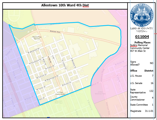
I'm creating a map series in Arc Pro. I've had to rework our Voting Precincts and Polling Places from our previous format. There's a relationship class between them. 1 to 1 Precincts to polling places
The map series is based on the extent of each precinct. There's dynamic data on the map, both from the attributes of the precinct and the related polling place. The data from the polling place is: Location Name, Location address, and whether signs are allowed at that location.
The issue seems to be that the map series application seems to run a spatial query on the map when looking for the related dynamic data. The issues I'm running into are:
- If the polling place is not within the actual boundary of the precinct, the dynamic text displays no data
- If more than 1 polling place resides within the boundary of a precinct, the data from all polling places gets added to the display. Due to the pandemic, we have some polling locations handling up to 4 precincts
- example of issue: Two Neighboring precincts share a polling location. One of the maps in the series will have no data, the other will have the data repeated.
- If precinct A's related polling place is outside of its own boundary, BUT precinct B's polling place is within A's precinct boundary, the data from the B's polling place will display on A's map.
As far as the map frame in Arc Pro I have:
- "My Polling Place" = Matches Map Series - Normal sized marker
- "Other Polling Places" = Does not match - smaller version of matched
- "My Voting Precinct" = Matches map series - No fill / thick outline
- "Other Voting Precincts" = Does not match - colored fill / translucent
- "All Voting Precincts" = Map series is based off of this layer. - not visible
- Mark as New
- Bookmark
- Subscribe
- Mute
- Subscribe to RSS Feed
- Permalink
Hi Ryan,
I'm not sure what is going on here. As far as I know, values from related fields is not supported with dynamic text unless you have discovered a unexpected workaround. My expectation would be that you can only use the "native" fields for dynamic text. I'm pretty sure this is true for Page Queries as well.
My advice would be to add a field to "Polling Places" that contains the corresponding precinct name. That should remove the spatial component from the filter.
Hope this helps,
Tom
- Mark as New
- Bookmark
- Subscribe
- Mute
- Subscribe to RSS Feed
- Permalink
Hi Tom.
I did figure a work around. I feel dumb for not having thought of it before 😕
I just joined the polling place table to the precinct table so it works in ArcMap and Pro.
However, for the future, it would be awesome to incorporate relates into Map Series. Especially in regards to view extents. It would help maps like this from looking like they're missing something. The polling place is off the view extent. I know I can adjust the extent, but then, as it's a map series, it affects ALL maps. Not just those that need it. So all the other maps will look small in comparison if the polling location falls within its boundaries.
Isn't there a place I can propose that as a future feature?
- Mark as New
- Bookmark
- Subscribe
- Mute
- Subscribe to RSS Feed
- Permalink
Ryan,
I'm glad you got it to work! You're doing important work. Please let me know if there is anything else I can help out with your map series.
There are 2 ideas covering this on the Ideas Site that you may want to vote on or add additional information:
https://community.esri.com/ideas/1219
Display related tables information (1-M relationships) on the layout while using data driven pages
We do look at these as they help us prioritize work.
Here is a related (excuse the pun) thread:
Related Table Support in Data Driven Pages
Tom
- Mark as New
- Bookmark
- Subscribe
- Mute
- Subscribe to RSS Feed
- Permalink
Nice. Thanks for your help, Tom. I voted them up and added one of my own for view extents based on related features 