- Home
- :
- All Communities
- :
- Products
- :
- ArcGIS Pro
- :
- ArcGIS Pro Questions
- :
- 10.6 Buffer Wizard crashing
- Subscribe to RSS Feed
- Mark Topic as New
- Mark Topic as Read
- Float this Topic for Current User
- Bookmark
- Subscribe
- Mute
- Printer Friendly Page
10.6 Buffer Wizard crashing
- Mark as New
- Bookmark
- Subscribe
- Mute
- Subscribe to RSS Feed
- Permalink
I installed 10.6 yesterday late and noticed today that the buffer wizard crashes ArcMap every time I try to use it. I used the buffer tool instead but figured I would make a note of this indirectly for tech support. Here is an error message from Event Viewer:
Faulting application name: ArcMap.exe, version: 10.6.0.8321, time stamp: 0x5a2b5885
Faulting module name: ucrtbase.dll, version: 10.0.16299.125, time stamp: 0x9e3394c7
Exception code: 0xc0000409
Fault offset: 0x00091912
Faulting process id: 0x2234
Faulting application start time: 0x01d39154445590b7
Faulting application path: C:\Program Files (x86)\ArcGIS\Desktop10.6\bin\ArcMap.exe
Faulting module path: C:\WINDOWS\System32\ucrtbase.dll
Report Id: 879c0a8d-cd27-4f28-8c37-c971a354e504
Faulting package full name:
Faulting package-relative application ID:
- Mark as New
- Bookmark
- Subscribe
- Mute
- Subscribe to RSS Feed
- Permalink
Confirmed... crashes in my case too (I used only 4 point features, no dissolving and creating graphics). Can anyone of you report this bug in my.esri? CC KKramer-esristaff
- Mark as New
- Bookmark
- Subscribe
- Mute
- Subscribe to RSS Feed
- Permalink
I checked internally and here is the explanation I found: "the data is stored in a coordinate system which is not appropriate. The polygon extends past the valid horizon of this coordinate system. Either switch to using geoprocessing buffer tool or re-project the data into a more appropriate coordinate system (like GCS_1984)."
I haven't tested myself to determine specifics, particularly the part about "the polygon extends past the valid horizon of this coordinate system" but the meaning is clear. This has to do with the coordinate system. Reproject the data to a coordinate system with a larger spatial domain, or use the geoprocessing tool.
If you are still experiencing a crash and can send a reproducible case, please contact me.
Thank you!
- Mark as New
- Bookmark
- Subscribe
- Mute
- Subscribe to RSS Feed
- Permalink
Thanks KKramer-esristaff !
I will test with a projected and geographic coordinate system and post back the results, but I'm pretty sure that it will generate an error (and any way, when ArcMap crashes it is definitely a bug, since that should never happen).
- Mark as New
- Bookmark
- Subscribe
- Mute
- Subscribe to RSS Feed
- Permalink
You're welcome, Xander Bakker I was not debating whether this is a bug or not, just trying to provide some helpful information
- Mark as New
- Bookmark
- Subscribe
- Mute
- Subscribe to RSS Feed
- Permalink
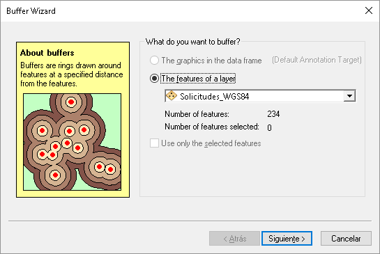
Just did a test with a point layer using the GCS_WGS_1984 coordinate system:

These are the settings I used:
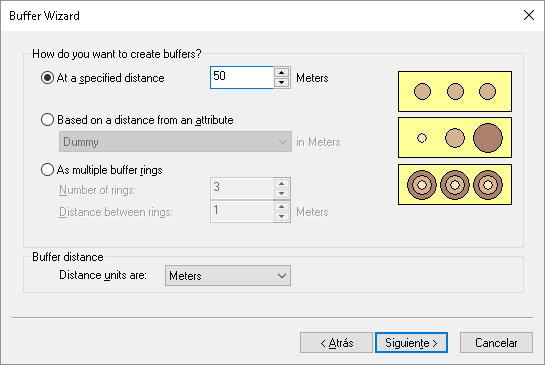

... which results in a crash:

I also used the same layer projected to Web Mercator Auxiliary Sphere.using the almost the same settings:

This time I did not generate graphics, I choose to write the features to a new featureclass in a FGDB:
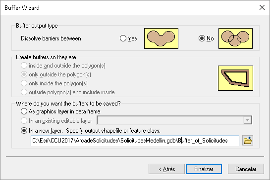
and again it crashed.

Kory Kramer, I have attached the data if you want to test it yourself...
- Mark as New
- Bookmark
- Subscribe
- Mute
- Subscribe to RSS Feed
- Permalink
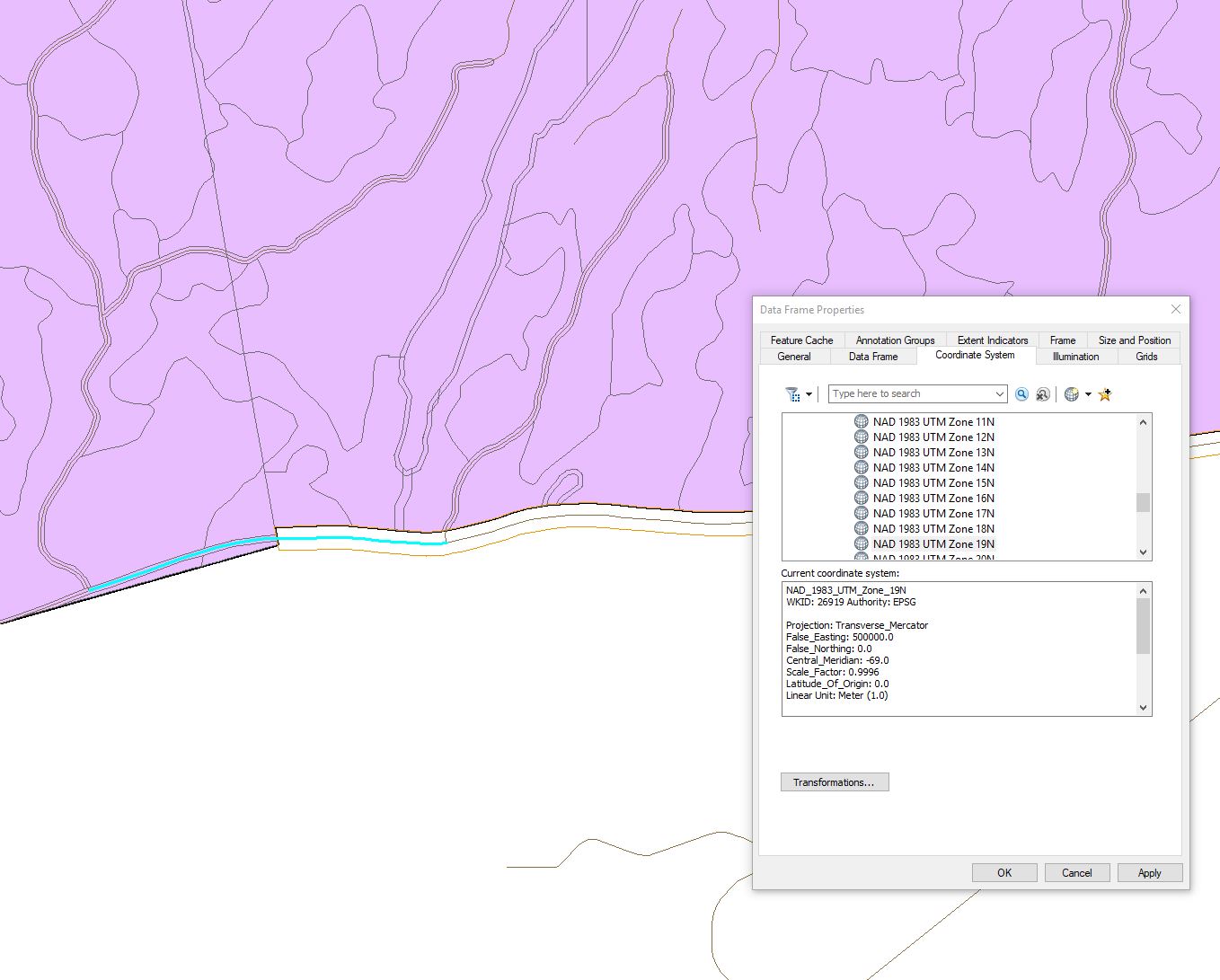
In case this is useful, I'll note I had the crash, and just repeated the crash, using the plain old garden variety UTM Nad83 Z19 coordinate system (26919), both for the data frame and the source data. I also tested the Editor buffer tool and it does work.
- Mark as New
- Bookmark
- Subscribe
- Mute
- Subscribe to RSS Feed
- Permalink
Screenshots, John?
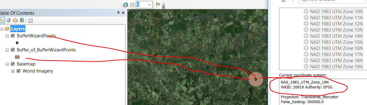
It looks like I can create a buffer right along the "edge" of the coordinate system:

Are you buffering points, lines, polygons?
Can you send data (or even just a single feature that will reproduce the crash)?
Or at least a screenshot giving some more context?
Cheers
- Mark as New
- Bookmark
- Subscribe
- Mute
- Subscribe to RSS Feed
- Permalink
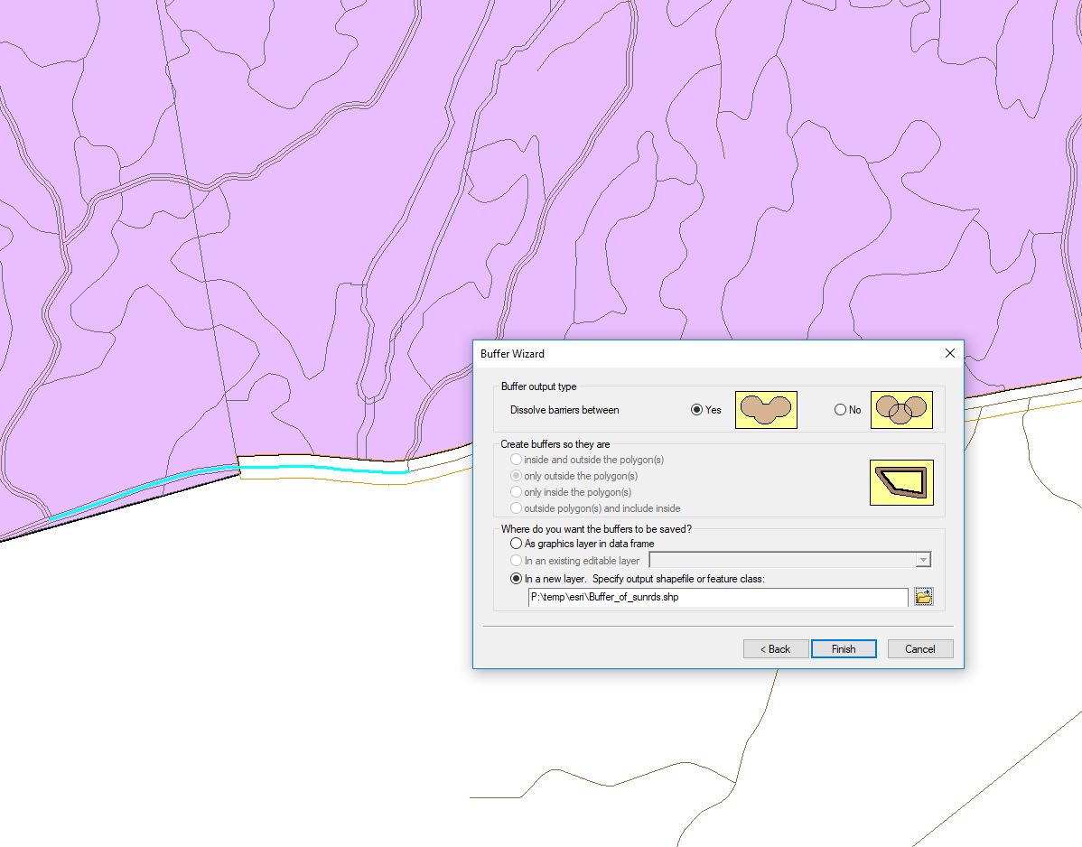
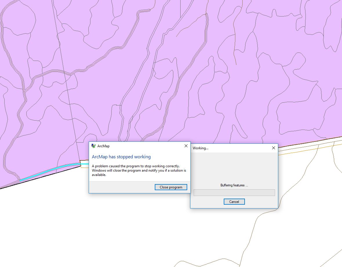
I took 3 snippets.