- Home
- :
- All Communities
- :
- Products
- :
- ArcGIS Pro
- :
- ArcGIS Pro Ideas
- :
- Pro: GP Inputs should display full path to sources...
- Subscribe to RSS Feed
- Mark as New
- Mark as Read
- Bookmark
- Follow this Idea
- Printer Friendly Page
Pro: GP Inputs should display full path to sources (as does Arc)
- Mark as New
- Bookmark
- Subscribe
- Mute
- Subscribe to RSS Feed
- Permalink
In Arc, when I'm dragging or selecting feature classes into a GP input, the full path of the source is displayed. This is helpful, say, if I'm merging stuff from many different folders (Did I already add the feature class from the thumbdrive? Wait, is that last one from the laptop? )
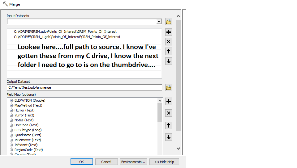
In Pro....I have to hold the mouse over each input UI, or click on it, to get the same information:
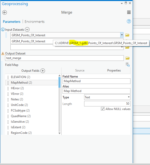
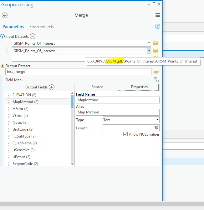
Mickey Mouse? Yes. More steps? Yes. Is that as efficient, or as fast, as I can get the same information in Arc? No......Let's say I'm merging 10, or 50, feature classes. How is holding the mouse over every one of those is going to clue you in as to which ones are in the "box", and which ones are left to grab?
I too do not like this method of reducing the file path down to the table name. Why did they even implement it, no other application I'm aware of does this? As Pro is following in the footsteps of Microsoft office with ribbons why have they introduced this confusing, non-intuitive, non-standard dumb-it-down approach?
We need to see the full path.
Yes a long path is just as irritating, but at least you know what you are looking at and the idea of placing the full path into the tool tip is a good solution.
We have a staging database where feature classes are staged using the same name as the one in the master database. Our existing tools have inputs for the target fc and the source fc then doing a truncate-append. If the user has update rights to both locations this could be disastrous if they get mixed up! Once both are set I always double check to see that I didn't get the target and source backwards.
Is it planned to be released in 2.7?


Implemented in ArcGIS Pro 2.7.
See Ideas in ArcGIS Pro 2.7: Something to Celebrate
And check out what's new in ArcGIS Pro 2.7!
Right but how to display the path of the input as well?


Hi Jamal,
It looks like you're adding the layer (from the Contents pane) as input to the tool, rather than the data source (from the Catalog pane or view, or by browsing to the data source).
Here is a screenshot from ArcMap when I add the layer - the tool's input displays the layer name:

And when I add the data source:

The geoprocessing setting in Pro makes the display path behavior work the same.
Cheers
Thanks Kory for the illustration
best
Jamal
You must be a registered user to add a comment. If you've already registered, sign in. Otherwise, register and sign in.