- Home
- :
- All Communities
- :
- Products
- :
- ArcGIS Pro
- :
- ArcGIS Pro Ideas
- :
- Access Geoprocessing tools through TOC
- Subscribe to RSS Feed
- Mark as New
- Mark as Read
- Bookmark
- Follow this Idea
- Printer Friendly Page
- Mark as New
- Bookmark
- Subscribe
- Mute
- Subscribe to RSS Feed
- Permalink
In ArcMap, it would be helpful to have direct access to commonly used Geoprocessing Tools by right-clicking the layer in the Table of Contents.
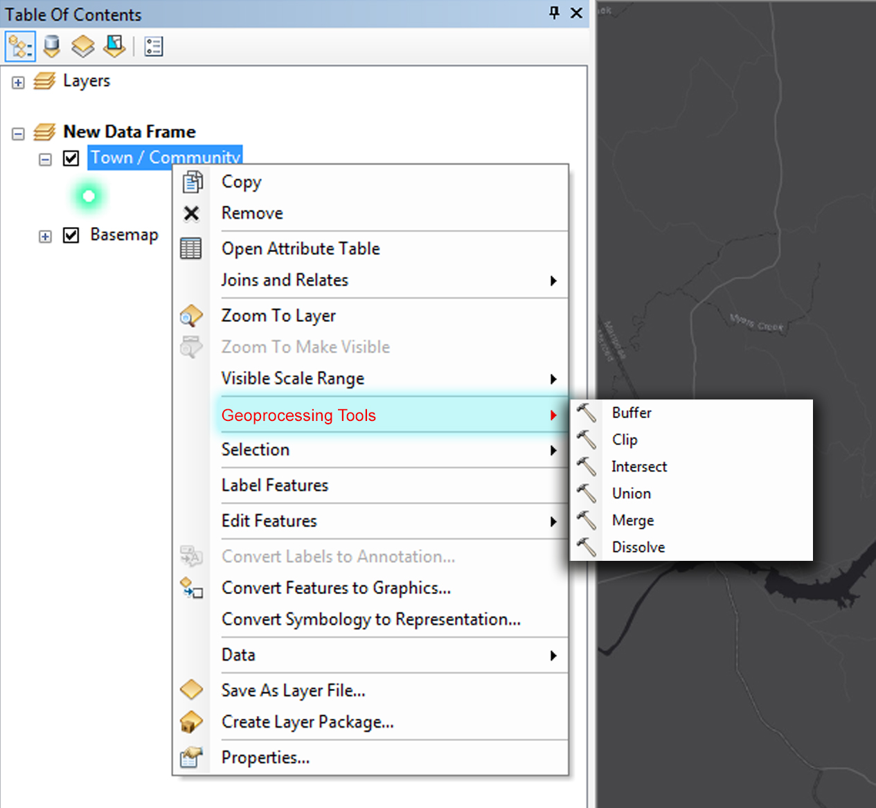
The Geoprocessing Tools could be filtered based on the chosen layers' geometry or data type. For example, right-clicking a point layer for Towns and choosing 'Geoprocessing Tools' will expose commonly used tools when a point feature is used as an input.
What about the Tools gallery in ArcGIS Pro? I realize that the idea is for ArcMap 10.x, just wondering if you've explored Pro yet.

or Save a custom set of geoprocessing tools—ArcGIS Pro | ArcGIS Desktop
We might design and introduce additional locations in the ArcGIS Pro UI to access geoprocessing and analysis capabilities. But likely not from the layer Contents. Perhaps from the Analysis Tools gallery, like Kory mentioned.
You must be a registered user to add a comment. If you've already registered, sign in. Otherwise, register and sign in.