- Home
- :
- All Communities
- :
- Products
- :
- ArcGIS Online
- :
- ArcGIS Online Questions
- :
- Re: Why is my scale being limited in AGO?
- Subscribe to RSS Feed
- Mark Topic as New
- Mark Topic as Read
- Float this Topic for Current User
- Bookmark
- Subscribe
- Mute
- Printer Friendly Page
Why is my scale being limited in AGO?
- Mark as New
- Bookmark
- Subscribe
- Mute
- Subscribe to RSS Feed
- Permalink
- Report Inappropriate Content
Hi all -
I've finally got users using ArcGIS Online but now they are complaining that they can't zoom into our orthos to their full resolution. Meaning, the zoom in function is often disabled before they can see what they need to. I'm seeing this happening repeatedly.
If I create a new map in AGO and just load our image service I can zoom in much closer.
Why is this happening?!
Thanks in advance.
Cheers,
Joanna
- Mark as New
- Bookmark
- Subscribe
- Mute
- Subscribe to RSS Feed
- Permalink
- Report Inappropriate Content
Hi Joanna,
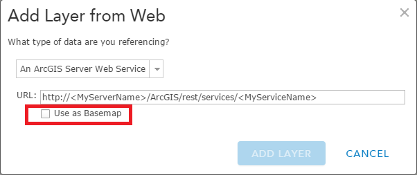
It would depend on if your service was added as a basemap or as an operational layer. If it's added as a basemap, the map will use the tiling scheme of your service and you'll be able to zoom into the largest scale. It sounds like they're not able to zoom in far enough because they're limited by the arcgis online basemap tiling scheme.
- Mark as New
- Bookmark
- Subscribe
- Mute
- Subscribe to RSS Feed
- Permalink
- Report Inappropriate Content
I actually did not add it as a basemap. I ended up just creating a new map, with all the same layers, and haven't had the problem again. But I think it will repeat. Good to know I could try that, I guess. Thanks!
- Mark as New
- Bookmark
- Subscribe
- Mute
- Subscribe to RSS Feed
- Permalink
- Report Inappropriate Content
I am having similar problems. I have added an operational layer to the map (no basemap other than the standard online ones). I can only zoom in to around 1:10000.
Interestingly, I have "don't draw when zoomed out beyond 1:10,000" set for one of the layers. Not sure if this impacts on the map. I have not found a way to resolve it, other than to remove and reload the data (but then it comes back again anyway).