- Home
- :
- All Communities
- :
- Products
- :
- ArcGIS Online
- :
- ArcGIS Online Questions
- :
- Re: "Adjust size automatically" glitching in new M...
- Subscribe to RSS Feed
- Mark Topic as New
- Mark Topic as Read
- Float this Topic for Current User
- Bookmark
- Subscribe
- Mute
- Printer Friendly Page
"Adjust size automatically" glitching in new Map Viewer
- Mark as New
- Bookmark
- Subscribe
- Mute
- Subscribe to RSS Feed
- Permalink
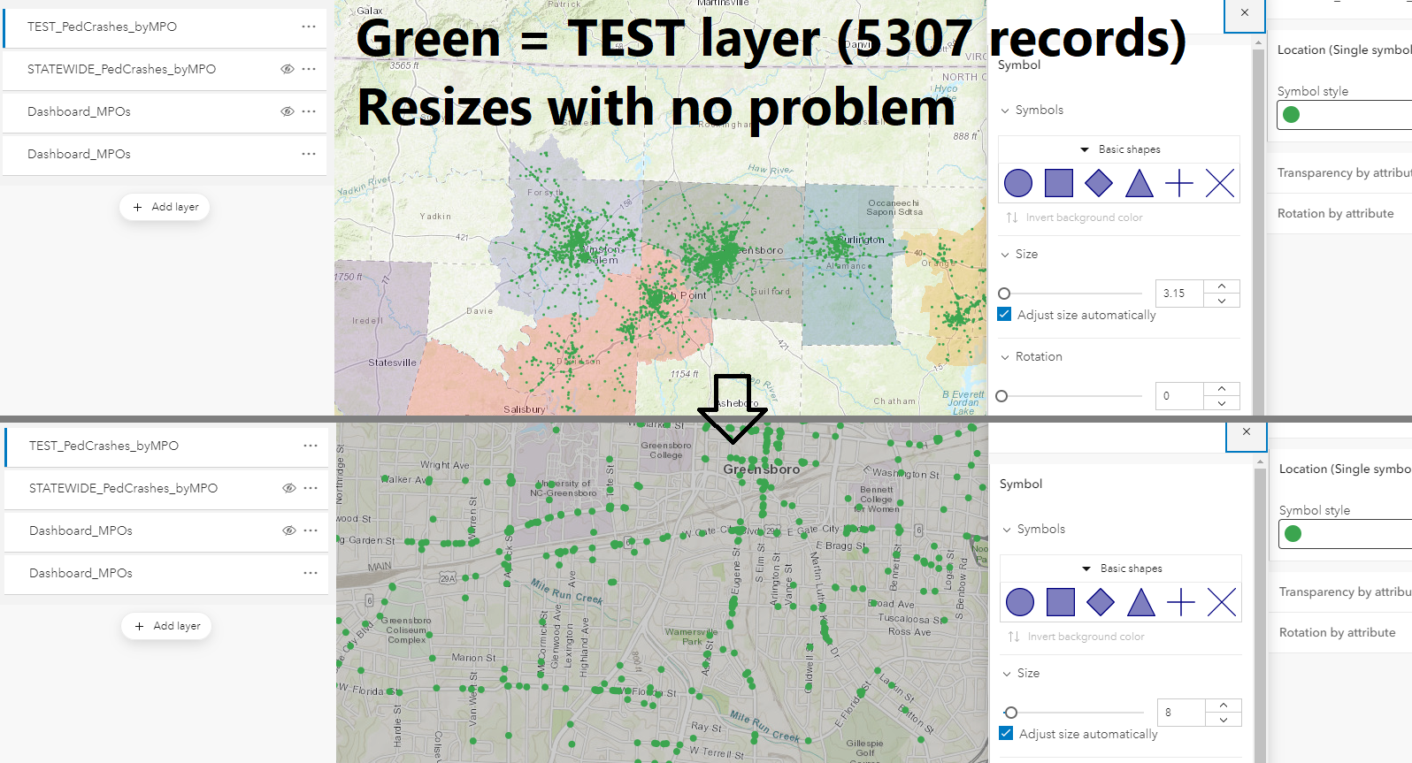
I am having a strange issue with the auto scale adjustment in the new Map Viewer. I have two layers showing locations of auto crashes involving pedestrians in the state of North Carolina.* One is a TEST layer that I clipped to the boundary of a few of the state's more populous MPO jurisdictions; it has 5,703 records, and resizes beautifully as I zoom from block level out to regional/statewide level. (see screenshot1)
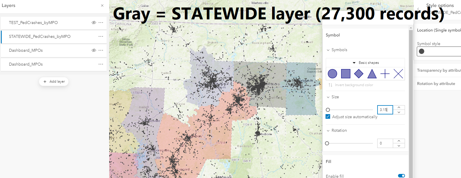
After doing all of my testing with this clipped subset of the data, I brought in the STATEWIDE layer, which covers the entire state, consisting of 27,300 records. (see screenshot2)
Unfortunately, when I try to use the "Adjust size automatically" setting on this new layer, I get very different results. No matter whether I zoom way out and manually set the size to be very small, or zoom in and make it larger, the automatic adjustments as I move between zoom levels are very slight when they happen at all. (See screenshot3)
I understand that, as this Esri blog post notes, "The default sizes for each scale depend on the size and density of features in your layer. So you will not see the same sizes at similar scales for different layers." Even though one layer is just a clipped version of the other, the STATEWIDE layer has a much greater extent, so I don't expect them to behave exactly the same. But it seems odd that the TEST layer resizes smoothly every time I change scale, and the STATEWIDE layer does not resize at all until I am zoomed out almost far enough to show the layer's full extent! I don't think this is the intended behavior of this feature, and I'm curious whether anyone has encountered similar bugs.
EDIT: Forgot to include the link to the Esri blog post referenced in the last paragraph: https://www.esri.com/arcgis-blog/products/arcgis-online/mapping/auto-size-by-scale-now-available-in-...
*: These location data are collected by the U.S. Federal Government and made publicly available, so no privacy concerns re: posting these images 🙂
- Mark as New
- Bookmark
- Subscribe
- Mute
- Subscribe to RSS Feed
- Permalink
UPDATE: Problem resolved! I needed to clean the original dataset better: the crash locations were generated via linear referencing, and there were a number of non-located points that had not been removed and were presumably interfering with the algorithm that determines the optimal symbol size based on density/extent.
I'll leave this here in case anyone else in future has the same issue...