Turn on suggestions
Auto-suggest helps you quickly narrow down your search results by suggesting possible matches as you type.
Cancel
- Home
- :
- All Communities
- :
- Products
- :
- ArcGIS Online
- :
- ArcGIS Online Questions
- :
- Maps online + shapes + my data ?
Options
- Subscribe to RSS Feed
- Mark Topic as New
- Mark Topic as Read
- Float this Topic for Current User
- Bookmark
- Subscribe
- Mute
- Printer Friendly Page
Maps online + shapes + my data ?
Subscribe
1933
7
06-03-2011 12:50 AM
06-03-2011
12:50 AM
- Mark as New
- Bookmark
- Subscribe
- Mute
- Subscribe to RSS Feed
- Permalink
Hello,
I apologise, if you find my questions a bit crazy, but I discovered this site yesterday and I'm totaly lost in all the terms and amazing possibilities ArcGIS offers, trying to find the way it will work for my project.
In short - we create and host for free a database of military units, from any period of human history (of course, mainly from 20-21th century). There is nothing similar to our project, because we store the data in kind of semantic web, with defined relationships between objects, so we are able to produce some interesting overviews and automated reports, order of battle for given date and so on. The main goal is to store any data in specified and described form, so they can be reused later, and we don't have to do the things manually again (currently we list several thousand units and this database is growing every day, imagine that for each unit we keep the information about its subordinate units, its superior unit, its commanders, its dislocation, even weaponry, logos and patches, medals and citations ... its huge amount of data). For example, someone is interested in history of a unit, someone else wants to see a battlefield, where this unit participated. Someone else is interested to see a career of a commander ... many different views, that can be satisfied using good data structure 🙂
Part of our project is "geolocating" the unit during its existence. Simplified, we pinpoint them on the map, while setting a DATE and TIME, when this unit has been on given spot on the map. Again, this can be used for several automated "reports", like "show me way of 1st Infantry Division Big Red 1 during WW2 thru Europe". There are several dozens of users, who are (or will be) doing this, so it needs to be done over the internet browser (preferable Firefox or Chrome, but cannot exclude IE as some users are using it :().
So far, I'm able to program this using google maps, jQuery and our PHP backend, because the units are simple POINTS on the map (using own set of military marking icons to differentiate between infantry, armoured, cavalry, .... divisions, corps, brigades ... you get the idea I guess).
But, when showing the movements, and by trying to reproduce maps like this
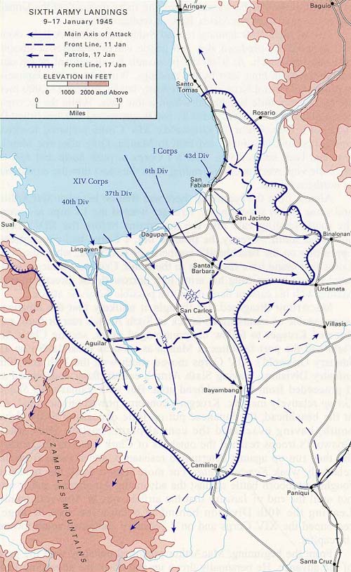
I need the possibility to draw lines and arrows, and this is why I came to this site. I've found this
http://www.arcgis.com/home/webmap/viewer.html
and was amazed by the possibility to DRAW, MODIFY and ROTATE the arrows, change their COLOR and also that they SCALE with the map ! This is something I'm really looking for. I'm a programmer, can do PHP and able to work with JS, but this type of modification of shapes is far beyond my skill (and why to do it, when someone already did it :D)
Now, my question is - is this something I can add to my maps, via some JS library or something, or is it bound to this server only ? Because, for us, we need to store data locally on our server (no offense, but sites quite often get shut down, change their URLs and so on, so we are not going to risk, that after adding several hundert thousand locations and relationships to our object these maps will get lost somewhere), at least the relationship - ID of the UNIT, DATE, COORDINATES, plus these new objects - ARROWS and LINES, their COORDINATES and SHAPE, DATE and ZOOM LEVEL. And we need to be able to draw it back to a map as an "overlay", but "user controlled", meaning the user can pick a DATE, TIME, and move freely on the map to see the location of the units (all over the globe and his chosen zoom level). For now, this is done via generated georss feed added to google map.
So, please, help me answer this question, or tell me which product am I exactly looking for :), and of course if there is free solution or something we need to buy.
Thank you
Radek Havelka
I apologise, if you find my questions a bit crazy, but I discovered this site yesterday and I'm totaly lost in all the terms and amazing possibilities ArcGIS offers, trying to find the way it will work for my project.
In short - we create and host for free a database of military units, from any period of human history (of course, mainly from 20-21th century). There is nothing similar to our project, because we store the data in kind of semantic web, with defined relationships between objects, so we are able to produce some interesting overviews and automated reports, order of battle for given date and so on. The main goal is to store any data in specified and described form, so they can be reused later, and we don't have to do the things manually again (currently we list several thousand units and this database is growing every day, imagine that for each unit we keep the information about its subordinate units, its superior unit, its commanders, its dislocation, even weaponry, logos and patches, medals and citations ... its huge amount of data). For example, someone is interested in history of a unit, someone else wants to see a battlefield, where this unit participated. Someone else is interested to see a career of a commander ... many different views, that can be satisfied using good data structure 🙂
Part of our project is "geolocating" the unit during its existence. Simplified, we pinpoint them on the map, while setting a DATE and TIME, when this unit has been on given spot on the map. Again, this can be used for several automated "reports", like "show me way of 1st Infantry Division Big Red 1 during WW2 thru Europe". There are several dozens of users, who are (or will be) doing this, so it needs to be done over the internet browser (preferable Firefox or Chrome, but cannot exclude IE as some users are using it :().
So far, I'm able to program this using google maps, jQuery and our PHP backend, because the units are simple POINTS on the map (using own set of military marking icons to differentiate between infantry, armoured, cavalry, .... divisions, corps, brigades ... you get the idea I guess).
But, when showing the movements, and by trying to reproduce maps like this
I need the possibility to draw lines and arrows, and this is why I came to this site. I've found this
http://www.arcgis.com/home/webmap/viewer.html
and was amazed by the possibility to DRAW, MODIFY and ROTATE the arrows, change their COLOR and also that they SCALE with the map ! This is something I'm really looking for. I'm a programmer, can do PHP and able to work with JS, but this type of modification of shapes is far beyond my skill (and why to do it, when someone already did it :D)
Now, my question is - is this something I can add to my maps, via some JS library or something, or is it bound to this server only ? Because, for us, we need to store data locally on our server (no offense, but sites quite often get shut down, change their URLs and so on, so we are not going to risk, that after adding several hundert thousand locations and relationships to our object these maps will get lost somewhere), at least the relationship - ID of the UNIT, DATE, COORDINATES, plus these new objects - ARROWS and LINES, their COORDINATES and SHAPE, DATE and ZOOM LEVEL. And we need to be able to draw it back to a map as an "overlay", but "user controlled", meaning the user can pick a DATE, TIME, and move freely on the map to see the location of the units (all over the globe and his chosen zoom level). For now, this is done via generated georss feed added to google map.
So, please, help me answer this question, or tell me which product am I exactly looking for :), and of course if there is free solution or something we need to buy.
Thank you
Radek Havelka
7 Replies
06-07-2011
04:10 AM
- Mark as New
- Bookmark
- Subscribe
- Mute
- Subscribe to RSS Feed
- Permalink
please any answer ?
06-08-2011
08:55 AM
- Mark as New
- Bookmark
- Subscribe
- Mute
- Subscribe to RSS Feed
- Permalink
It isn't bound to this server and we do have a JavaScript API you can use independently. It might be interesting to actually animate movement, like shown on this map.
http://www.arcgis.com/home/webmap/viewer.html?webmap=dfa1e187310c4c7a897e4c919dd3f781
Here's a general link to our JavaScript API reference
http://help.arcgis.com/en/webapi/javascript/arcgis/
Here is a reference to a specific sample that shows the coding pattern, although this sample is meant for a mobile device.
http://help.arcgis.com/en/webapi/javascript/arcgis/help/jssamples/mobile_geolocaterenderer.html
Hope this helps,
Mike
06-09-2011
11:58 PM
- Mark as New
- Bookmark
- Subscribe
- Mute
- Subscribe to RSS Feed
- Permalink
great, thank you for pointing me the right direction 🙂 i'm really lost in so many options and APIs available here 🙂
yeah, we are aiming to do the time animation - our max resolution should be 1 hour, so we should be able to animate small units in battles during the day in large detail maps (cities and vilages) as well as armies movements thru the year in low detail level maps (countries)
will post back here as soon as we have something to present !
06-10-2011
07:54 AM
- Mark as New
- Bookmark
- Subscribe
- Mute
- Subscribe to RSS Feed
- Permalink
Wow! this is a really amazing project you are working on. I don't have any advice for you, but I just wanted to say keep up the good work. I'd love to see how things turn out.
06-22-2012
03:22 PM
- Mark as New
- Bookmark
- Subscribe
- Mute
- Subscribe to RSS Feed
- Permalink
Wow! this is a really amazing project you are working on. I don't have any advice for you, but I just wanted to say keep up the good work. I'd love to see how things turn out.
I agree, this is a really neat project. National Geographic just did an animated timeline Civil War map for the iPad a few months ago. These maps you're making have a lot of potential. I'd love to see some examples when you're done.
06-22-2012
04:52 PM
- Mark as New
- Bookmark
- Subscribe
- Mute
- Subscribe to RSS Feed
- Permalink
I agree, this is a really neat project. National Geographic just did an animated timeline Civil War map for the iPad a few months ago. These maps you're making have a lot of potential. I'd love to see some examples when you're done.
See this Battlefields of the Civil War map made with ArcGIS Online by Allen Carroll and team at Esri: http://storymaps.esri.com/stories/civilwar/
For more info about this kind of map, and more examples including ready-to-use templates, see http://storymaps.esri.com.
04-30-2014
06:27 AM
- Mark as New
- Bookmark
- Subscribe
- Mute
- Subscribe to RSS Feed
- Permalink
Would be possible to get the code of that great map?? thanks!!!!