- Home
- :
- All Communities
- :
- Products
- :
- ArcGIS Online
- :
- ArcGIS Online Questions
- :
- Layers not Drawing Completely
- Subscribe to RSS Feed
- Mark Topic as New
- Mark Topic as Read
- Float this Topic for Current User
- Bookmark
- Subscribe
- Mute
- Printer Friendly Page
Layers not Drawing Completely
- Mark as New
- Bookmark
- Subscribe
- Mute
- Subscribe to RSS Feed
- Permalink
Hello,
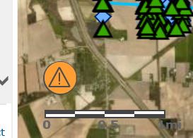
I am still experiencing the small, persistent orange circle of annoyance. Nearly every map I pull up (all hosted on AGOL) features this little orange monstrosity in the lower corner no matter how many features are in the feature layer (20 vs 6,000).
I've noticed this since the last update and wondered if anyone had any ideas or if anyone else was experiencing the same thing.
The really irrigating thing is that even though it says it can't draw all oft he features, it does.....Until you start panning and zooming. Then the map gets really slow and unresponsive and it just stops drawing features all together. All of this is very intermittent...except for the orange circle.
Any insight is appreciated! I had asked on another thread but hadn't received any substantial answers.
- Mark as New
- Bookmark
- Subscribe
- Mute
- Subscribe to RSS Feed
- Permalink
I downed and re-upped the data with 'simple' symbols and the new version of the data seems to be working

Below is the JSON for the renderer using esriSMSCircle :
{"renderer":{"type":"uniqueValue","field1":"color","defaultSymbol":{"type":"esriSMS","style":"esriSMSCircle","color":[130,130,130,255],"size":12,"angle":0,"xoffset":0,"yoffset":0,"outline":{"color":[0,0,0,255],"width":2.1000000000000001}},"defaultLabel":"Unknown","uniqueValueInfos":[{"symbol":{"type":"esriSMS","style":"esriSMSCircle","color":[255,0,0,255],"size":12,"angle":0,"xoffset":0,"yoffset":0,"outline":{"color":[0,0,0,255],"width":2.1000000000000001}},"value":"1","label":"Red"},{"symbol":{"type":"esriSMS","style":"esriSMSCircle","color":[255,255,255,255],"size":12,"angle":0,"xoffset":0,"yoffset":0,"outline":{"color":[0,0,0,255],"width":2.1000000000000001}},"value":"2","label":"White"},{"symbol":{"type":"esriSMS","style":"esriSMSCircle","color":[230,230,0,255],"size":12,"angle":0,"xoffset":0,"yoffset":0,"outline":{"color":[0,0,0,255],"width":2.1000000000000001}},"value":"3","label":"Yellow"},{"symbol":{"type":"esriSMS","style":"esriSMSCircle","color":[85,255,0,255],"size":12,"angle":0,"xoffset":0,"yoffset":0,"outline":{"color":[0,0,0,255],"width":2.1000000000000001}},"value":"4","label":"Lime green"},{"symbol":{"type":"esriSMS","style":"esriSMSCircle","color":[0,92,230,255],"size":12,"angle":0,"xoffset":0,"yoffset":0,"outline":{"color":[0,0,0,255],"width":2.1000000000000001}},"value":"5","label":"Blue"},{"symbol":{"type":"esriSMS","style":"esriSMSCircle","color":[255,170,0,255],"size":12,"angle":0,"xoffset":0,"yoffset":0,"outline":{"color":[0,0,0,255],"width":2.1000000000000001}},"value":"6","label":"Orange"}],"fieldDelimiter":","},"transparency":0,"labelingInfo":null}
- Mark as New
- Bookmark
- Subscribe
- Mute
- Subscribe to RSS Feed
- Permalink
@KellyGerrow
I am having a similar issue. I have a feature layer generated from a Survey123 form with a child point layer and a related table below that. This is the structure:
- Point feature (parent) - this is the layer not displaying
- Point feature (child)
- Related table (child)
- Point feature (child)
The parent point layer does not display in webmaps and gives the orange triangle that everyone is describing with the error The layer, [layer_name], did not draw completely. The layer contains 164 point features. Following suggestions from this and other threads, I have tried rebuilding the spatial index, zooming in to see if it is an issue to do with too many features, viewing the webmap in a different browser, and checking geometry. None of these have fixed the issue, and both ESRI and OGC validation checks found no geometry issues. The layer displays as expected in ArcGIS Pro.
Any ideas?
- « Previous
- Next »
- « Previous
- Next »