- Home
- :
- All Communities
- :
- Products
- :
- ArcGIS Online
- :
- ArcGIS Online Questions
- :
- Layers not Drawing Completely
- Subscribe to RSS Feed
- Mark Topic as New
- Mark Topic as Read
- Float this Topic for Current User
- Bookmark
- Subscribe
- Mute
- Printer Friendly Page
Layers not Drawing Completely
- Mark as New
- Bookmark
- Subscribe
- Mute
- Subscribe to RSS Feed
- Permalink
Hello,
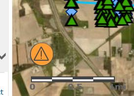
I am still experiencing the small, persistent orange circle of annoyance. Nearly every map I pull up (all hosted on AGOL) features this little orange monstrosity in the lower corner no matter how many features are in the feature layer (20 vs 6,000).
I've noticed this since the last update and wondered if anyone had any ideas or if anyone else was experiencing the same thing.
The really irrigating thing is that even though it says it can't draw all oft he features, it does.....Until you start panning and zooming. Then the map gets really slow and unresponsive and it just stops drawing features all together. All of this is very intermittent...except for the orange circle.
Any insight is appreciated! I had asked on another thread but hadn't received any substantial answers.
- Mark as New
- Bookmark
- Subscribe
- Mute
- Subscribe to RSS Feed
- Permalink
Here, same problem but we have only one layer with 2 points related to another layer with only 1 line.
- Mark as New
- Bookmark
- Subscribe
- Mute
- Subscribe to RSS Feed
- Permalink
Are you able to share your web map?
- Mark as New
- Bookmark
- Subscribe
- Mute
- Subscribe to RSS Feed
- Permalink
Thanks for sharing Fernando.
There is an issue with the query to ItinerariosOperativos - Puntos de Interes. The server response is indicating that there is an invalid query. It seems to be related to reprojecting the data. Would you like to display this data in Web Mercator or your local projection?
I'd suggest getting in contact with Technical support to fully troubleshoot what is happening with this layer.
How did you create the layer? Was it published from ArcGIS Desktop or a file geodatabase?
If you remove the scale visibility from the layer, are you able to see the two points?
If this should be secured, feel free to unshare the layer.
-Kelly
- Mark as New
- Bookmark
- Subscribe
- Mute
- Subscribe to RSS Feed
- Permalink
Thanks for the info Kelly,
Answer:
1. I would like to project in my projection (ED50)
2. The layer was created trought Arcgis Desktop in my own Enterprise Geodatabase
3. The layer was published with Arcgis Desktop using AGOL Hosted Services option
4. About scale visibilty, i am not understanding exactly this suggestion. I have made to actions, At webmap level, change the scale range of this layer to be visible, at all scales. Also at Webapp level, i have hide the scale bar. After this changes, the problem persists.
Also i have changed the basemap with a tile layer of the organization that has the same projection of the layers. But the problem persists. This basemap is now activated, but i though you cannot access to it, because is only accesible from our intranet.
I will contact support and try to obtain a solution. I will post it back later.
Thanks again for your help Kelly
- Mark as New
- Bookmark
- Subscribe
- Mute
- Subscribe to RSS Feed
- Permalink
I finally contacted Esri Support, and obtain a solution. In my case, the origin of the problem, was in a 1:N relationship defined between two layers. The problem was not exactly the relationship but the data. I created the layers with arcmap and introduced some sample data. Then I pubish the service with this sample data to the AGOL. This sample data was not as consistent as it would be, because some child records, pointed to no one parent. So finally, the solution was to delete the sample data, and publish an empty feauture service. Then I created sample data using AGOL and problem desappeared.
This is a workaorund to avoid this misfunctional of AGOL, but I hope this bug will be addressed in the future. The issue was not scaled to dev team.
- Mark as New
- Bookmark
- Subscribe
- Mute
- Subscribe to RSS Feed
- Permalink
Having similar issues here too. Feature layers with one or two points only will generate the error although it is somewhat of a random nature. Definitely more stable on Chrome or Edge than IE. Suspect it may have something to do with Base Map projection?
- Mark as New
- Bookmark
- Subscribe
- Mute
- Subscribe to RSS Feed
- Permalink
Same issue here. Under 100 features. I used ArcPro to publish. The feature class was set to 3857 but the service says 102100. Link below:
https://bcitgis.maps.arcgis.com/home/item.html?id=b276b9def6574ef48cc1408cab2d21cf
The features show up in the attribute table in AGO but are not drawn on the screen. Select a row and a blue square shows up on the map.
- Mark as New
- Bookmark
- Subscribe
- Mute
- Subscribe to RSS Feed
- Permalink
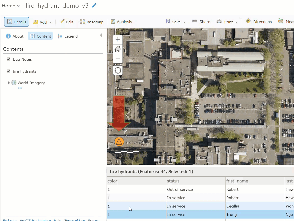
Note: 44 features with error but the features are there via attributes. The layer does have attachments enabled
- Mark as New
- Bookmark
- Subscribe
- Mute
- Subscribe to RSS Feed
- Permalink
I found a possible issue with a picture marker symbol. I had the same problem on another hosted service and I was able to fix it there.