- Home
- :
- All Communities
- :
- Products
- :
- ArcGIS Online
- :
- ArcGIS Online Questions
- :
- Re: How to convert polygon shapefile to csv for si...
- Subscribe to RSS Feed
- Mark Topic as New
- Mark Topic as Read
- Float this Topic for Current User
- Bookmark
- Subscribe
- Mute
- Printer Friendly Page
How to convert polygon shapefile to csv for simpler online mapping?
- Mark as New
- Bookmark
- Subscribe
- Mute
- Subscribe to RSS Feed
- Permalink
I am trying to create an online map showing points within a boundary polygon. The points are displayed as a heat map, and the polygon boundary file sits on top of the heatmap, but I want it to be underneath. I've been told that converting the polygon shapefile to a CSV will resolve the issue, so I've been trying to use the Quick Export tool but it keeps telling me it threw an exception (which probably means I don't know what I'm doing) but I can't seem to find any way to convert it properly.
By pulling up the attribute table, exporting it, loading it in excel, and saving it as a csv, it looks like it works, but there are not coordinates to load in my online map.
Suggestions?
Solved! Go to Solution.
Accepted Solutions
- Mark as New
- Bookmark
- Subscribe
- Mute
- Subscribe to RSS Feed
- Permalink
I think I found the answer:
"Layers are always displayed on top of a basemap and feature layers are always displayed on top of heat maps and tileset layers (map, imagery, and tiles). Depending on the type of layers you have in your map, you may not be able to move them all up or down. For example, if you have one map layer and three feature layers, you can reorder the feature layers, but you cannot move the map layer on top of them. You cannot reorder a KML layer or a basemap."
- Mark as New
- Bookmark
- Subscribe
- Mute
- Subscribe to RSS Feed
- Permalink
Can you clarify a little more on what you are trying to accomplish? Do you simply want to take your shapefiles and display them in ArcGIS Online?
- Mark as New
- Bookmark
- Subscribe
- Mute
- Subscribe to RSS Feed
- Permalink
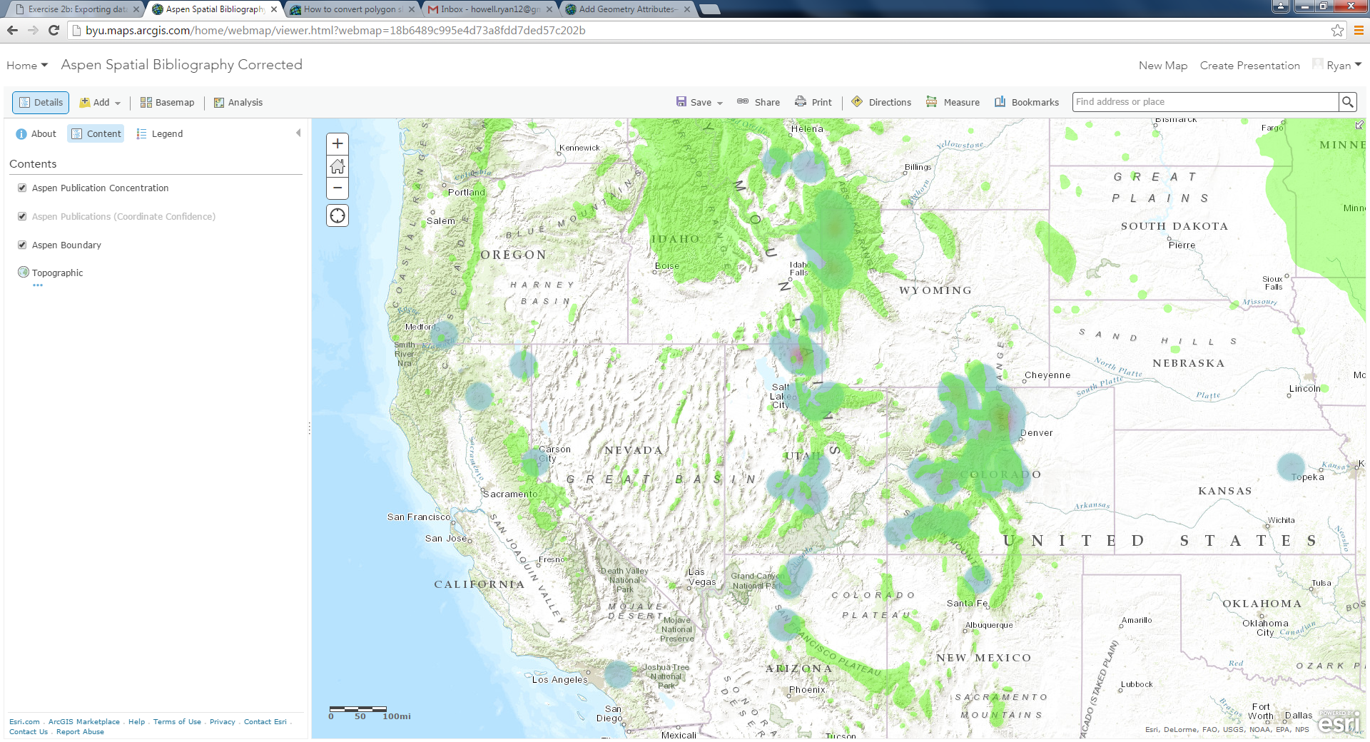
My end goal is to have a large polygon boundary layer underneath a point heatmap on arcgis online. I have uploaded the boundary shapefile to arcgis online, but it draws on top of my heat map made from points. I'm told that converting the polygon shapefile to csv will allow me to draw it under the heat map.
- Mark as New
- Bookmark
- Subscribe
- Mute
- Subscribe to RSS Feed
- Permalink
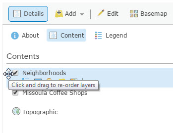
Are you unable to simply move the polygon layer to the bottom of the list in the Contents section? You can re-order a layer by hover to the left of the layer name in the Contents until you mouse pointer changes to a four directional arrow...just hold your left mouse button down and drag the layer down in the list.
- Mark as New
- Bookmark
- Subscribe
- Mute
- Subscribe to RSS Feed
- Permalink
I can move it, but it doesn't change the drawing order. I've listed it at the top and the bottom and it was the same.
I'm told it's because my point files is a csv and my polygon layer is a shapefile, and it is set up to draw the csv first regardless of order
- Mark as New
- Bookmark
- Subscribe
- Mute
- Subscribe to RSS Feed
- Permalink
I just got the idea that maybe if I loaded my point files as a shapefile instead of as a csv I would be able to change the drawing order. So the files I have is a polygon shapefile and a point heatmap.
The polygon is still on top of the heatmap, but if I display the points as location only points, they sit on top of the polygon.
I'm baffled
- Mark as New
- Bookmark
- Subscribe
- Mute
- Subscribe to RSS Feed
- Permalink
I was able to replicate the issue...not sure if it is a bug or simply limited capability with how the heat map is actually being rendered. You could run the Calculate Density analysis tool as a work around although the result will likely look different than the heat map but you will be able to reorder the layers. You may also consider making you polygon layer just an outline, that would allow the heat map to be visible.
- Mark as New
- Bookmark
- Subscribe
- Mute
- Subscribe to RSS Feed
- Permalink
I think I found the answer:
"Layers are always displayed on top of a basemap and feature layers are always displayed on top of heat maps and tileset layers (map, imagery, and tiles). Depending on the type of layers you have in your map, you may not be able to move them all up or down. For example, if you have one map layer and three feature layers, you can reorder the feature layers, but you cannot move the map layer on top of them. You cannot reorder a KML layer or a basemap."
- Mark as New
- Bookmark
- Subscribe
- Mute
- Subscribe to RSS Feed
- Permalink
Bummer...
Thanks for your help!