Turn on suggestions
Auto-suggest helps you quickly narrow down your search results by suggesting possible matches as you type.
Cancel
- Home
- :
- All Communities
- :
- Products
- :
- ArcGIS Online
- :
- ArcGIS Online Questions
- :
- Error in relation to Fill tool
Options
- Subscribe to RSS Feed
- Mark Topic as New
- Mark Topic as Read
- Float this Topic for Current User
- Bookmark
- Subscribe
- Mute
- Printer Friendly Page
Error in relation to Fill tool
Subscribe
898
1
04-07-2020 04:42 PM
04-07-2020
04:42 PM
- Mark as New
- Bookmark
- Subscribe
- Mute
- Subscribe to RSS Feed
- Permalink
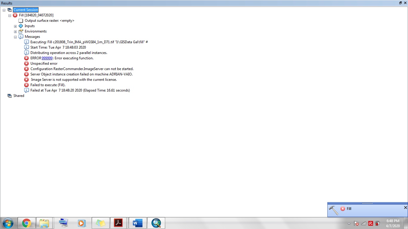
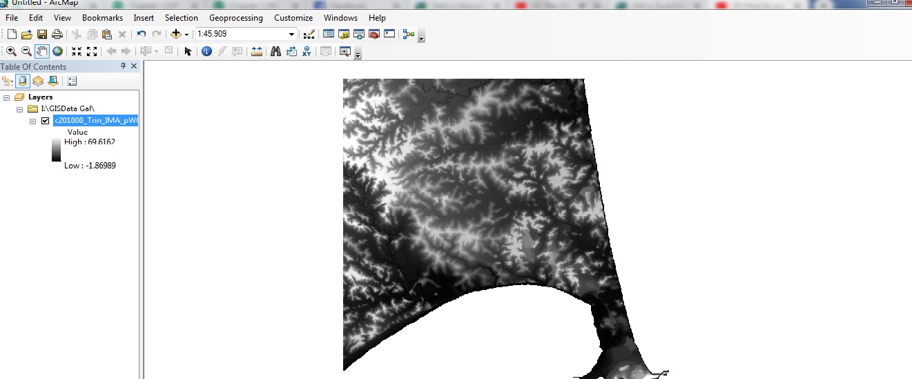
I have been experiencing an error when attempting to use a Spatial analyst tool under Hydrology called the Fill tool,I am using this tool as part of a process to delineate a Water shed using a DEM model, however the errors received in the results are unknown to me, I carefully followed the steps, I have also used the data before for other analysis so I don't think it's corrupted in anyway. I've attached an image of what the error message entails also attached is an image of the file and the type.
1 Reply
04-08-2020
04:31 AM
- Mark as New
- Bookmark
- Subscribe
- Mute
- Subscribe to RSS Feed
- Permalink
"image service is not supported by the current license"
seems to be the root cause, you had better check your licensing