- Home
- :
- All Communities
- :
- Products
- :
- ArcGIS Online
- :
- ArcGIS Online Questions
- :
- Re: Collaborative editing: Change polygon color ba...
- Subscribe to RSS Feed
- Mark Topic as New
- Mark Topic as Read
- Float this Topic for Current User
- Bookmark
- Subscribe
- Mute
- Printer Friendly Page
Collaborative editing: Change polygon color based on whether it has been edited or not
- Mark as New
- Bookmark
- Subscribe
- Mute
- Subscribe to RSS Feed
- Permalink
I am working with two other persons on an urban development project and we need to enter information on more than 12000 parcels manually . I need to know if there is a way to edit in ArcGIS online collaboratively and to be able to keep track of what has been edited and what has not. Maybe a color change in every polygon that has been edited. Is there something like that?
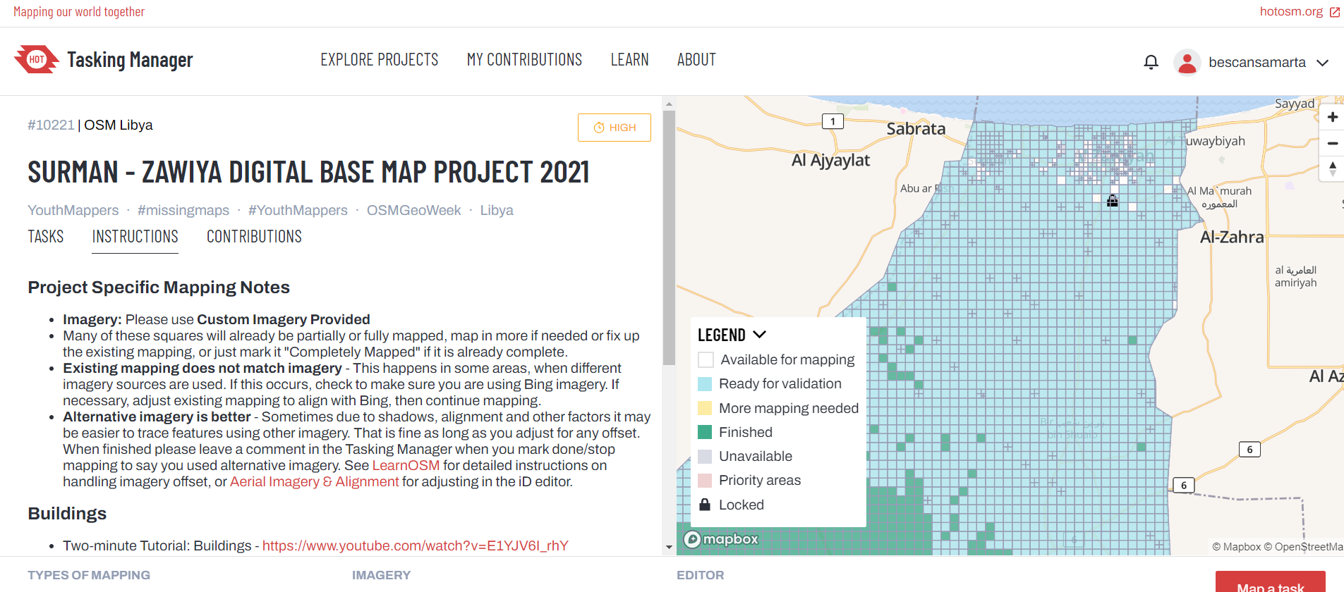
In Humanitarian Open Street Maps they have a very efficient system, but I don't know if it is possible to do something similar with ArcGIS. I attach one picture for reference.
Thanks,
Marta
Solved! Go to Solution.
Accepted Solutions
- Mark as New
- Bookmark
- Subscribe
- Mute
- Subscribe to RSS Feed
- Permalink
I need to know if there is a way to edit in ArcGIS online collaboratively
If the data resides in an SDE database, it can be edited by multiple editors at the same time, using versioning:
https://pro.arcgis.com/en/pro-app/latest/help/data/geodatabases/overview/overview-of-versioning-in-a...
and to be able to keep track of what has been edited and what has not
You can add a field (e.g. "EditStatus") to your table(s) that describes the current state of the feature. This could be something simple, e.g. 1: edited, 0 or null: not edited. Or you could use more statuses, like in your screenshot. After you finish editing a feature, you would set the field's value, probably using a domain to make that even easier. In the map, you would use distinct symbology for each value of the EditStatus field.
Have a great day!
Johannes
- Mark as New
- Bookmark
- Subscribe
- Mute
- Subscribe to RSS Feed
- Permalink
Thanks Johannes. That is what I was thinking. Just wondered if there was an embedded system to conduct such projects. With Humanitarian OpenStreetMaps you can even assign specific area to different persons and things like that.. It is very well organised.
Thank you!