Turn on suggestions
Auto-suggest helps you quickly narrow down your search results by suggesting possible matches as you type.
Cancel
- Home
- :
- All Communities
- :
- Products
- :
- ArcGIS Online
- :
- ArcGIS Online Ideas
- :
- Create hosted feature layers directly within Porta...
Options
- Subscribe to RSS Feed
- Mark as New
- Mark as Read
- Bookmark
- Follow this Idea
- Printer Friendly Page
Create hosted feature layers directly within Portal/AGOL
Follow this Idea
2160
3
04-17-2015 06:12 AM
Status:
Implemented
- Mark as New
- Bookmark
- Subscribe
- Mute
- Subscribe to RSS Feed
- Permalink
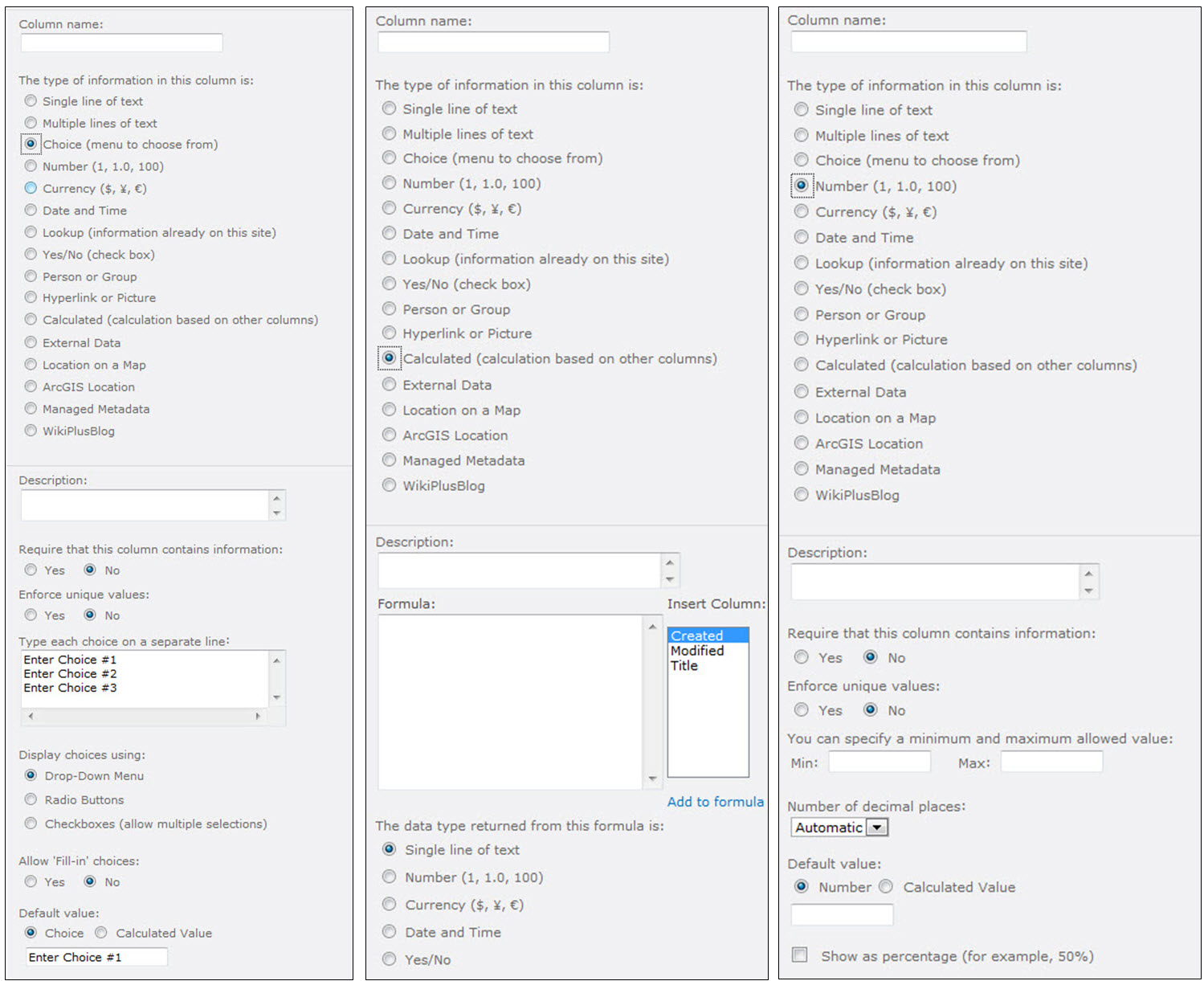
Allow the creation of feature layers using a schema builder similar to Microsoft's SharePoint list wizard. You would pick the geometry type (point/line/polygon) then add attributes. Based on the data type like Text, Pick List, Number, Date, Yes/No, etc you would have other setup options. The user would define the pick list domain values, any default values, decimals places and min/max values for numbers, date vs date/time. Include calculated fields based on other attributes. For example, a user inputs a "inspection date" and the calculated field adds 7 days and auto-inputs the "follow-up date". Include system attributes like lat,lon for points, length for lines, area & perimeter for polygons. These attrubutes could be greyed out or hidden. Customize the data input forms (order, format, etc) using the builder or the existing pop-up configuration tools. These adhoc features layers would be useful for quick inspections using Collector. The web map could be authored using operational data as the background then layer these editable features on top. The adhoc features could be consumed into ArcMap like any hosted service or exported from Portal/AGOL as Shapefiles.

3 Comments
Although not directly embedded in AGOL or Portal, the ArcGIS Developers site has a Feature Service builder that could satisfy most of what you are looking for: schema, rendering, extent, etc. You will find it on the site under the "My Hosted Data" section.
https://developers.arcgis.com/en/hosted-data/#/new
https://developers.arcgis.com/en/hosted-data/#/new
Though not completely implemented, creating layers in ArcGIS Online has been significantly improved at the December 2021 ArcGIS Online update, and a lot of what is mentioned in this idea is now possible through the combination of creating the layer, modifying schema on the data tab of the layer, and leveraging form-based editing in Fields Maps or Map Viewer.
You must be a registered user to add a comment. If you've already registered, sign in. Otherwise, register and sign in.