- Home
- :
- All Communities
- :
- Products
- :
- ArcGIS Online
- :
- ArcGIS Online Ideas
- :
- Complex Symbology on ArcGIS Online
- Subscribe to RSS Feed
- Mark as New
- Mark as Read
- Bookmark
- Follow this Idea
- Printer Friendly Page
- Mark as New
- Bookmark
- Subscribe
- Mute
- Subscribe to RSS Feed
- Permalink
I know a lot of fields have complex symbology they are using for polyline and polygon features, which would be great as web feature services for collaboration.
I have found that this is a major show-stopper for my organisation (85,000 pers) in adopting ArcGIS Online as a mainstream tool in day-to-day planning. We have a team committed to making this work, but without complex symbology drawing options, we are limited in expanding our consumer-base to the bulk of the organisation.
For example, we have line features with triangles, boxes with circles in them and specific markers on the contour lines... all of which are fairly hard to draw on a computer to start with. They also have to made on a map, at certain scales and with coordinate systems. Our current GIS software is dating and only allows GIS users to use it effectively. We now have Portal and ArcGIS Online, but without that final representation, we cannot empower our end-users to conduct the work themselves.
Thanks,
Keven
Hi Both,
Are you ESRI UK clients?
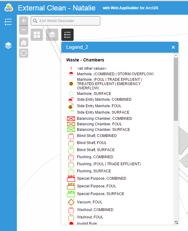
We were told the same back when AGOL was a beta in 2014, however after many many hours with the GIS team we cracked it. The issue is the symbology is being controlled by an integer field rather than the Symboloy_Text field which is a string.. If you convert the Symbology to Representation you can use any symbology you use like. We taught this back to ESRI so it's sad to see it's not widely known.
We built an “Advanced sample map to show it can be done - This is just uploading from Arcgis desktop.

any update on this procedure? this info would be very helpful for complex symbology.
This would be a bigger deal than y'all must realize. It can't be that difficult to add.
Is there some document explaining how to do this? I created a representation and uploaded the feature service, but the complex symbology is lost..
Thanks in advance,
Tom
This is an issue with Server as well. I'm currently trying to publish a feature with complex symbology for an EMS evacuation/incident map that was created way back in 2012. Pro is telling me that the symbology will be "downgraded" before publishing to server. Why is this still an issue?
I would like this to be upgraded in ArcGIS Online. After attending the UC last week, I asked about it. I changed the solid strokes and shape markers to picture stoke and picture marker, which did not work. The symbology was downgraded when attempting to publish to AGOL. I would like to avoid using representation as well. Thanks
You must be a registered user to add a comment. If you've already registered, sign in. Otherwise, register and sign in.