- Home
- :
- All Communities
- :
- Products
- :
- ArcGIS Online
- :
- ArcGIS Online Ideas
- :
- Add Vertical Elevation Exaggeration option to 3D A...
- Subscribe to RSS Feed
- Mark as New
- Mark as Read
- Bookmark
- Follow this Idea
- Printer Friendly Page
Add Vertical Elevation Exaggeration option to 3D ArcGIS online Scene Viewer
- Mark as New
- Bookmark
- Subscribe
- Mute
- Subscribe to RSS Feed
- Permalink
In order to effectively visualize relief in flat topographic areas, we need the ability to add vertical exaggeration to the online scene viewer. This ability exists in ArcPro, and even in the legacy ArcScene, but not in online scene viewer? This makes it very difficult to share interactive 3D data with non-GIS users.
I made a goof while sharing a map in AGOL and accidentally had elevation data in feet which gets read as meters when published. The thing is, it looks so much better with the vertical exaggeration I almost want to leave it that way. Having an option to adjust vertical exaggeration in web scenes like you can in ArcPro would be terrific as I could apply that change to make the scene's details easier to view while not having bad elevation data.
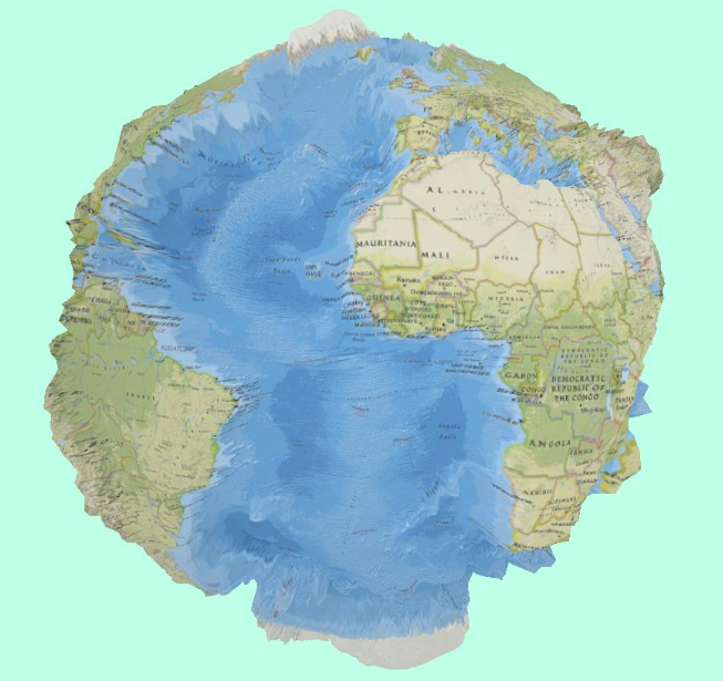
I would love to be able to create something like this using the TopoBathy3D elevation layer and vertical exaggeration to extenuate variations in surface and sub-surface elevations. This was created in ArcGIS Pro.

I'm working on creating vertical exaggerated layers but it's not easy.
https://experience.arcgis.com/experience/40cdd50316a64f7ebb75633313930642/page/3d-view-(6-X)/
Wow, @TommyDSM! The mountains along the San Pedro River Valley have never looked steeper! Mind sharing what resources or approaches you used to achieve vertical exaggeration of elevation in ArcGIS Online Local Scene? I'm attempting to do something similar for another area, and am disappointed that this can't be directly adjusted in the properties of the elevation source.
Hi David, I did this months ago with USGS 10 m data that i interpolated to a 4 m DEM. Those methods are not working. I've had a case open for almost a month working with ESRI to figure out why and work arounds. Once I get a procedure that is working, I will send you my methods.
A use case for which we would like to have vertical exaggeration is for displaying different excavation levels in an archaeological trench after it is has been fully excavated. The length/width of excavated areas is often on the order of a few meters, while the vertical may only be a few centimeters. Vertical exaggeration is necessary to visually separate the layers a usable distance.
I'd love to see this for aquifer/groundwater visualization as well. Some of the underground layers would appear to be fixed and not variable without exaggeration. Currently I'd have to cheat by multiplying all my raster layers and vector elevation/height attribute values to fake (exaggerated) numbers for visualization purposes and then maybe turn off any popups based on those exaggerated values so users don't see them and confuse them with real measurements.
You must be a registered user to add a comment. If you've already registered, sign in. Otherwise, register and sign in.