Turn on suggestions
Auto-suggest helps you quickly narrow down your search results by suggesting possible matches as you type.
Cancel
- Home
- :
- All Communities
- :
- Products
- :
- ArcGIS Network Analyst
- :
- ArcGIS Network Analyst Questions
- :
- Re: Service Area Polygon Shapes Look Wrong
Options
- Subscribe to RSS Feed
- Mark Topic as New
- Mark Topic as Read
- Float this Topic for Current User
- Bookmark
- Subscribe
- Mute
- Printer Friendly Page
Service Area Polygon Shapes Look Wrong
Subscribe
5681
12
08-18-2011 01:00 PM
08-18-2011
01:00 PM
- Mark as New
- Bookmark
- Subscribe
- Mute
- Subscribe to RSS Feed
- Permalink
Hello,
I am trying to create a single service area for a number of facilities using distance limits. I have run a number of tests and each time the polygons and lines created seem to be incomplete. The analysis seems to ignore some streets completely while not traveling the full impedance distance on other roads which creates very lopsided polygons. Why is this happening? I am using minimal parameters and my network is set up correctly.
I recently started using the tutorial data and network dataset downloaded as part of ArcTutor for my tests in case there is something else going on with my data and network but I am seeing the same issues. I have included a screen shot to help illustrate my issues. I simplified the analysis in the screen shot example. My impedance distance is 500 meters. Why are roads that are clearly within a distance of 500 meters from my facility not included as lines and not within the generated polygon?
Thank you very much from a stressed GIS Analyst with a looming deadline
12 Replies
08-18-2011
01:10 PM
- Mark as New
- Bookmark
- Subscribe
- Mute
- Subscribe to RSS Feed
- Permalink
Your screen shot is very fuzzy so cannot really tell what lines should be in or out of the service area. Also it is not shown where the facility location is that generated the service area.
But it looks like you are doing the default Generalized service ares. Bring up the service area layer properties and on the Polygon generation tab click on the Detailed method and re-solve and see if that will clear the problems you are encountering.
Jay Sandhu
But it looks like you are doing the default Generalized service ares. Bring up the service area layer properties and on the Polygon generation tab click on the Detailed method and re-solve and see if that will clear the problems you are encountering.
Jay Sandhu
08-18-2011
01:16 PM
- Mark as New
- Bookmark
- Subscribe
- Mute
- Subscribe to RSS Feed
- Permalink
Thanks Jay. Hopefully this screenshot is clearer. I have played around with the polygon generation tab quite a bit already. Honestly I don't really care about the polygon as much as the line that are traversed. Why are some lines very close to the facility (Green Dot) not traversed?
Thanks
Thanks
08-18-2011
02:59 PM
- Mark as New
- Bookmark
- Subscribe
- Mute
- Subscribe to RSS Feed
- Permalink
Paris has quite a few one way roads and the Paris tutorial data reflects this. The service area solver only goes one way on a street because the oneway restriction attribute is honored by default. To change this:
- Right click on the "Service Area" layer in the table of contents
- Select "Properties" (on the bottom of the list of commands)
- Click on the Analysis Settings tab for the service area layer properties
- Uncheck the Oneway restriction (this will allow you to traverse the wrong way down a oneway street)
08-19-2011
09:19 AM
- Mark as New
- Bookmark
- Subscribe
- Mute
- Subscribe to RSS Feed
- Permalink
Thanks Douglas. I removed the one-way restriction for the Paris test data and the was able to better understand the service area lines created. I appreciate your help.
Mike
Mike
09-14-2011
05:59 AM
- Mark as New
- Bookmark
- Subscribe
- Mute
- Subscribe to RSS Feed
- Permalink
Hi All,
I am having some similar problem:
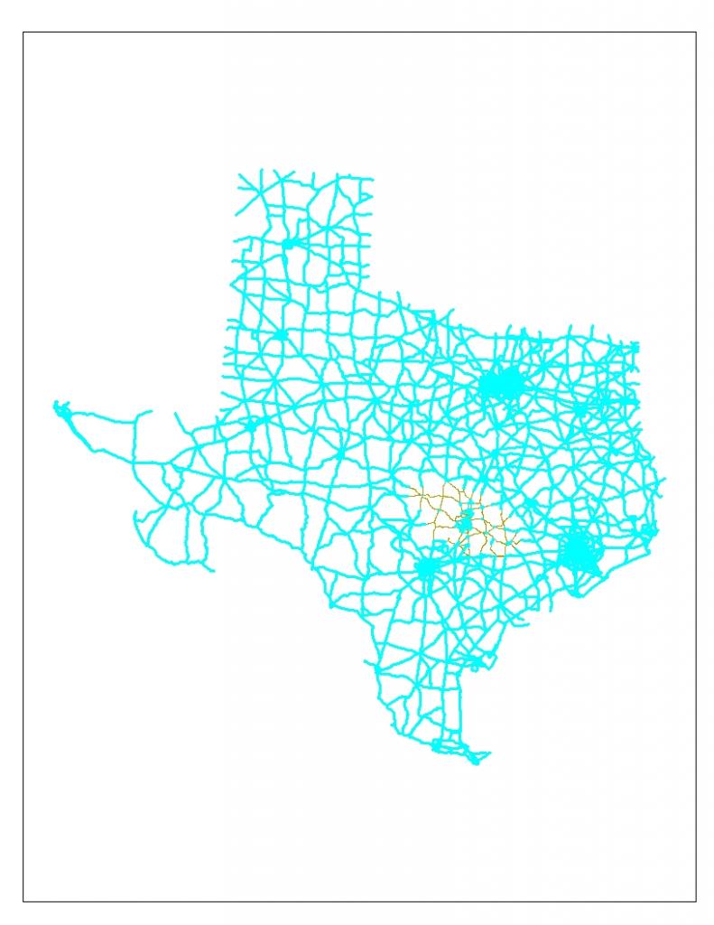
1) I need to find the service area within 5, 10, 15 minutes of the county centroids. When i solve that with the create new service area tool of network analyst it doesn't give the correct answer (it selects the whole state of Texas for some of the points which is wrong. It should create concentric circles around the county centroids with regions at 5, 10, 15 minutes from those points).
2) I am having the same issue with the cities too. When I try to create a service area within 3 hours from San Antonio, Austin, Houston and Dallas it selects the whole of Texas. In fact it should create a circle around the city with areas within 3 hrs from it.
The data is at the following site:
http://kbdi.tamu.edu/SHRP2/Projected/deb.zip
I am attaching a screenshot for this.
i would greatly appreciate if you could kindly look into the matter and get back to me at the earliest.
I am having some similar problem:
1) I need to find the service area within 5, 10, 15 minutes of the county centroids. When i solve that with the create new service area tool of network analyst it doesn't give the correct answer (it selects the whole state of Texas for some of the points which is wrong. It should create concentric circles around the county centroids with regions at 5, 10, 15 minutes from those points).
2) I am having the same issue with the cities too. When I try to create a service area within 3 hours from San Antonio, Austin, Houston and Dallas it selects the whole of Texas. In fact it should create a circle around the city with areas within 3 hrs from it.
The data is at the following site:
http://kbdi.tamu.edu/SHRP2/Projected/deb.zip
I am attaching a screenshot for this.
i would greatly appreciate if you could kindly look into the matter and get back to me at the earliest.
09-14-2011
08:24 AM
- Mark as New
- Bookmark
- Subscribe
- Mute
- Subscribe to RSS Feed
- Permalink
Hi All,
I am having some similar problem:
1) I need to find the service area within 5, 10, 15 minutes of the county centroids. When i solve that with the create new service area tool of network analyst it doesn't give the correct answer (it selects the whole state of Texas for some of the points which is wrong. It should create concentric circles around the county centroids with regions at 5, 10, 15 minutes from those points).
2) I am having the same issue with the cities too. When I try to create a service area within 3 hours from San Antonio, Austin, Houston and Dallas it selects the whole of Texas. In fact it should create a circle around the city with areas within 3 hrs from it.
The data is at the following site:
http://kbdi.tamu.edu/SHRP2/Projected/deb.zip
I am attaching a screenshot for this.
i would greatly appreciate if you could kindly look into the matter and get back to me at the earliest.
1. I have never seen nor expected to see concentric circles around any location for which I've created a service area for. It just dosen't work that way. I haven't looked at your data, but you should; obviously there is a problem with the way your travel time calculation is or isn't working to be able to drive 15 minutes across Texas.
2. Again, it won't create a circle. Leave that misconception behind. And again, look more closely at your data and or you drive time calculations.
That should just about do it....
09-14-2011
08:42 AM
- Mark as New
- Bookmark
- Subscribe
- Mute
- Subscribe to RSS Feed
- Permalink
Joe,
thx for your insights...i agree that the service area will not be circular in the true sense but what i meant by concentric circles is basically a region around the centroid with a travel time of 5, 10 or 15 min. But if you see the attached diagram, a 15 min travel time selects the whole of Texas. Am not sure where am i going wrong...i have followed the standard steps as in the Tutorial.
I am new to Network Analyst and am not sure where to start checking.....I can guess there is some problem with the network data but don't know what..:)....
thx
Deb
09-14-2011
11:39 AM
- Mark as New
- Bookmark
- Subscribe
- Mute
- Subscribe to RSS Feed
- Permalink
Deb- I just took a peek at your data; you only have 13483 roads in your network: 13070 have a value of 0 (zero) minutes.
You are basing your analysis on drive time and using the minutes field as your basis of accumulation. If the vast majority of your roads have no time calculated, then the 5,10,15, or any amount of time is never met.
See attached jpg; I selected minutes = 0.
You are basing your analysis on drive time and using the minutes field as your basis of accumulation. If the vast majority of your roads have no time calculated, then the 5,10,15, or any amount of time is never met.
See attached jpg; I selected minutes = 0.
That should just about do it....
09-14-2011
07:01 PM
- Mark as New
- Bookmark
- Subscribe
- Mute
- Subscribe to RSS Feed
- Permalink
Joe,
Thanks a ton for taking a look at my data. I know that vast majority of the roads have 0 minutes but the roads surrounding the county centroids have some value in the minutes field. If you just try with 5 minutes then you will see that most of the county centroids have a service area around them except for Caldwell and Hayes. Hayes is not on the network so lets ignore it. For Caldwell, it is generating the service area across whole of Texas. And as you pointed out, is it because of the edges with zero minutes?? I just saw a few of them near to the County Centroid named Caldwell. Do you know of any road network dataset for Texas which will have the minutes for all the edges?? Then I can use that to get the service area with time as impedence.
Once again, thanks for your inputs.....:)
Deb