- Home
- :
- All Communities
- :
- Products
- :
- ArcGIS Network Analyst
- :
- ArcGIS Network Analyst Questions
- :
- Network Analyst -- No route between two locations
- Subscribe to RSS Feed
- Mark Topic as New
- Mark Topic as Read
- Float this Topic for Current User
- Bookmark
- Subscribe
- Mute
- Printer Friendly Page
Network Analyst -- No route between two locations
- Mark as New
- Bookmark
- Subscribe
- Mute
- Subscribe to RSS Feed
- Permalink
I am attempting to create routes between bus stops using Network Analyst. In some cases, I get an error message that says there is no route between two locations. I have played around with the topology in case there were issues there (increasing xy tolerance to 1ft) and I have also set the directionality for all segments to be bidirectional. Both of these were in an attempt to get a temporary solution. I am not exactly sure what to look for in determining what the issue is. I have attached a screenshot showing the two points that cannot be routed along with the error message.
- Mark as New
- Bookmark
- Subscribe
- Mute
- Subscribe to RSS Feed
- Permalink
Jeremy,
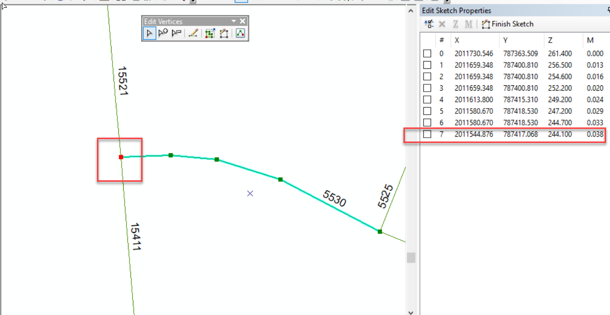
Looking at the data explains the issue. Your street line data is 3D! So even though the X,Y may be the same, the Z values are not. For example, the three lines around bus stop feature 20 that do not connect have the following vertices:
15411, 2011544.876, 787417.068, 247.212
15521, 2011544.876, 787417.068, 247.212
5530, 2011544.876, 787417.068, 244.100
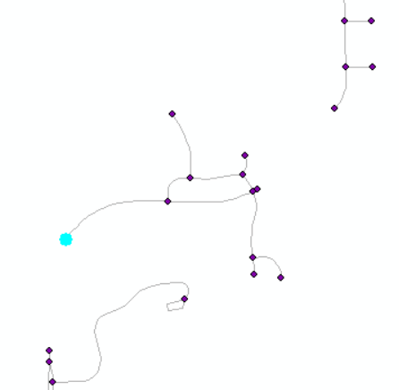
Even though the X and Y are the same, the Z values of one of them, 244.1 does not match the 247.212 of the others. Visually:
You could either fix the data at the places the z's do not match or drop the z's and rebuild the network
Jay Sandhu
- Mark as New
- Bookmark
- Subscribe
- Mute
- Subscribe to RSS Feed
- Permalink
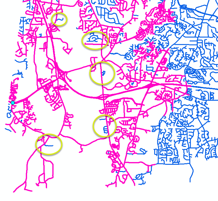
The streets around junction 49 are not connected to anything:
I did a service area lines for 30,000 feet around junction 52 and say many disconnected areas: Purple is the reached service area lines over the blue streets. I put yellow circle around some of the disconnected edges.
Jay Sandhu
- Mark as New
- Bookmark
- Subscribe
- Mute
- Subscribe to RSS Feed
- Permalink
Jay,
I meant the OBJECTID off the bus route layer, not the junctions layer. I
know there are a few instances of 'islands' due to cutting the network
dataset to our service area. I may have to expand to ensure this does not
happen with the final product. However, catching the differences in the
z-coordinate was the difference (I am assuming you manually calculated this
or was there another step you did to find this discrepancy?). This was not
something that I would have thought and probably should have just removed
it from the network dataset to start with since I wasn't worried about
elevation. After removing elevation from the network dataset, I was able to
route 1031 bus routes (all but 9). I will dig deeper into these 9, but I
have a feeling they will be based on the issue you raised about the
'islands'.
Thank you so much for your assistance!
Jeremy
- Mark as New
- Bookmark
- Subscribe
- Mute
- Subscribe to RSS Feed
- Permalink
I meant to say ObjectID not junctionID. Those 49 and 52 were the ones you mentioned, so I was using them in the examples. Glad that removing the 3D has given you most of the routes. The rest I expect are going to be disconnected portions of the network. Let me know if you are not able to find the root cause for them.
As far as the 3D, I just looked at the line feature class properties and realized it was Z enabled, so used the Editor to examine the 3D sketch properties and see the 3D vertices.
Regards,
Jay Sandhu
- « Previous
-
- 1
- 2
- Next »
- « Previous
-
- 1
- 2
- Next »