- Home
- :
- All Communities
- :
- Products
- :
- ArcGIS Network Analyst
- :
- ArcGIS Network Analyst Questions
- :
- Re: Network analysis issue
- Subscribe to RSS Feed
- Mark Topic as New
- Mark Topic as Read
- Float this Topic for Current User
- Bookmark
- Subscribe
- Mute
- Printer Friendly Page
Network analysis issue
- Mark as New
- Bookmark
- Subscribe
- Mute
- Subscribe to RSS Feed
- Permalink
Hello everybody !
I am encoutering an issue using Network analysis extension on Arcmap 10.5.
What I would do is by the use of a route analysis, generate a route for pedestrian on sidewalks of a city.
I followed a tutorial which has permitted me to generate a route for the visit of every subway station of Paris (just an example!)
So my issue is the following :
- In the tutorial I have data for the streets represented by lines that are all linked.
- In my dataset, sidewalks are represented by polylines that are NOT linked.
I can't manage to do this analysis. Please if someone has an idea on the subject, let me know.
- Mark as New
- Bookmark
- Subscribe
- Mute
- Subscribe to RSS Feed
- Permalink
If pedestrians can cross the street, those crossings should also be represented in you network dataset with lines.
- Mark as New
- Bookmark
- Subscribe
- Mute
- Subscribe to RSS Feed
- Permalink
Besides what Xander Bakker suggested, run topology to ensure your linework is truly connected. I mention this as much linework that represents roads, streets, pedestrian paths and such comes from CAD, which does not always snap the linework together so the lines touch. Tiny gaps, which are not readily visible, will stop a Network analysis cold. This is a very common issue.
I would suggest loading your data into a Feature Dataset in a File Geodatabase and then run Topology to ensure the linework is truly connected. Use the rule "Must Not Have Dangles". Note that this will trigger on valid situations, like dead ends, so you will have to review the results and make a determination for each case that shows up.
Another alternative is to employ this Add-in created by GeoNet Member Tim Witt, which automates the Topology process.
Topology Check Python AddIn (6/30/17)
Chris Donohue, GISP
"Network Analysis = 1% Analysis + 99% Data Cleanup"
- Mark as New
- Bookmark
- Subscribe
- Mute
- Subscribe to RSS Feed
- Permalink
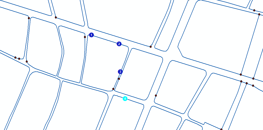
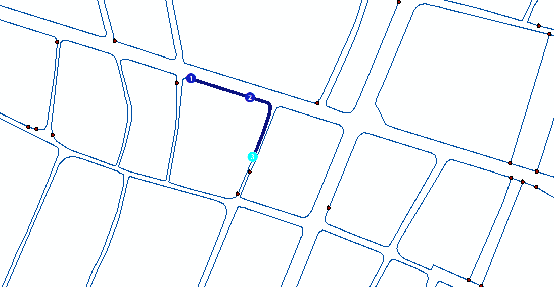
From your screen shots, it looks like you do not have a street network. You have polygon blocks that do not connect to another polygon block. As in your not working screenshot, there is no link between stop 3 to stop 4. The streets are missing. You will have to either convert these to centerlines and set up all the attributes like street names, travel costs and restrictions such as pedestrian crosswalks, etc., or get that street data from a vendor. It is not going to be easy to convert these polygons into streets.
Jay Sandhu
- Mark as New
- Bookmark
- Subscribe
- Mute
- Subscribe to RSS Feed
- Permalink
Thanks for all of your replies. I'll try to find an other dataset representing streets, or at least informations about missing crossings. Do you think that my issue could be solved using an other extension for example?
- Mark as New
- Bookmark
- Subscribe
- Mute
- Subscribe to RSS Feed
- Permalink
The Network Analyst is what is used for movement studies using linear networks. I don't think even the Spatial Analyst with its Cost Path analysis would help.