- Home
- :
- All Communities
- :
- Products
- :
- ArcGIS Network Analyst
- :
- ArcGIS Network Analyst Questions
- :
- Re: measure distance between points, - taking terr...
- Subscribe to RSS Feed
- Mark Topic as New
- Mark Topic as Read
- Float this Topic for Current User
- Bookmark
- Subscribe
- Mute
- Printer Friendly Page
measure distance between points, - taking terrain elevatin into account.
- Mark as New
- Bookmark
- Subscribe
- Mute
- Subscribe to RSS Feed
- Permalink
Ok I'm changing this, it just got simpler. Yes- and I have 10.1 advanced, and enterprise server- with spatial analyst, 3d and network analyst.
don't care about topography
They pass us a location, that will be a point from one of a series of preexisting layers (which may include lat long or mailing address, but not generally. Generally it will be a preexisting point for a point layer.
We need to measure a straight line from that - selected point - to a bunch of points in 1 other layer.
That's it. - looking for an output of a table of distances and point information.
- Mark as New
- Bookmark
- Subscribe
- Mute
- Subscribe to RSS Feed
- Permalink
This sounds like a Spatial Analyst function. Do you have a spatial analyst license?
edit:
maybe How the path distance tools work—Help | ArcGIS for Desktop
- Mark as New
- Bookmark
- Subscribe
- Mute
- Subscribe to RSS Feed
- Permalink
EDIT
It appears the question was edited to simplify the problem to ignore terrain or 3D distance so ...
--------------------- to original question
You need the 3D analyst
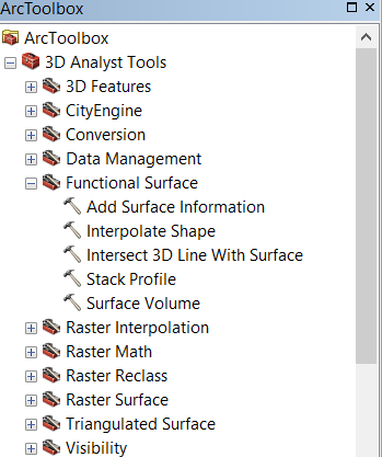
Depending how you want to do it,you can produce graphs using the 3D toolbar or you can use one of the tools in arctoolbox perhaps the Add Surface Information tool, if you already have shapes, particularly polylines.
- Mark as New
- Bookmark
- Subscribe
- Mute
- Subscribe to RSS Feed
- Permalink
If you're only interested in the straight-line 3d distance between points, you can use good-old math to figure it out without 3D Analyst:
>>> sr = arcpy.Describe("valley_pt_elev").spatialReference # spatial ref
... with arcpy.da.SearchCursor("valley_pt_elev","SHAPE@",spatial_reference=sr) as sCursor: # get original point geometry
...     for sRow in sCursor:
...         orig_point = sRow[0].centroid
... with arcpy.da.UpdateCursor("mtn_pnts_elev",["SHAPE@","dist_3d"],spatial_reference=sr) as uCursor: # loop through other points
...     for uRow in uCursor:
...         point = uRow[0].centroid
...         dx = point.X - orig_point.X
...         dy = point.Y - orig_point.Y
...         dz = point.Z - orig_point.Z
...         hor_dist = math.sqrt(math.pow(dx,2) + math.pow(dy,2)) # calculate horizontal distance
...         dist_3d = math.sqrt(math.pow(dz,2) + math.pow(hor_dist,2)) # calculate 3d distance
...         print(dx,dy,dz,dist_3d,hor_dist,uRow[0].distanceTo(orig_point)  )
...         uRow[1] = dist_3d
...         uCursor.updateRow(uRow) # update 3d distance field