- Home
- :
- All Communities
- :
- Products
- :
- ArcGIS Network Analyst
- :
- ArcGIS Network Analyst Questions
- :
- Re: Build network dataset failed
- Subscribe to RSS Feed
- Mark Topic as New
- Mark Topic as Read
- Float this Topic for Current User
- Bookmark
- Subscribe
- Mute
- Printer Friendly Page
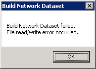
Build network dataset failed
- Mark as New
- Bookmark
- Subscribe
- Mute
- Subscribe to RSS Feed
- Permalink
Is there no longer a need to rebuild a network after editing in .gdb format?
Thanks for any comments or assistance you can provide,
Frank
- Mark as New
- Bookmark
- Subscribe
- Mute
- Subscribe to RSS Feed
- Permalink
Jay Sandhu
- Mark as New
- Bookmark
- Subscribe
- Mute
- Subscribe to RSS Feed
- Permalink
Jay
I am getting the same error. I tried it in GeoDatabase and FileDatabase. I already enabled turns in the network dataset and Hard disk has more than 13 GB space left.
- Mark as New
- Bookmark
- Subscribe
- Mute
- Subscribe to RSS Feed
- Permalink
Gurmeet,
can you post some more details on the size of your network dataset, and is your TEMP folder in the same place with the free 13 GB disk space.
Jay Sandhu
- Mark as New
- Bookmark
- Subscribe
- Mute
- Subscribe to RSS Feed
- Permalink
Hi Jay,
I am having the same problem with my network dataset failing to build. I searched my C drive and there are a few Temp folders. Would it be this one? --> C:\Windows\Temp ? If so, my C drive has 47 GB of free space. Can you please give me guidance on how to get my dataset to build? My network dataset is 832 MB (roads for all of the PNW).
thanks so much
natalie
- Mark as New
- Bookmark
- Subscribe
- Mute
- Subscribe to RSS Feed
- Permalink
The Build Network leaves a log file. You can open it in Notepad and see what messages are in there. The file is usually created in a temporary folder inside the system temp folder. To get to the system temp, in an explorer window, navigate to %TEMP% this is usually c:\users\<user name>\AppData\Temp and then search for a recent folder perhaps starting with the word arc and look for a build.txt file.
Jay Sandhu
- Mark as New
- Bookmark
- Subscribe
- Mute
- Subscribe to RSS Feed
- Permalink
Hi Jay,
I looked in C:\Windows\Temp and C:\Users\Natalie\AppData\Local\Temp and there is no recent folder or text file associated with esri or build.txt. I also searched my C drive for build.txt and nothing came up. Is there a way to specify in ArcCatalog where it will put the log file?
thank you,
natalie
- Mark as New
- Bookmark
- Subscribe
- Mute
- Subscribe to RSS Feed
- Permalink
You can specify the location of the TEMP but not where to put the log file. I suggest that you start the build network and then while it is running, open the arc folder while it is still running. These folders are normally deleted when you exit ArcCatalog app.
Jay Sandhu
- Mark as New
- Bookmark
- Subscribe
- Mute
- Subscribe to RSS Feed
- Permalink
I apologize for being dense when it comes to this background computing stuff, but I don't know which arc folder you are referring to. Can you please be a little more specific?
- Mark as New
- Bookmark
- Subscribe
- Mute
- Subscribe to RSS Feed
- Permalink
"navigate to %TEMP% this is usually c:\users\<user name>\AppData\Temp and then search for a recent folder perhaps starting with the word ARC and look for a build.txt file"