- Home
- :
- All Communities
- :
- Products
- :
- Mapping and Charting Solutions
- :
- Mapping and Charting Questions
- :
- Re: How does a proj-string (UTM) w/o a zone number...
- Subscribe to RSS Feed
- Mark Topic as New
- Mark Topic as Read
- Float this Topic for Current User
- Bookmark
- Subscribe
- Mute
- Printer Friendly Page
How does a proj-string (UTM) w/o a zone number work?
- Mark as New
- Bookmark
- Subscribe
- Mute
- Subscribe to RSS Feed
- Permalink
Software: RStudio
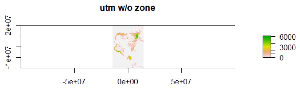
Data: a world elevation map, elev, which was downloaded from Manuel Gimond's web site
The original crs is as follows:
+proj=longlat +ellps=WGS84 +towgs84=0,0,0,0,0,0,0 +no_defsI did a test as follows, just out of curiosity:
elev_projected <- projectRaster(elev, crs = "+proj=utm +ellpse=WGS84") # the +zone= parameter not specified
In ArcGIS Desktop, when projecting to UTM, we have to specify which specific zone to use. R, however, seems to allow this to happen w/o complaining. Even though there was a warning message, the raster was projected anyway.
3 projected point(s) not finiteThe extent of the output is as follows:
xmin : -14587336 xmax : 14350664 ymin : -19985214 ymax : 20161986I wonder what actually happens when the zone parameter is missing from the proj string. Does this string make any sense? The output map is attached. Thanks.
- Mark as New
- Bookmark
- Subscribe
- Mute
- Subscribe to RSS Feed
- Permalink
There are 60 zones north of the equator that are identical and 60 zones south of the equator that are identical (albeit, for a given datum).
The 'relative' location of objects within a zone will remain the same, however, the central meridian of each, as you know is different. So, it really doesn't matter what you do with the data that are projected in UTM as long as you don't try to tie it into real world coordinates... which requires that the central meridian (in meters) is translatable to a longitude of the appropriate datum.
- Mark as New
- Bookmark
- Subscribe
- Mute
- Subscribe to RSS Feed
- Permalink
Totally agreed! We could use whatever projection available as long as we don't tie it into coordinates. The R community should have made the zone parameter "required" in this proj string. Thanks.
- Mark as New
- Bookmark
- Subscribe
- Mute
- Subscribe to RSS Feed
- Permalink
Those pirates 