- Home
- :
- All Communities
- :
- Products
- :
- Mapping and Charting Solutions
- :
- Mapping and Charting Questions
- :
- Having two UTM Zones and Grids on One Map
- Subscribe to RSS Feed
- Mark Topic as New
- Mark Topic as Read
- Float this Topic for Current User
- Bookmark
- Subscribe
- Mute
- Printer Friendly Page
Having two UTM Zones and Grids on One Map
- Mark as New
- Bookmark
- Subscribe
- Mute
- Subscribe to RSS Feed
- Permalink
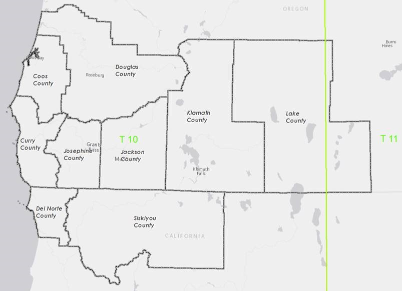
I am building a wall map for our SAR team and the regional SAR group which includes 9 counties in southern Oregon and Northern California. They would like to have a UTM grid on it and while it is primarily in UTM T 10 the eastern portion is in UTM T 11. This creates issues with grid angles and at this point I haven’t found a projection that works with 2 different utm zones on the same map. Any ideas suggestions or ideas? What am I missing? ?
?
- Mark as New
- Bookmark
- Subscribe
- Mute
- Subscribe to RSS Feed
- Permalink
is it the grids for the 2 zones that you want on? ( a dual zone or zipper grid)
Grid Properties—Help | ArcGIS for Desktop
Coordinate system zones and neatline clipping—Help | ArcGIS for Desktop
There seems to be options in the Production Mapping or Defense mapping extensions... I haven't tried it, but one would assume that this base functionality wouldn't be confined to those extensions
- Mark as New
- Bookmark
- Subscribe
- Mute
- Subscribe to RSS Feed
- Permalink
Thanks for the response. I am not sure what you mean by zipper grid but dual zone would probably be correct. They would like to have a usable UTM grid on the 44'' x 62" map. It spans 2 UTM zones so, depicting this in a way that makes it easy to calculate coordinates is problematic.Your Coordinate system Zones... link seems promising.
- Mark as New
- Bookmark
- Subscribe
- Mute
- Subscribe to RSS Feed
- Permalink
Hi Bob,
With ArcGIS Pro for 2.2, UTM zones can be clipped to the boundary. The clipping apples to all the components of the grid. Please let us know if it addresses your need.
Thanks,
Vishnu.