- Home
- :
- All Communities
- :
- Products
- :
- Mapping and Charting Solutions
- :
- Mapping and Charting Questions
- :
- Re: gps coordinates showing up in 2 different loca...
- Subscribe to RSS Feed
- Mark Topic as New
- Mark Topic as Read
- Float this Topic for Current User
- Bookmark
- Subscribe
- Mute
- Printer Friendly Page
gps coordinates showing up in 2 different locations!
- Mark as New
- Bookmark
- Subscribe
- Mute
- Subscribe to RSS Feed
- Permalink
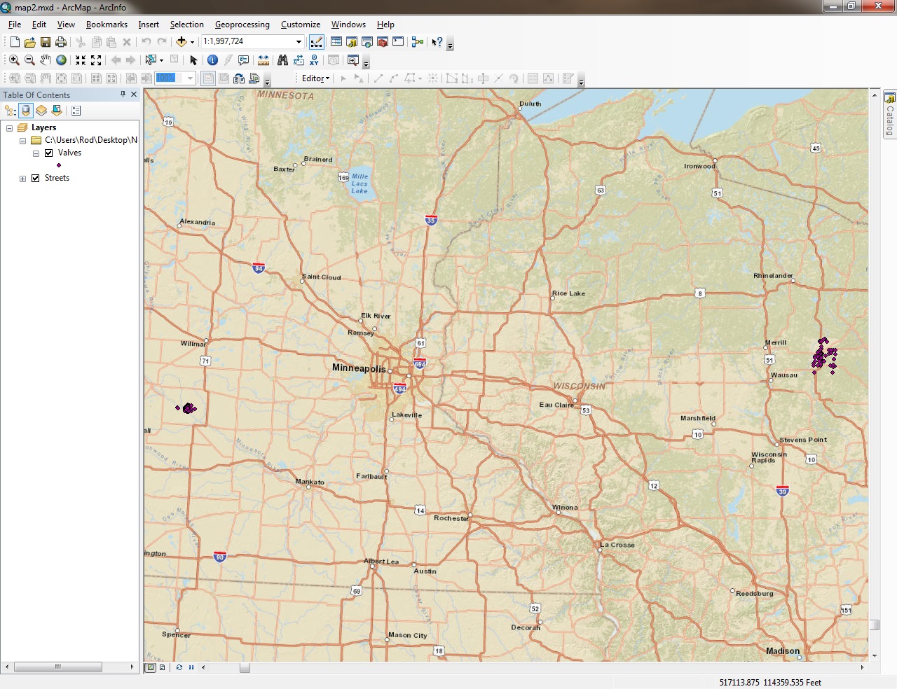
 I'm adding data including gps information that is in decimal degrees into arcmap, and the data is showing up in 2 different locations on the map! Not sure what's causing this! The correct location should be central Wisconsin on the right side of the screenshot! Thanks
- Mark as New
- Bookmark
- Subscribe
- Mute
- Subscribe to RSS Feed
- Permalink
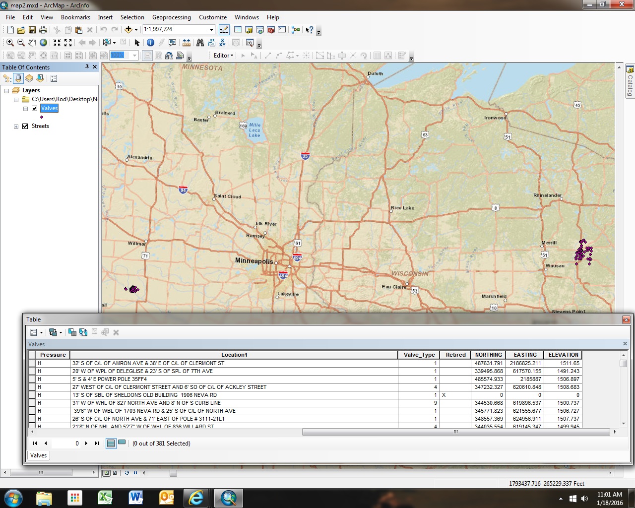
If the gps data is in dd, why are they showing up as what appears to be state plane feet?
- Mark as New
- Bookmark
- Subscribe
- Mute
- Subscribe to RSS Feed
- Permalink
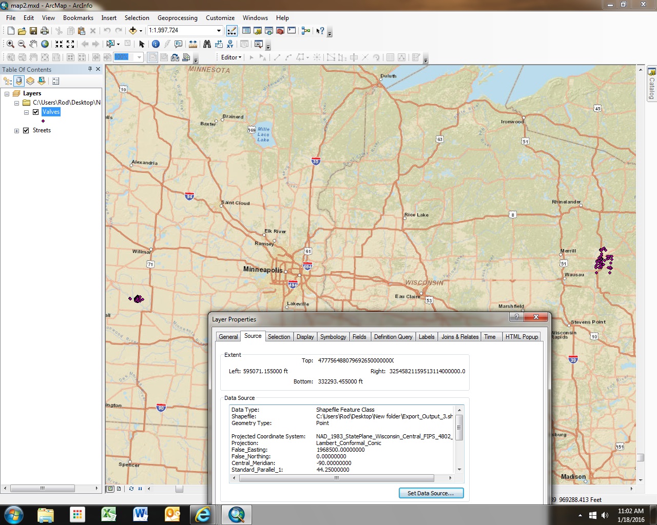
Not sure if I understand what you did. You say you have GPS data in decimal degrees, but the second screenshot is showing projected coordinates in the fields (NORTING and EASTING). Furthermore, the third screenshot shows a projected coordinate system (not geographic). Are you sure the proper coordinate system was assigned (corresponding to the source of the coordinates)? You may need one that has a different "False_Easting".
- Mark as New
- Bookmark
- Subscribe
- Mute
- Subscribe to RSS Feed
- Permalink
The table doesn't look like coordinates in decimal degrees...maybe they are hidden and if so you want to make sure your data frame is set to WGS 84. Otherwise make sure your data frame is set to match the datum of your x,y values.
- Mark as New
- Bookmark
- Subscribe
- Mute
- Subscribe to RSS Feed
- Permalink
My mistake, not in decimal degrees! I changed it to WGS 84 and the points disappear from the basemap!
- Mark as New
- Bookmark
- Subscribe
- Mute
- Subscribe to RSS Feed
- Permalink
are you at the border between two projected zones by any chance? don't know what the extent E-W would be for a state plane or utm at that latitude
- Mark as New
- Bookmark
- Subscribe
- Mute
- Subscribe to RSS Feed
- Permalink
I’m getting things sorted out! Just talked to how did the gps points and there was 2 different coordinated systems used! Got the lat and long coordinates now so hopefully solve my issues! Thanks