- Home
- :
- All Communities
- :
- Developers
- :
- JavaScript Maps SDK
- :
- JavaScript Maps SDK Questions
- :
- Polygon renderer issue fixed in v4.13 - when's the...
- Subscribe to RSS Feed
- Mark Topic as New
- Mark Topic as Read
- Float this Topic for Current User
- Bookmark
- Subscribe
- Mute
- Printer Friendly Page
Polygon renderer issue fixed in v4.13 - when's the release date?
- Mark as New
- Bookmark
- Subscribe
- Mute
- Subscribe to RSS Feed
- Permalink
Hello,
I recently tried upgrading from v4.10 to v4.12 and encountered some breaking changes where my choropleth lost its fill. v4.11 is not affected, and from my understanding, v4.12 implemented a paradigm shift for performance improvements - renderers not working correctly appears to be a common complaint, maybe from the following in the release notes:
As part of performance optimizations, incorrect polygon geometries that don't follow the expected clockwise order, no longer display. Polygon rings should be clockwise, with counterclockwise rings considered holes.
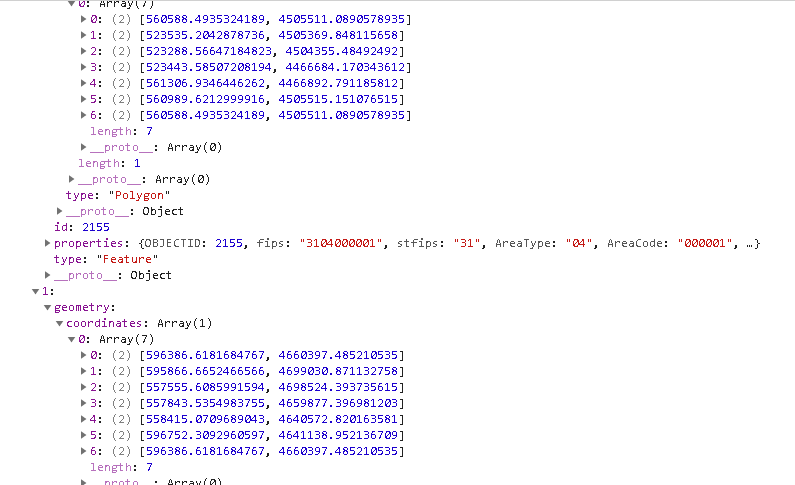
I am fetching a geojson from ArcGIS Server; a copy of those data has been attached (geom.geojson). Here's a screenshot from the debugger:
...and the code I'm using to create the graphics:
data = jsonData;
const graphicsPromise = promiseUtils.create(function (resolve,
reject) {
const graphics = data.features.map(function (feature, i) {
// create a polygon instance from the GeoJSON data
const polygon = new Polygon({
//spatialReference: SpatialReference.WGS84
spatialReference: new SpatialReference(6343)
});
// read the GeoJSON's geometry and add to the polygon rings
feature.geometry.coordinates.forEach(function (coord) {
const coordinates = feature.geometry.type ===
"MultiPolygon" ? coord[0] : coord;
polygon.addRing(coordinates);
});
const graphic = {
geometry: polygon,
attributes: feature.properties
};
return graphic;
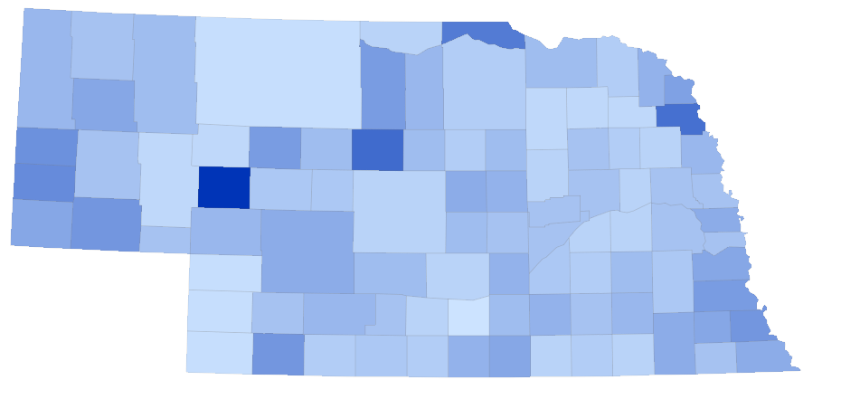
});Here's what's rendering:

...and the renderer in the FeatureLayer:
renderer: {
type: "class-breaks",
defaultLabel: "No data",
defaultSymbol: defaultSym,
visualVariables: [{
type: "color",
field: "val",
stops: [{
value: minMax.min,
color: "#cce3ff"
}, {
value: minMax.max,
color: "#0034b7"
}
]
}
]
}In 4.13 and version < 4.12, it works fine:
I noticed there were some breaking changes to a module I wasn't using, so I removed it... but, this does have me concerned since we'd be using a version that isn't supposed to be live yet. When will it deploy officially? Do we know yet what the issue is? I see some talk about loading rings clockwise... shouldn't everything be OK if I'm pulling geojson from a query against an ArcGIS Server (v10.6) REST node on a layer that checks-out topologically?
Solved! Go to Solution.
Accepted Solutions
- Mark as New
- Bookmark
- Subscribe
- Mute
- Subscribe to RSS Feed
- Permalink
Chris,
Normally it comes out the week or so after AGOL gets updated. So real soon...
- Mark as New
- Bookmark
- Subscribe
- Mute
- Subscribe to RSS Feed
- Permalink
Chris,
Normally it comes out the week or so after AGOL gets updated. So real soon...
- Mark as New
- Bookmark
- Subscribe
- Mute
- Subscribe to RSS Feed
- Permalink
And I did see in the FAQ - Frequently Asked Questions | ArcGIS API for JavaScript 4.12
We release four times a year. Version 4.12 is planned for summer 2019, and version 4.13 is planned for fall 2019.
I'm hoping to narrow it down between now and December 21st, lol!
- Mark as New
- Bookmark
- Subscribe
- Mute
- Subscribe to RSS Feed
- Permalink
Yes, lol. Very soon.
- Mark as New
- Bookmark
- Subscribe
- Mute
- Subscribe to RSS Feed
- Permalink
4.13 was just released!
- Mark as New
- Bookmark
- Subscribe
- Mute
- Subscribe to RSS Feed
- Permalink
I just noticed! Good timing!