I have some problem with sticking draggable SVG to ArcGIS map, using D3.js. Let's assume that I had latitude:-34.42507,longitude: 150.89315 to place some point that the SVG would be stick.
Here the point of code:
var newg = svg.append("g")
.data([{x: width / 2, y: height / 2}]);
var dragline = newg.append("line")
.attr("x1", function(d) { return d.x + (width - 20); })
.attr("y1", function(d) { return d.y + (height - 20); })
.attr("x2", 700)
.attr("y2", 465)
.attr("stroke-width", 2)
.attr("stroke", "gray")
.attr("width",width)
.attr("height",height)
.attr("cursor", "move")
.call(drag);
When I drag the map, the SVG is stay on the screen, exactly with screen coodinates. What I want is the line is sticked with the coordinates.
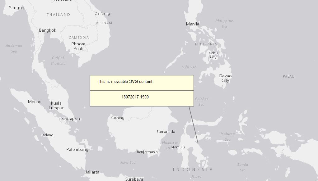
What I supposed to do to insert coordinates and make them stick with maps? Thanks a lot.