Turn on suggestions
Auto-suggest helps you quickly narrow down your search results by suggesting possible matches as you type.
Cancel
- Home
- :
- All Communities
- :
- Developers
- :
- JavaScript Maps SDK
- :
- JavaScript Maps SDK Questions
- :
- Line Rendering Problem (Feature Layer vs Dynamic L...
Options
- Subscribe to RSS Feed
- Mark Topic as New
- Mark Topic as Read
- Float this Topic for Current User
- Bookmark
- Subscribe
- Mute
- Printer Friendly Page
Line Rendering Problem (Feature Layer vs Dynamic Layer)
Subscribe
2400
1
08-24-2012 06:43 AM
08-24-2012
06:43 AM
- Mark as New
- Bookmark
- Subscribe
- Mute
- Subscribe to RSS Feed
- Permalink
Hi,
I'm going crazy here.
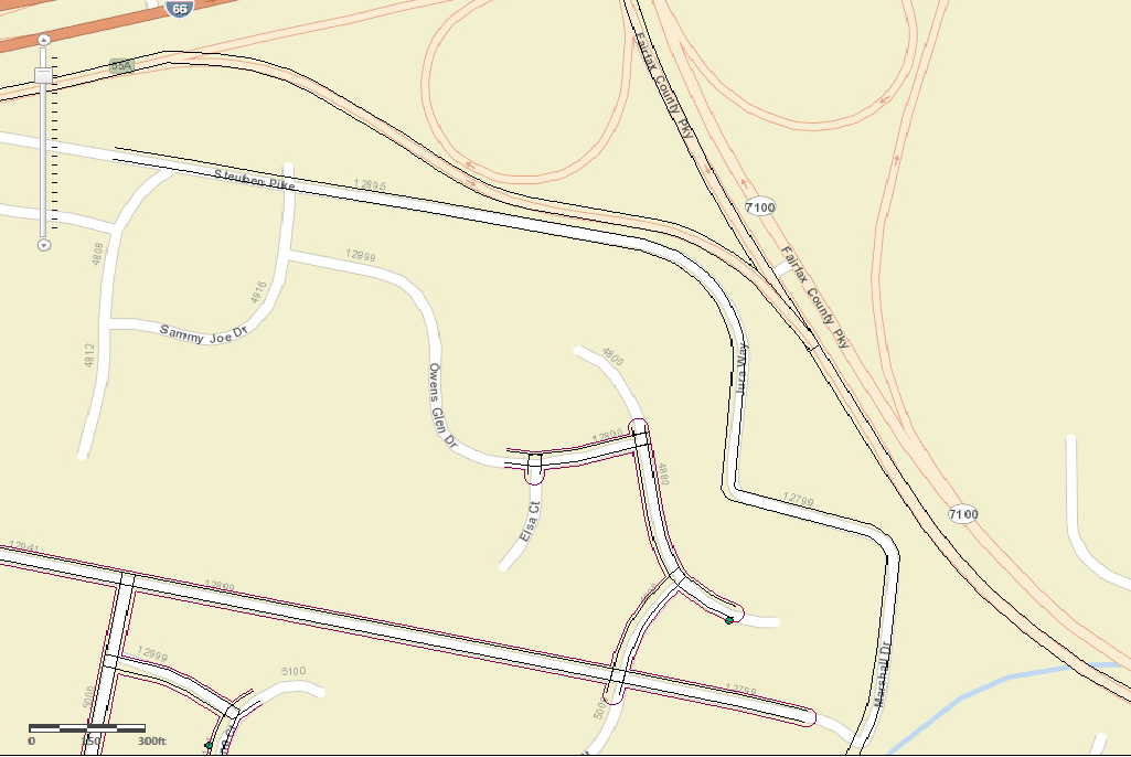
When I add a map as a FeatureLayer, the lines are rendered on top of each other (incorrect), however when added as a DynamicLayer, it's displayed just how it's displayed in ArcMap (correct).
Here's my simple simple code:
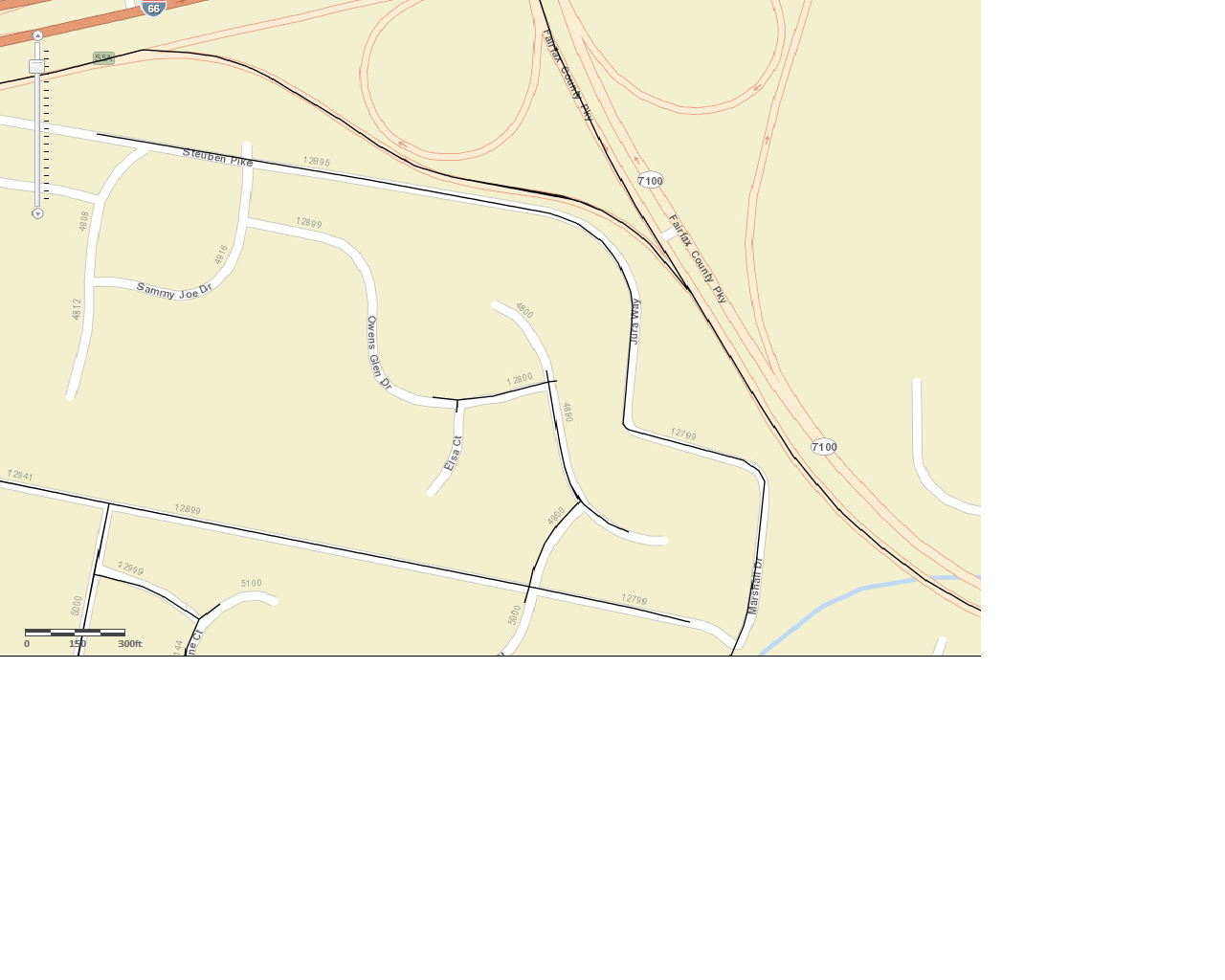
Please look at my attachments to get a better idea. You can ignore the red lines on dynamicLayer.png. What's important are the black lines.
Thanks,
Aaron
I'm going crazy here.
When I add a map as a FeatureLayer, the lines are rendered on top of each other (incorrect), however when added as a DynamicLayer, it's displayed just how it's displayed in ArcMap (correct).
Here's my simple simple code:
var myURL = "http://..."

var fl = new esri.layers.FeatureLayer(myURL+ /layerIndex)
var dl = new esri.layers.ArcGISDynamicMapServiceLayer(myURL)

map.addLayer(fl)
map.addLayer(dl)
Please look at my attachments to get a better idea. You can ignore the red lines on dynamicLayer.png. What's important are the black lines.
Thanks,
Aaron
1 Reply
08-26-2012
09:03 AM
- Mark as New
- Bookmark
- Subscribe
- Mute
- Subscribe to RSS Feed
- Permalink
Did some digging, and found my answer-
If you define your lines as cartographic lines in ArcMap, and proceed to call them in a feature layer on your client side javascript, the cartographic lines get "downgraded" to simple lines.
...Anyone out there find a workaround?
Here's the passage and article:
Quote from article: http://help.arcgis.com/en/arcgisserver/10.0/help/arcgis_server_dotnet_help/index.html#//009300000021...
If you define your lines as cartographic lines in ArcMap, and proceed to call them in a feature layer on your client side javascript, the cartographic lines get "downgraded" to simple lines.
...Anyone out there find a workaround?
Here's the passage and article:
For line layers, simple line symbols are supported. If other symbols are used, the feature service downgrades them to simple line symbols. For example, a cartographic line symbol in the map document may be drawn as a simple solid line in a feature service client. Also, if a line symbol has multiple layers, the feature service considers only the top layer.
Quote from article: http://help.arcgis.com/en/arcgisserver/10.0/help/arcgis_server_dotnet_help/index.html#//009300000021...