Turn on suggestions
Auto-suggest helps you quickly narrow down your search results by suggesting possible matches as you type.
Cancel
- Home
- :
- All Communities
- :
- Developers
- :
- JavaScript Maps SDK
- :
- JavaScript Maps SDK Questions
- :
- How to add cluster on 3d globe?
Options
- Subscribe to RSS Feed
- Mark Topic as New
- Mark Topic as Read
- Float this Topic for Current User
- Bookmark
- Subscribe
- Mute
- Printer Friendly Page
How to add cluster on 3d globe?
Subscribe
3223
6
06-24-2020 10:25 AM
06-24-2020
10:25 AM
- Mark as New
- Bookmark
- Subscribe
- Mute
- Subscribe to RSS Feed
- Permalink
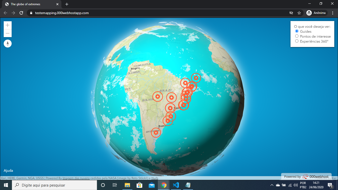
Hello guys, I'm using this tutorial as a base: https://www.esri.com/arcgis-blog/products/js-api-arcgis/3d-gis/interactive-3d-globe/ my doubt is how to add a grouping of the added points. I already tried to use the clustering system that is in the documentation and it was not effective for me This is the markers code: const extremesLayer = new GeoJSONLayer({ url: "extreme-points.geojson", elevationInfo: { mode: "absolute-height", offset: offset }, copyright: "Powered By <a href=\"https://visibleearth.nasa.gov/view.php?id=57747\" target=\"_blank\">Imagem das nuvens</a> cedidas pela NASA (image by Reto Stöckli) e <a href=\"https://hurb.com\" target=\"_blank\">Hurb</a>", renderer: { type: "simple", symbol: { type: "point-3d", symbolLayers: [{ type: "icon", resource: { primitive: "circle" }, material: { color: [0, 0, 0, 0] }, outline: { color: [245, 99, 66, 1], size: 4 }, size: 10 }, { type: "icon", resource: { primitive: "circle" }, material: { color: [0, 0, 0, 0] }, outline: { color: [245, 99, 66, 1], size: 2 }, size: 30 }] } },how to add a cluster? help me pls Sorry for bad English
6 Replies
06-24-2020
11:23 AM
- Mark as New
- Bookmark
- Subscribe
- Mute
- Subscribe to RSS Feed
- Permalink
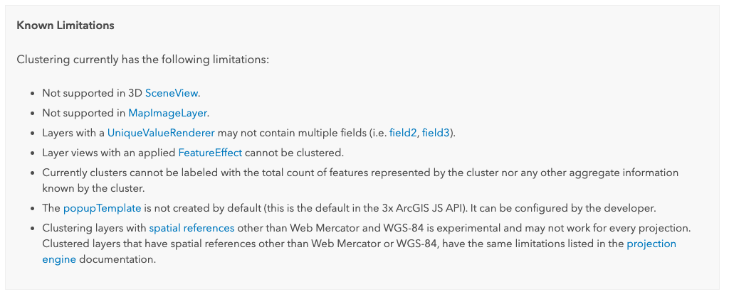
Clustering is not available for 3D. See the documentation:
06-24-2020
02:21 PM
- Mark as New
- Bookmark
- Subscribe
- Mute
- Subscribe to RSS Feed
- Permalink
Current known limitation for clustering:
07-07-2023
07:21 AM
- Mark as New
- Bookmark
- Subscribe
- Mute
- Subscribe to RSS Feed
- Permalink
Hey @FlavieMoraux. Unfortunately, it's still a known limitation at this time, and I can't speak to what the future holds. If you want to submit an Idea, that might help as well.
https://community.esri.com/t5/custom/page/page-id/arcgis-ideas
09-07-2023
01:22 AM
- Mark as New
- Bookmark
- Subscribe
- Mute
- Subscribe to RSS Feed
- Permalink
Hy,
Here is new idea : https://community.esri.com/t5/arcgis-javascript-maps-sdk-ideas/clustering-point-geometries-in-a-3d-s...
Thanks,
Flavie
01-20-2022
07:52 AM
- Mark as New
- Bookmark
- Subscribe
- Mute
- Subscribe to RSS Feed
- Permalink
Hy,
2022, the limitation is still there... When will clustering 3D implementation be done?
Regards,
Flavie