- Home
- :
- All Communities
- :
- Developers
- :
- JavaScript Maps SDK
- :
- JavaScript Maps SDK Questions
- :
- Converting coordinates to route params
- Subscribe to RSS Feed
- Mark Topic as New
- Mark Topic as Read
- Float this Topic for Current User
- Bookmark
- Subscribe
- Mute
- Printer Friendly Page
- Mark as New
- Bookmark
- Subscribe
- Mute
- Subscribe to RSS Feed
- Permalink
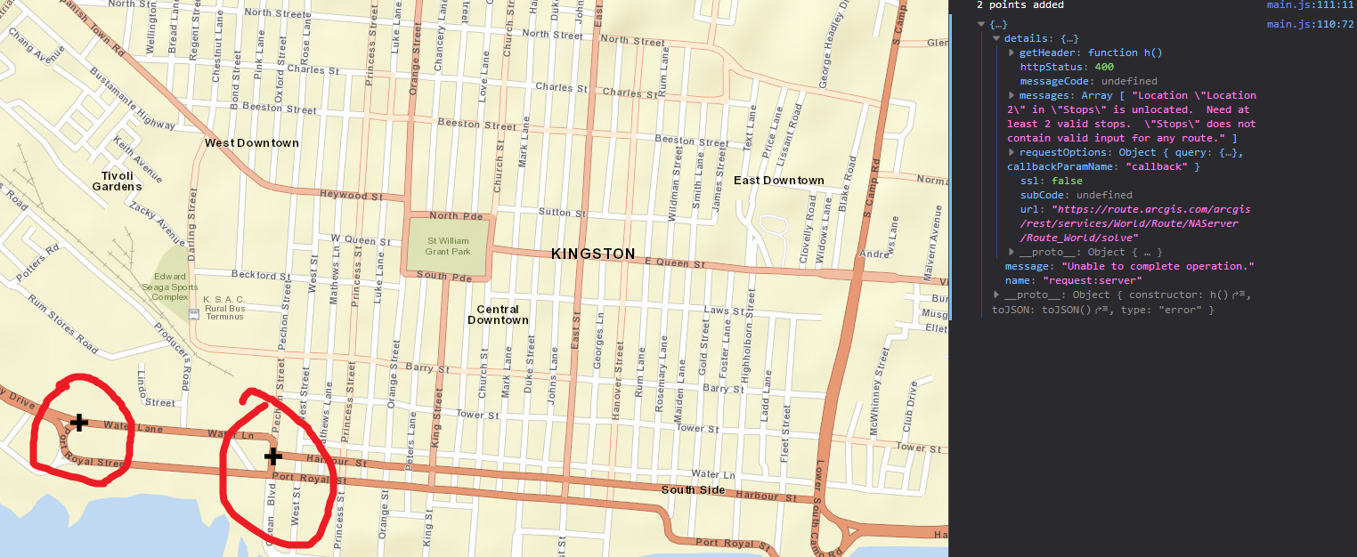
How can i convert coordinates to routeparam compatible stops in order to carry out a RouteTask?
These coordinates are coming from the browser geolocation. Currently when i click on a point and then use the geolocation from the browser I get an error from attempting to solve the route, however when i click on 2 separate points the route solves successfully.
Solved! Go to Solution.
- Mark as New
- Bookmark
- Subscribe
- Mute
- Subscribe to RSS Feed
- Permalink
I am going to try that right now, should I pass in the new geom object to the stops array in the routeparams?
- Mark as New
- Bookmark
- Subscribe
- Mute
- Subscribe to RSS Feed
- Permalink
This indeed works, so in order to use coordinates you have to convert the geometry to webmercator geometry first then push that to the routes params. Esri should make a note of this, or amend it in future releases. thanks for pointing out the suggestions I was stumped.
- Mark as New
- Bookmark
- Subscribe
- Mute
- Subscribe to RSS Feed
- Permalink
Evon,
I don't think they have to be in Web Mercator it is just the fact that all the stops have to be in the same WKID.
- Mark as New
- Bookmark
- Subscribe
- Mute
- Subscribe to RSS Feed
- Permalink
Ok I see, i guess the clicked points were not in the same wkid then.
- Mark as New
- Bookmark
- Subscribe
- Mute
- Subscribe to RSS Feed
- Permalink
Evon,
Correct the clicked points would be created in the WKID of the Map. Which if you are using a standard esri basemap means that it would be WKID 102100 and the browsers geolocation will always be WKID 4326.
- « Previous
-
- 1
- 2
- Next »
- « Previous
-
- 1
- 2
- Next »