- Home
- :
- All Communities
- :
- Developers
- :
- JavaScript Maps SDK
- :
- JavaScript Maps SDK Questions
- :
- Collapsing a DIV, then Reopen it?
- Subscribe to RSS Feed
- Mark Topic as New
- Mark Topic as Read
- Float this Topic for Current User
- Bookmark
- Subscribe
- Mute
- Printer Friendly Page
Collapsing a DIV, then Reopen it?
- Mark as New
- Bookmark
- Subscribe
- Mute
- Subscribe to RSS Feed
- Permalink
Hello Everyone! I was wondering if anyone has developed an application where you have a DIV that contains a legend, then you have an arrow or button that collapses it within an application?
If so, how can this be done?
Example:
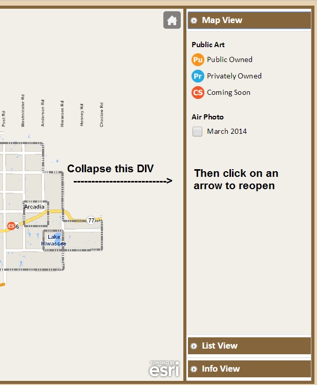
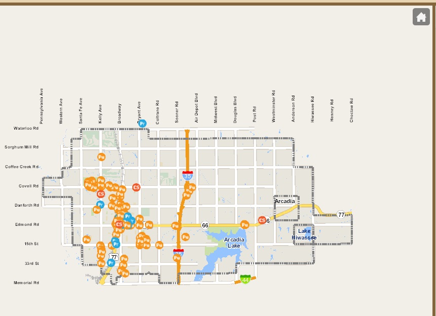
The result would be more map space:
Any suggestions? This will be the first time trying this out. Thank you.

- Mark as New
- Bookmark
- Subscribe
- Mute
- Subscribe to RSS Feed
- Permalink
I've been looking into bootstrap styling. This isn't setup as a tool, it's more checking the size of the screen and responding by collapsing the sidebar when the window is too small. I have an 'everything must work on mobile' mandate.
I started with this:
- Mark as New
- Bookmark
- Subscribe
- Mute
- Subscribe to RSS Feed
- Permalink
Nice find Tracy Schloss! Nice work Tom Wayson.
- Mark as New
- Bookmark
- Subscribe
- Mute
- Subscribe to RSS Feed
- Permalink
Bootstrapmap is on ESRI's gitHub, Bootstrap-map by itself only gets you part of the way, because the examples deal largely with just the map itself and not much on a complete interface.
I've had several instances where I've replaced Map with BootstrapMap, largely because it does a better job of resizing itself automatically, and you don't have to code listeners for that circumstance. It might be the part of a solution for you, Ian, since once the sidebar is collapsed, you'll need the map to resize to fill out the frame.
I also got ideas from:
http://odoe.net/blog/dojo-bootstrap-with-arcgis-javascript-api/
Using Bootstrap Map? You Might Not Need jQuery… | Tom Wayson