- Home
- :
- All Communities
- :
- Developers
- :
- JavaScript Maps SDK
- :
- JavaScript Maps SDK Blog
- :
- ComeFlyWithMe: a ArcGIS JS & FlightAware API Mashu...
ComeFlyWithMe: a ArcGIS JS & FlightAware API Mashup
- Subscribe to RSS Feed
- Mark as New
- Mark as Read
- Bookmark
- Subscribe
- Printer Friendly Page
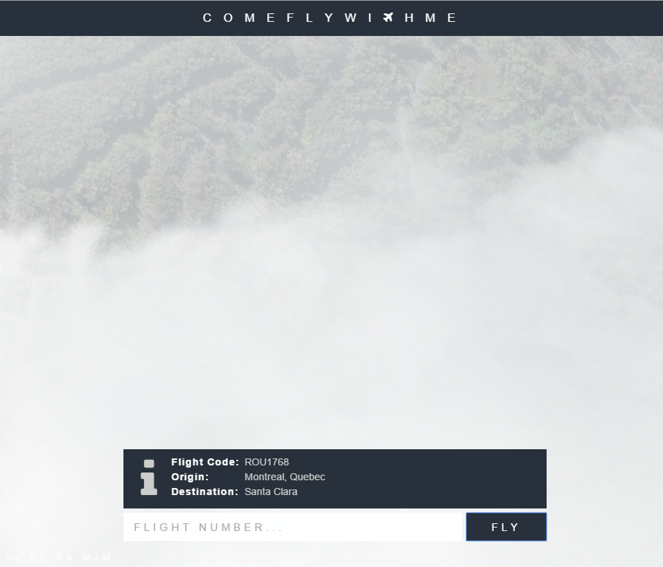
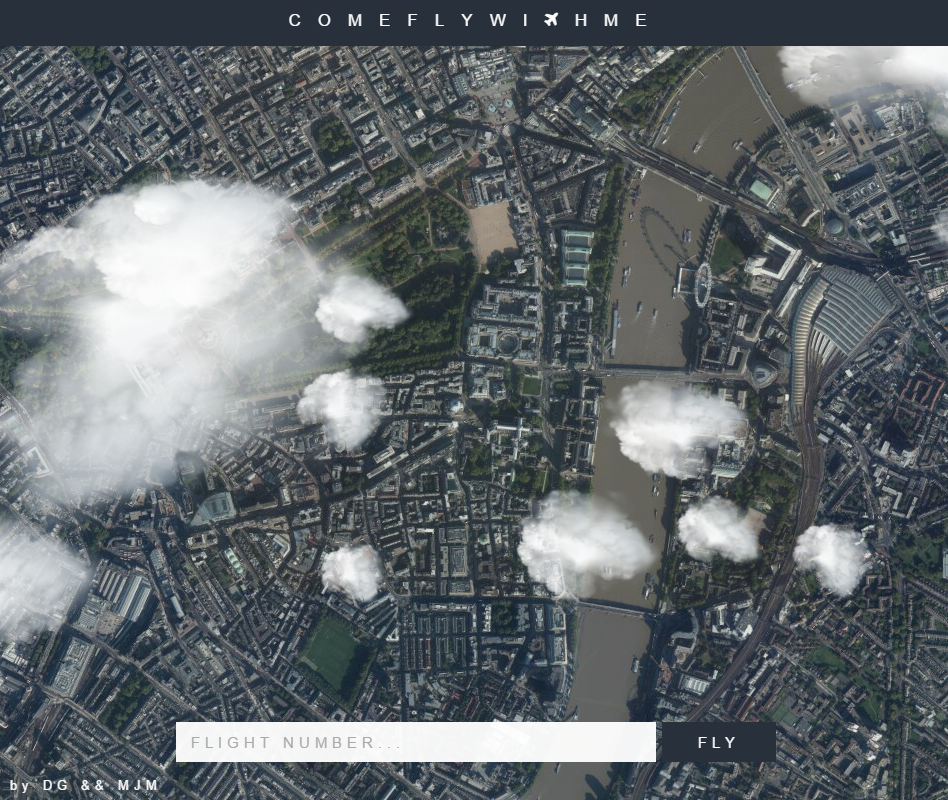
ComeFlyWithMe is an application built by two university students Max Maybury and Darren Gilbert. It allows you to see what's directly underneath a flight at any given any point in time, using a combination of the ArcGIS JavaScript API and the the FlightAware API. The project started at SpaceApps London, held at Inmarsat.
Max:"We were provided with a list of challenges that we could pick from, and we chose one where the challenge was to provide the user with a view from a plane. We had a few ideas to use Google Earth, but found the API didn't really exist, so we just decided to integrate Google Maps, and move the map to represent the movement of the plane. We use the altitude of the plane to affect the zoom of the map, so that the map becomes more zoomed in as the plane begins its descent."
But they didn't feel like this application was enough to wow the judges, so they began to look deeper. They started thinking about how they could make the app more realistic and visually appealing, look to the plugin free web graphics library WebGL.
Max: "[we started to] look into the weather, and how we could represent that on the screen. We use WebGL to dynamically generate cloud coverage, based on a percentage we get from a weather API. We also add a filter for flights which are flying through the night.
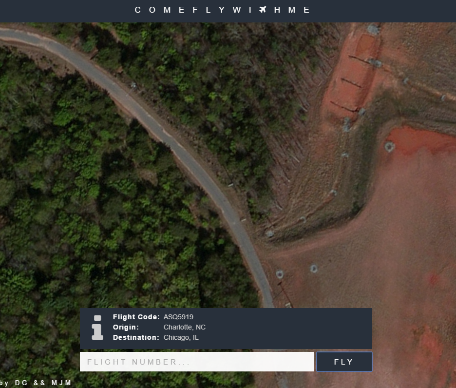
After the event, we realised that the maps that Esri provide are better quality, so we decided to integrate them into the system. We had a few problems which we had overcome here, trying to find out if the zoom levels of the Esri maps differ from Google Maps, and how we could render the map more quickly. We removed the pan duration, pan rate, zoom duration, and zoom rate, when we initially set the centre point of the map. This meant that the map loaded a lot quicker when a flight was entered.
We used the Flight Aware API to get more accurate location information for the flights. We didn't want to call the API too much, as this would slow the server down a lot, so we wrote our own calculations for the flight path based on the bearing of the plane, and the speed it was travelling at. We called the flight API every minute or so, so that it could fix its position. The website uses Node.js in the backend, with WebGL and the Esri maps API in the front end.""
Max and Darren won the People's Choice Award at SpaceApps London, with the judges citing that "Come Fly with me was the best example of a fully working demo after 24 hours and something we could see airlines being interested to show where you are in flight in as well as friends / family interested in where loved ones are currently mid flight."
They also exhibited the app at the Inmarsat booth during the Esri UK Annual Conference on May 19th at QEII in Westminster, London, where Inmarsat was showing off innovative use of flight location data. In the future they see opportunities to feature the flights on in-flight entertainment systems, so that users can find out more about where they are travelling over. They state that this could also lead all sorts of additional exciting data being overlaid onto the surface imagery.
If you are interested in the code you can check out its GitHub account here: https://github.com/DMJGilbert/comeflywithme
You must be a registered user to add a comment. If you've already registered, sign in. Otherwise, register and sign in.