- Home
- :
- All Communities
- :
- Products
- :
- ArcGIS Hub
- :
- ArcGIS Hub Questions
- :
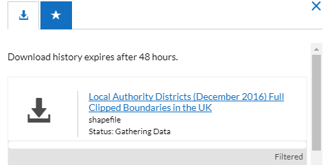
- What does Gathering Data mean
- Subscribe to RSS Feed
- Mark Topic as New
- Mark Topic as Read
- Float this Topic for Current User
- Bookmark
- Subscribe
- Mute
- Printer Friendly Page
What does Gathering Data mean
- Mark as New
- Bookmark
- Subscribe
- Mute
- Subscribe to RSS Feed
- Permalink
What does Gathering Data mean?
It seems to be in a constant state of gathering data but when I look at the service in Server Manager. It isn't being used. Is there anything I can do to make the download work? Anything I can do in Server Manager regarding the properties.
Thanks
Matt

- Mark as New
- Bookmark
- Subscribe
- Mute
- Subscribe to RSS Feed
- Permalink
Hi Matt,
Would you mind trying this download again? We just fixed a bug that was causing some download processes to become stuck and never complete. If trying again does not work, would you please post a link to the dataset?
Thanks,
Daniel Fenton
Software Engineer | ArcGIS Hub
- Mark as New
- Bookmark
- Subscribe
- Mute
- Subscribe to RSS Feed
- Permalink
Hi Daniel,
One of them worked, but this one doesn't download the shapefile
Thanks
Matt
- Mark as New
- Bookmark
- Subscribe
- Mute
- Subscribe to RSS Feed
- Permalink
While this link to shapefile download just errors straight away but I can't find anything ambiguous in the ArcGIS Server Manager logs.
- Mark as New
- Bookmark
- Subscribe
- Mute
- Subscribe to RSS Feed
- Permalink
Ok. This error is in our download system and not your ArcGIS server. We will look into it.
- Mark as New
- Bookmark
- Subscribe
- Mute
- Subscribe to RSS Feed
- Permalink
Thanks Daniel
- Mark as New
- Bookmark
- Subscribe
- Mute
- Subscribe to RSS Feed
- Permalink
Hi Daniel,
When will this be corrected?
Thanks
Matt
- Mark as New
- Bookmark
- Subscribe
- Mute
- Subscribe to RSS Feed
- Permalink
I am getting this when looking at the Datasets in the Data section - ESRI UK are aware of the problem. Is this an Open Data error?
Thanks
Matt
Warning Query performance on layer is suboptimal and will impact user experience.
Warning Specified display field LAD16CD is not present in the layer. The first field will be used.
Warning A recent attempt to download this dataset failed. Reset the dataset to resolve this issue or contact support with this information: Request 'null' returned HTTP code 500 and Error 'Error: OGR Failed : undefined' for dataset at 2018-01-09T08:04:18.292Z.
- Mark as New
- Bookmark
- Subscribe
- Mute
- Subscribe to RSS Feed
- Permalink
Hi Daniel,
After resetting the download I inspected the download shapefile link for http://geoportal.statistics.gov.uk/datasets/686603e943f948acaa13fb5d2b0f1275_0 (2016 local authority full clipped boundaries) - this gave me the specific download link
It generates and finally errors -
{"processingTime":"0 seconds","status":"Failed","error":{"message":"Error: OGR Failed ","code":500,"timestamp":"2018-01-09T09:05:00.916Z"}}
Matt
- Mark as New
- Bookmark
- Subscribe
- Mute
- Subscribe to RSS Feed
- Permalink
Hi Matt,
I believe this class of issues has been resolved. I'm sorry about the ambiguous error message. There was a subtle bug in our download system that had to be worked out.