Turn on suggestions
Auto-suggest helps you quickly narrow down your search results by suggesting possible matches as you type.
Cancel
- Home
- :
- All Communities
- :
- Products
- :
- ArcGIS for Microsoft
- :
- ArcGIS for Microsoft 365
- :
- ArcGIS for SharePoint
- :
- ArcGIS for SharePoint Questions
- :
- Re: Zooming to specific levels/ online display
Options
- Subscribe to RSS Feed
- Mark Topic as New
- Mark Topic as Read
- Float this Topic for Current User
- Bookmark
- Subscribe
- Mute
- Printer Friendly Page
Zooming to specific levels/ online display
Subscribe
2966
1
04-01-2014 05:32 PM
04-01-2014
05:32 PM
- Mark as New
- Bookmark
- Subscribe
- Mute
- Subscribe to RSS Feed
- Permalink
Hi,
I have mapped an entire museum (rocks, minerals, fossils) on MSU campus in the geology department. Now that I have the database compiled, it consists of cabinets, shelves, and points on each shelf.
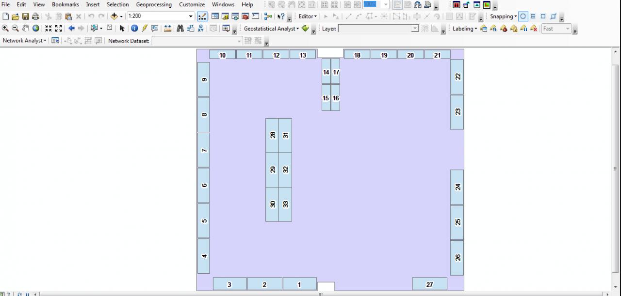
There are 35 cabinets.
I simply want to display all 35 cabinets as polygons as illustrated in (mus.jpg).
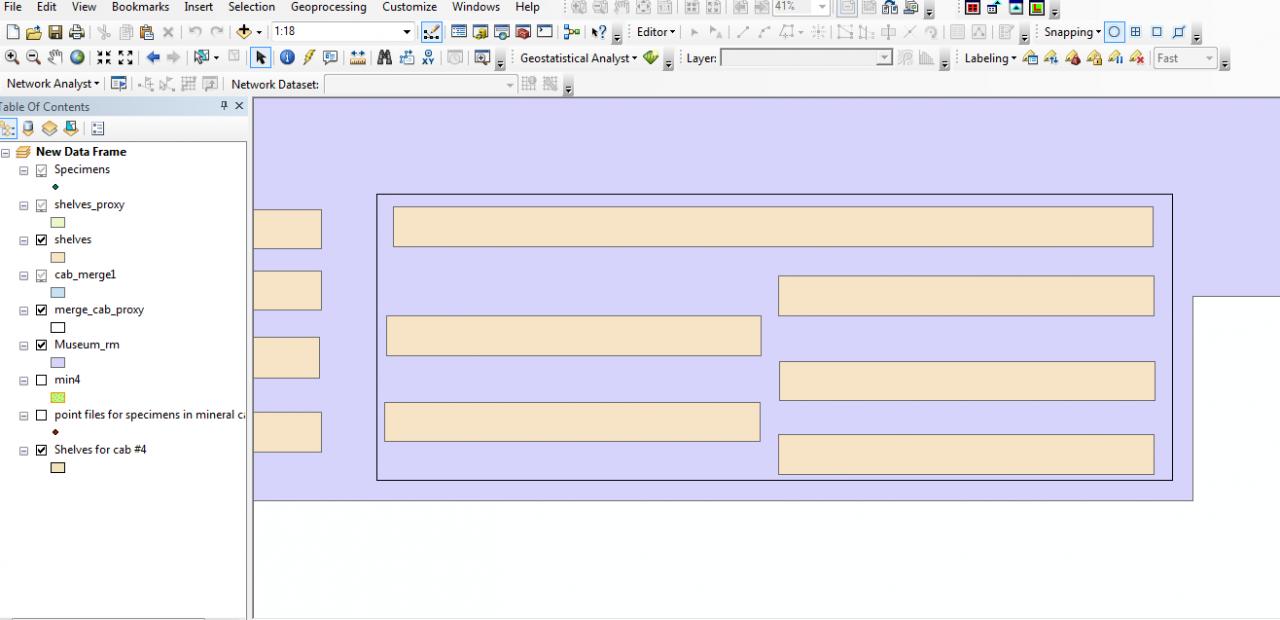
Then, when you click on a cabinet, it should zoom to the cabinet as show in (cab.jpg).
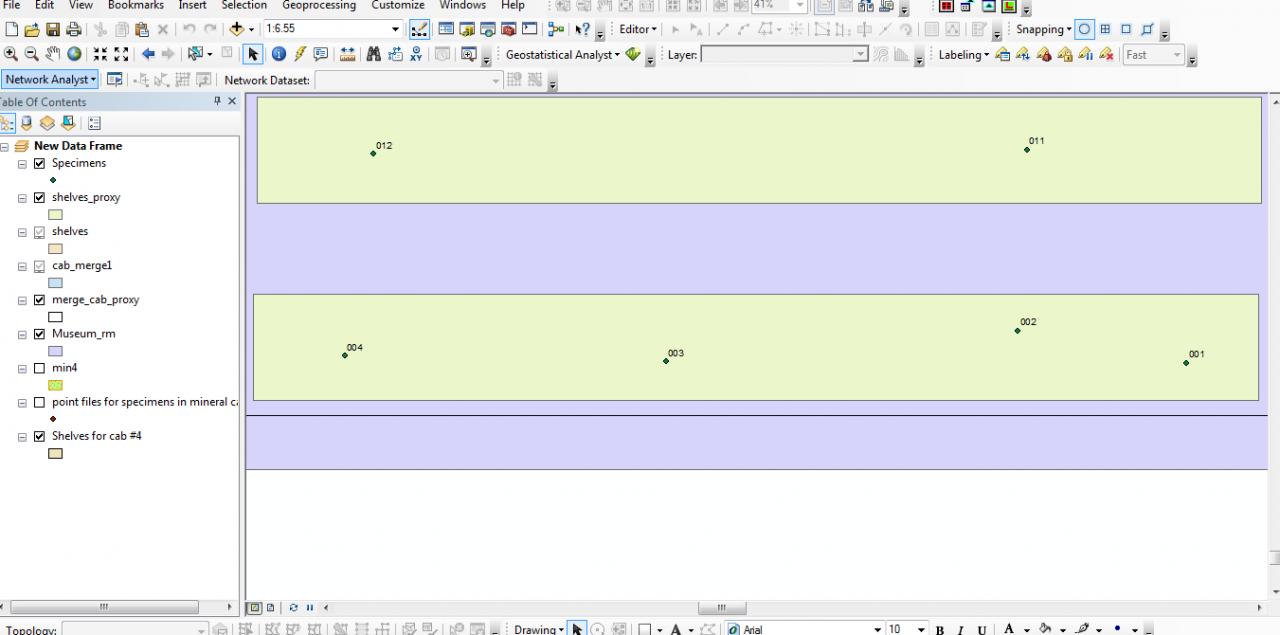
Finally, when you click on a shelf, it should zoom to that shelf and nothing else be visible - not even adjacent shelves (kinda like shelf.jpg).
I was thinking about creating a GUI that allowed this, but I have already mapped everything. It should easy; just be some setting or something. The user interface should be customized to make it user friendly and intuitive. Please advise which direction someone may take to make this available online.
Thanks,
Orry
I have mapped an entire museum (rocks, minerals, fossils) on MSU campus in the geology department. Now that I have the database compiled, it consists of cabinets, shelves, and points on each shelf.
There are 35 cabinets.
I simply want to display all 35 cabinets as polygons as illustrated in (mus.jpg).
Then, when you click on a cabinet, it should zoom to the cabinet as show in (cab.jpg).
Finally, when you click on a shelf, it should zoom to that shelf and nothing else be visible - not even adjacent shelves (kinda like shelf.jpg).
I was thinking about creating a GUI that allowed this, but I have already mapped everything. It should easy; just be some setting or something. The user interface should be customized to make it user friendly and intuitive. Please advise which direction someone may take to make this available online.
Thanks,
Orry
1 Reply
04-02-2014
08:04 AM
- Mark as New
- Bookmark
- Subscribe
- Mute
- Subscribe to RSS Feed
- Permalink
Hi Orry,
Did you mean to post this in the Esri Maps for SharePoint forum? You might have better luck in one of the Desktop forums?
Katy
Did you mean to post this in the Esri Maps for SharePoint forum? You might have better luck in one of the Desktop forums?
Katy
Katy Dalton | Technical Consultant
THE SCIENCE OF WHERE™
THE SCIENCE OF WHERE™