- Home
- :
- All Communities
- :
- Products
- :
- ArcGIS Field Maps
- :
- ArcGIS Field Maps Questions
- :
- Register today: "Underground Utility Mapping Works...
- Subscribe to RSS Feed
- Mark Topic as New
- Mark Topic as Read
- Float this Topic for Current User
- Bookmark
- Subscribe
- Mute
- Printer Friendly Page
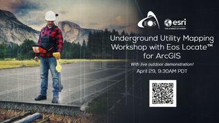
Register today: "Underground Utility Mapping Workshop with Eos Locate for ArcGIS Field Maps" (with live outdoor demonstration)
- Mark as New
- Bookmark
- Subscribe
- Mute
- Subscribe to RSS Feed
- Permalink
Eos Positioning Systems is pleased to offer a free, virtual high-accuracy underground utility mapping workshop on Thursday, April 29, 2021: "Underground Utility Mapping for ArcGIS Field Maps (with live outdoor demo)"
Details:
In this free educational training event, you will receive the following training:
- Learn about the new free, high-accuracy underground-mapping solution from partners Eos and Esri: Eos Locate™ for ArcGIS apps
- Explore how to improve the spatial accuracy of your entire network — by ensuring that the location data for existing buried infrastructure is (finally) just as good as that of newly installed assets
- Receive hands-on training in the software and hardware components required to map underground utilities directly into your Esri GIS
- Participate in a live outdoor data-collection demonstration during which we map an underground utility in real time
Technology covered:
This workshop will cover the following hardware and software technologies:
- Eos Arrow Gold GNSS receiver (including Eos Tools Pro app and Eos Locate solution)
- ArcGIS Field Maps (field data collection, differences/similarities with Collector)
- ArcGIS Online/Pro (web map configuration, including required metadata)
- Compatible utility locator models (e.g., Subsite, Radiodetection, Vivax-Metrotech)
Agenda summary:

Agenda at-a-glance:
The workshop is roughly divided into the following sections (subject to change):
- Foundational overview of GNSS/GPS and Eos Locate
- App tour of ArcGIS Field Maps
- Live web-map configuration for underground mapping
(Short Break Before Part II)
- Live outdoor demonstration (join us to map an underground utility live!)
- Review the data in a 3D scene
- Q&A panel discussion with experts
THURSDAY, APRIL 29, 2021
9:30a.m.-12p.m.(noon) PDT / 12:30-3p.m. EST
*** Please note registration closes one hour before the event ***
Please note: We recommend booking an extra hour after the workshop, as our panelists have agreed to stay longer for an extensive Q&A period.
