- Home
- :
- All Communities
- :
- Products
- :
- ArcGIS Explorer
- :
- ArcGIS Explorer Questions
- :
- Explorer on iPhone crashes
- Subscribe to RSS Feed
- Mark Topic as New
- Mark Topic as Read
- Float this Topic for Current User
- Bookmark
- Subscribe
- Mute
- Printer Friendly Page
Explorer on iPhone crashes
- Mark as New
- Bookmark
- Subscribe
- Mute
- Subscribe to RSS Feed
- Permalink
On Saturday, March 31, 2018 I created a KML file using Google Earth. I translated it to a GPX file using GPSBable.
I then created a map on ArcGis online for use on my mobile device. The GPX file loaded OK, but any time
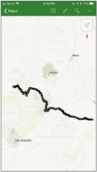
I zoomed or dragged the map, Explorer (ArcGis Mobile Explorer for iPhone) crashed. The map I made is public and can be seen here: https://arcg.is/1DyjSK or by searching for "Llano-Brenham-H&TC" -- it's a map of all the railroad lines, spurs and sidings between Llano and Brenham, Texas on the Houston and Texas Central Railroad (H&TC).
The KML files is 259,159 bytes in size and the GPX files is 433,863 bytes.
The GPX file is attached.
Ed Bradford
- Mark as New
- Bookmark
- Subscribe
- Mute
- Subscribe to RSS Feed
- Permalink
Ed,
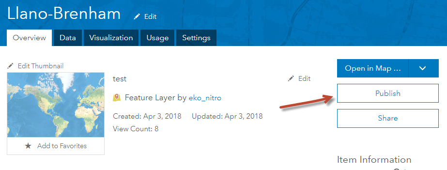
Can repro the crash. I was able to publish the feature collection as a hosted feature service, and the feature service does work.


Mark
- Mark as New
- Bookmark
- Subscribe
- Mute
- Subscribe to RSS Feed
- Permalink
Hi Ed Bradford,
I was able to reproduce this issue as well - thanks for sharing the GPX file. It appears that you are running into a known issue we have in handling large feature collections.
What mbockenhauer-esristaff suggests above will workaround this issue. Publishing a hosted feature layer from the collection.
Is this something that is a manageable workaround for you?
Thanks,
Heather