- Home
- :
- All Communities
- :
- Products
- :
- ArcGIS Enterprise
- :
- ArcGIS Enterprise Questions
- :
- Re: Why do ESRI Basemaps show pixelated tiles at L...
- Subscribe to RSS Feed
- Mark Topic as New
- Mark Topic as Read
- Float this Topic for Current User
- Bookmark
- Subscribe
- Mute
- Printer Friendly Page
Why do ESRI Basemaps show pixelated tiles at LODs 20-23 but my services don't
- Mark as New
- Bookmark
- Subscribe
- Mute
- Subscribe to RSS Feed
- Permalink
I have created the same LODs for my basemap that ESRI Imagery uses. While both the ESRI Imagery basemap and my basemap have LODs for 1:70.53 scale, there are no tiles that have been created for those scales in either service. The ESRI Imagery service shows pixelated tiles from previous, smaller scales but my basemap just shows a grey background. Is there a reason that the ESRI basemaps show pixelated tiles further zoomed in while my basemaps are simply grey? For example, my basemap has LODs for 1:70 and 1:140 but the largest scale tiles were created for was at 1:1128. When I zoom in to 1:70 in ArcGIS Online or WAB DE the background is grey. Even though the ESRI Imagery hasn't been tiled at 1:70, the tiles from the 1:1128 LOD show up, albeit pixelated.
I did notice that when printing at a scale larger scale via ArcGIS Online or WAB DE my basemaps do show pixelated tiles from the smaller scales when in the actual app the background is grey.
Any ideas what is going on here?
Thanks,
Andrew
Solved! Go to Solution.
Accepted Solutions
- Mark as New
- Bookmark
- Subscribe
- Mute
- Subscribe to RSS Feed
- Permalink
Esri's basemap servers have a "special" ability to generate tiles where none exist by resampling tiles that do exist. This feature will eventually become part of ArcGIS Server and ArcGIS Online. However, there is no timeline set as of now. I have made note of this thread and hopefully we can add this feature sooner rather than later...
Thanks,
Mike
- Mark as New
- Bookmark
- Subscribe
- Mute
- Subscribe to RSS Feed
- Permalink
Hi Andrew,
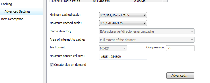
Are you using a Tiled Layer hosted in ArcGIS Online, or are you using an ArcGIS Server cached service? If the latter, do you have the option to create tiles on demand checked?
- Mark as New
- Bookmark
- Subscribe
- Mute
- Subscribe to RSS Feed
- Permalink
Hi Jake,
We're using ArcGIS for Server 10.3.1 cached map services. I do not have the "Create tiles on demand" checked. Idea being that smaller scales (LODs 1-19) are fully tiled then as users access the larger scales, tiles are generated on-demand? Is this how ESRI Imagery is setup?
Are new tiles were being generated at these larger scales (1:70) or are the tiles being shown at this scale actually tiles from a smaller scale (1:1128 say) and they were just coming through as pixelated at 1:70....that would actually be great
I'm somewhat concerned about this approach with users creating too many tiles on-demand and utilizing server resources but perhaps that's the tradeoff.
Thanks
- Mark as New
- Bookmark
- Subscribe
- Mute
- Subscribe to RSS Feed
- Permalink
I turned on the Create tiles on demand option but this increased my server utilization significantly. When I use the ESRI basemaps, it doesn't seem like tiles are being generated on the fly. Can you confirm? Any thoughts to the questions I posted above?
Thanks in advance,
Andrew
- Mark as New
- Bookmark
- Subscribe
- Mute
- Subscribe to RSS Feed
- Permalink
I just tested this myself, and the option to 'Create Tiles on Demand' did not provide a solution to this issue. I'll see if I can find any additional information to see if this is possible without caching to the larger scales.
- Mark as New
- Bookmark
- Subscribe
- Mute
- Subscribe to RSS Feed
- Permalink
It would be so nice to be able to dynamically resample your highest level of detail so the images don't simply disappear. That's really the way it should work, it has been that way forever in the desktop applications.
It flies in the face of logic that ESRI would actually generate tiles all the way up to 1:70 for their imagery and topo services, given the processing, storage requirements, and the fact that most places aren't adding any actual additional detail. But it sure seems like they did. I couldn't find a definitive answer. If they are being generated on demand, that server is cranking them out extremely quickly.
- Mark as New
- Bookmark
- Subscribe
- Mute
- Subscribe to RSS Feed
- Permalink
Esri's basemap servers have a "special" ability to generate tiles where none exist by resampling tiles that do exist. This feature will eventually become part of ArcGIS Server and ArcGIS Online. However, there is no timeline set as of now. I have made note of this thread and hopefully we can add this feature sooner rather than later...
Thanks,
Mike
- Mark as New
- Bookmark
- Subscribe
- Mute
- Subscribe to RSS Feed
- Permalink
Hey Mike, thank you so much for this reply. Your post provides the clear answer that could not be found when I was digging around for a solution to this issue. Judging by the number of threads/posts/blogs that I came across related to this issue, I think there would be a lot of happy people if a feature like you describe were implemented into ArcGIS Server/Online.
- Mark as New
- Bookmark
- Subscribe
- Mute
- Subscribe to RSS Feed
- Permalink
Thanks Mike.
Good info. The functionality you describe would be much appreciated.