- Home
- :
- All Communities
- :
- Products
- :
- ArcGIS Enterprise
- :
- ArcGIS Enterprise Questions
- :
- Print only layers shown in map extent
- Subscribe to RSS Feed
- Mark Topic as New
- Mark Topic as Read
- Float this Topic for Current User
- Bookmark
- Subscribe
- Mute
- Printer Friendly Page
Print only layers shown in map extent
- Mark as New
- Bookmark
- Subscribe
- Mute
- Subscribe to RSS Feed
- Permalink
I have a Print Geoprocessing Service that I use with apps I built in WebApp Builder Developer Edition 2.0.
I am using ArcGIS for Server 10.2.2.
When I print a map it shows all the layers in the legend. I only need it to show the layers that are visible in the current map extent.
In the File Geodatabase that is for the app, there is a Land Use Feature Class. It has 40 Land Use Classes.
For example, I open the WebMap, zoom to a location, I only see 4 Land Use Classes visible in the current map extent. So, I print the map, and the legend shows all 40 Land Use Classes when I only want it to show those 4.
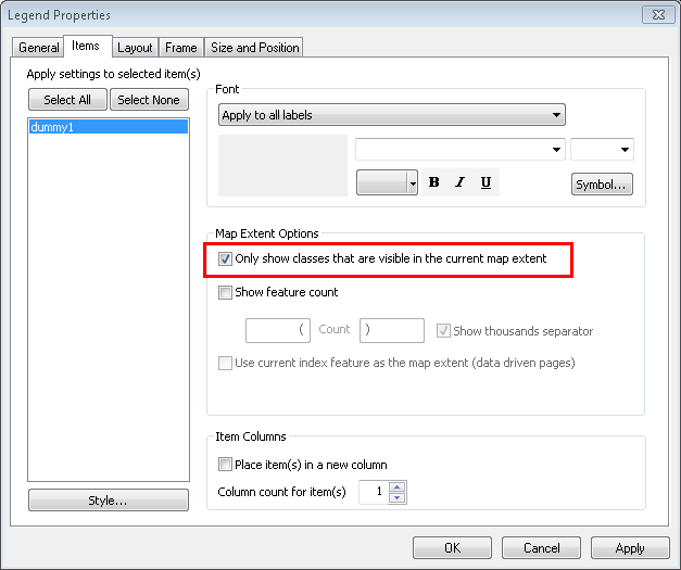
I have modified the Legend Properties in the MXD I am using for a Print Template to make sure that the box is checked next to "Only Show Classes Visible in the Current Map Extent". But, this does not seem to work as the printout still shows all the classes.
I have even separated the classes of the Feature Class in the Project MXD to be separate layers based on a Definition Query. Still get the same results.
Any ideas?