- Home
- :
- All Communities
- :
- Products
- :
- ArcGIS Enterprise
- :
- ArcGIS Enterprise Questions
- :
- Managing services
- Subscribe to RSS Feed
- Mark Topic as New
- Mark Topic as Read
- Float this Topic for Current User
- Bookmark
- Subscribe
- Mute
- Printer Friendly Page
Managing services
- Mark as New
- Bookmark
- Subscribe
- Mute
- Subscribe to RSS Feed
- Permalink
I'm researching how other entities organize and manage their enterprise map/feature services.
Specifically I’m looking for:
How do you organize and use folders on AGS?
By department?
By internal vs. external access?
By project?
By service types?
How do you address potential or actual duplicate services?
Do you provide Open Data map services and if yes, do you have similar map services elsewhere or try to steer your users to use the Open Data?
How do you organize services that need security vs. no security?
Any other useful best practice feedback is greatly appreciated!
- Mark as New
- Bookmark
- Subscribe
- Mute
- Subscribe to RSS Feed
- Permalink
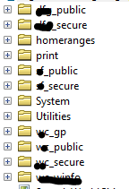
Although not perfect, for this current go around (still 10.2.2) I set the folders up for common (department wide) and also by division. Each group has a _public (non-secure) and a _secure folder. Many of the _secure folders are still empty. Services like basemaps are in the dept_public folder.
How do you address potential or actual duplicate services?
always a possibility, but we don't have so many at this time (and limited number of users that can publish) so it is not an issue...yet.
Do you provide Open Data map services and if yes, do you have similar map services elsewhere or try to steer your users to use the Open Data?
We are not using Open Data maps services yet. We use a different spatial reference than the standard WMA.
How do you organize services that need security vs. no security?
For accessing secure services outside the firewall (web sites) I have a proxy setup.
We use HTTPS and have the SSL cert that goes with it, but do not have SSO setup yet, so can be a bit of a hassle. Things are generally working, so SSO is pushed down the list of priorities right now.
- Mark as New
- Bookmark
- Subscribe
- Mute
- Subscribe to RSS Feed
- Permalink
Rebecca you are always so helpful! Thank you!
- Mark as New
- Bookmark
- Subscribe
- Mute
- Subscribe to RSS Feed
- Permalink
Your welcome Venus. I'm not saying mine is the best solution however. So I'll be interested in seeing how overs (and you) organize their services. This format is different than I had 10.1 setup, but I do like it better. Problem is, of course, changing the structure broke many of our MXD links, which is why I'm trying to get my tools to work. (But that is another discussion).
BTW - that is generally how I have them set up....but still seem to whip up a few additional folders when their is enough unique data to warrant their own folder....like "homeranges" below....and sometimes for gp services (still working on how I want to manage those. Also, since we have several custom print gp services, I've created a special folder for those. Still a bit fluid in structure.
- Mark as New
- Bookmark
- Subscribe
- Mute
- Subscribe to RSS Feed
- Permalink
I have a similar structure right now but I didn't incorporate the _public and _secure so I will definitely add that to our best practices document. I also have what we consider "base map" data like our streets, parcels, city limits, council districts, etc. at the root level as well as having a Utilities and Custom Print Layout folder. I don't have any geoprocessing services (short of geocoder services) yet so I don't know if it would be necessary to create a department related _GP folder or one folder with all geoprocessing services?
Once again . . . thank you for your input!
- Mark as New
- Bookmark
- Subscribe
- Mute
- Subscribe to RSS Feed
- Permalink
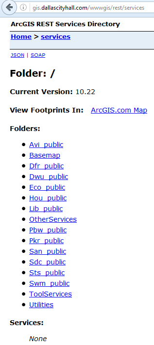
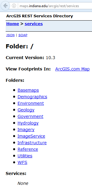
Now that map services are becoming more mainstream, I'm curious as to what people have done in regards to "map/feature service management so I'm reopening this question? How do you structure your "Folders" and "Services"? I recently started researching this again and the structures are all over the map (he, he, he, get it ... GIS ... all over the map). Anyways here is what I've found:
Some are "Category" focused:
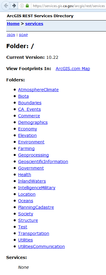
Some are "Department" focused:
Some don't use "Folders":
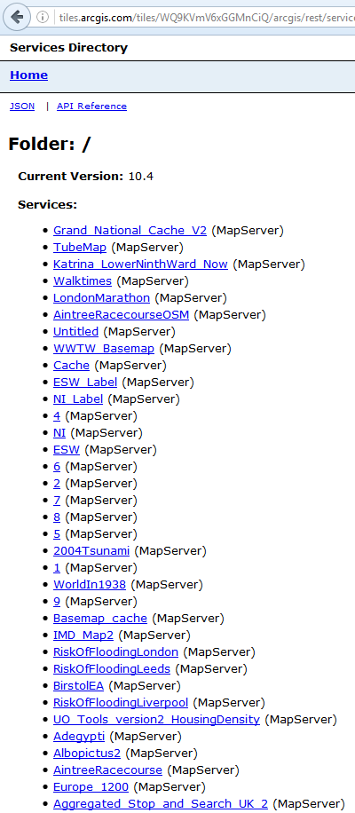
Some don't use "Services" and put everything in folders:
I'd like to know the pro's and con's of each of these and also what you folks do with "secured" services? Rebecca Strauch, GISP I'd be curious if you kept the structure you initially started configuring as well?
- Mark as New
- Bookmark
- Subscribe
- Mute
- Subscribe to RSS Feed
- Permalink
Hi Venus. Although we have added a few more folder, at least at this point we are handling is about the same. I don't see us changing our structure anytime soon, since you get to a point where too many things rely on the path, but I'll be curious to see if you get any other input from users.
Unlike some of the sample above, the agency owned data isn't as complicated enough to need a category structure, at this point. We do have basemap services, etc., but typically those are for in-house use for the convenience of our users, and for web maps/apps. I just keep those with the _public name and access them thru our non-secure web adaptor. Easier for me to keep track, but Ihave to admit, I think about it from the internal organization of things and not from the public user since in most cases they will be going thru some other gui. But, again, "we" may rethink that as we get more services/data online.
I know I am struggling right now on getting OpenData to use/access our secure services since there is no way for it to reference our local proxy file. So trying to change things behind the scenes, and that may change (add to) our structure.
- Mark as New
- Bookmark
- Subscribe
- Mute
- Subscribe to RSS Feed
- Permalink
Good information Becky! We need to consolidate some map/feature services here and I'm using the GeoJobe tool to determine what webmaps are using what services (even internally hosted ones) with their tool to perform an impact analysis of webmap/apps. Then I can determine if I can easily change the services structure if that's what we decide to do.
As usual girl, thanks for your feedback!