Turn on suggestions
Auto-suggest helps you quickly narrow down your search results by suggesting possible matches as you type.
Cancel
- Home
- :
- All Communities
- :
- Products
- :
- ArcGIS Enterprise
- :
- ArcGIS Enterprise Questions
- :
- Re: How to publish layer (lyr) with Geoprocessing ...
Options
- Subscribe to RSS Feed
- Mark Topic as New
- Mark Topic as Read
- Float this Topic for Current User
- Bookmark
- Subscribe
- Mute
- Printer Friendly Page
How to publish layer (lyr) with Geoprocessing tool to Arc Server?
Subscribe
1015
1
10-02-2020 08:54 AM
by
Anonymous User
Not applicable
10-02-2020
08:54 AM
- Mark as New
- Bookmark
- Subscribe
- Mute
- Subscribe to RSS Feed
- Permalink
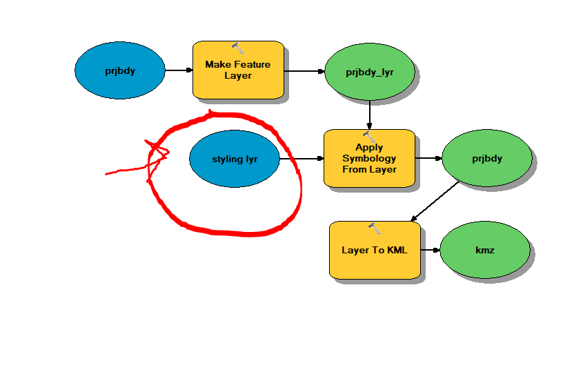
Basically I'm getting a WFS from out portal to export as a kmz in a widget in WAB. I've done this successfully, however I want to add symbology to it. It's pretty much useless without the symbology in it. My question is how do I get the styling layer to Arc Server? How do I run this GP tool successfully on my local computer and then publish it to Arc Server. I want the user to export a wfs layer to a kmz styled with WAB geoprocessing widget. Could someone help please? I've seen this question posted before with no replies.
Thanks!
1 Reply
by
Anonymous User
Not applicable
10-02-2020
01:06 PM
- Mark as New
- Bookmark
- Subscribe
- Mute
- Subscribe to RSS Feed
- Permalink
Actually this was pretty easy. Just have to register the folder on ArcGIS Server and make sure that the layer is in there.