- Home
- :
- All Communities
- :
- Products
- :
- ArcGIS Enterprise
- :
- ArcGIS Enterprise Questions
- :
- How can we monitor live positions by using smart p...
- Subscribe to RSS Feed
- Mark Topic as New
- Mark Topic as Read
- Float this Topic for Current User
- Bookmark
- Subscribe
- Mute
- Printer Friendly Page
How can we monitor live positions by using smart phones and ArcGIS web services?
- Mark as New
- Bookmark
- Subscribe
- Mute
- Subscribe to RSS Feed
- Permalink
We have an advanced web application in an ERP system called IFS Applications, where we can load map and feature services from ArcGIS. This enables the user to see work orders, assets and a lot more. Once linked to business objects, this is really powerful.
However, our customers often asks about live monitoring by using GPS in a mobile device (Android smart phone and Iphone). For example, in the same way as my family can monitor each others position by using Google Maps.
Example: An asset (pump, valve etc.) is broken and back office want to see the location of companies engineers by using those persons smart phones and Iphones. So, we need a map service with a layer showing live position of each mobile device.
Is there any easy out-of-the box solution for this?
- Mark as New
- Bookmark
- Subscribe
- Mute
- Subscribe to RSS Feed
- Permalink
You'll want to look into ArcGIS GeoEvent Server for real-time data. You can set up different connectors to ingest live data into GeoEvent and your GIS:
Input connectors—Real-time Data Feeds and Sensors (10.6) | ArcGIS Enterprise
Operations Dashboard would the application that lets you monitor real-time activities, (such as workers in the field):
Operations Dashboard for ArcGIS | Real-Time Data Visualization & Analytics
- Mark as New
- Bookmark
- Subscribe
- Mute
- Subscribe to RSS Feed
- Permalink
Ok, so it also requires the customer to also install the ArcGIS GeoEvent server and then configure it to feed positions to the map service. There is no other solution. GeoEvent server must be used. I was hoping for a somewhat easier setup, like installing an App on the smartphone and configure it to start feeding GPS positions, to a web service on ArcGIS online or portal. Anyway, thanks for the detailed answer and useful links.
- Mark as New
- Bookmark
- Subscribe
- Mute
- Subscribe to RSS Feed
- Permalink
Johan,
You may want to look at Workforce for ArcGIS. It works with both ArcGIS Online and ArcGIS Enterprise and lets you integrate your work order system into ArcGIS and then take it out to the field on iOS and Android devices. Workforce has the concept of the Worker sharing their last known location so you can use this to monitor where your workers are (we built it to support dispatching unplanned work).
We are also in the process of building a new solution simply for location tracking. We showed a preview of it at the Users Conference this year and it writes data to the BDS (similar to GeoEvents). We plan to start a tech preview of it soon and current plans are to release in March of next year. Here is a short blog article on it: Location Tracking Debuted at Esri User Conference (July 2018)
Jeff
- Mark as New
- Bookmark
- Subscribe
- Mute
- Subscribe to RSS Feed
- Permalink
Jeff,
Thanks for sharing!
I'm in a learning process trying to understand possibilities and limitations.
So far I've only tried with the Collector App. It it works!
- But, It only reports the location when the user decide to sync. Else, the location will not be reported.
- It reports all locations, not only the last known location. I will try to figure out a way to filter to show only the last known locations. I know that it's possible do that in the Web App on ArcGIS online or Portal, but I want that filter to also have effect on the map service. Or if, I can figure out a way to filter the layer when loaded in IFS.
Anyway, the Collector App works and it proves that GeoEvent server might not always be needed, at least not for simple location tracking.
Later on, I will also have a look at Workforce for ArcGIS
//Johan
- Mark as New
- Bookmark
- Subscribe
- Mute
- Subscribe to RSS Feed
- Permalink
Johan,
I'm not sure whether this is going to help you in this case (since I don't know all the details). Just in case this helps or give you some kind of guidance....
If your location data are stored in an enterprise database, you can use core database functionality to visualize latest position via a query layer as it is described in this blog post.
- Mark as New
- Bookmark
- Subscribe
- Mute
- Subscribe to RSS Feed
- Permalink
FYI Johan,
In case you haven't seen this, https://community.esri.com/groups/workforce-for-arcgis/blog/2018/09/21/uc-tech-session-workforce-for... - the session gives a nice overview of the app and workflows.
Hope this helps,
- Mark as New
- Bookmark
- Subscribe
- Mute
- Subscribe to RSS Feed
- Permalink
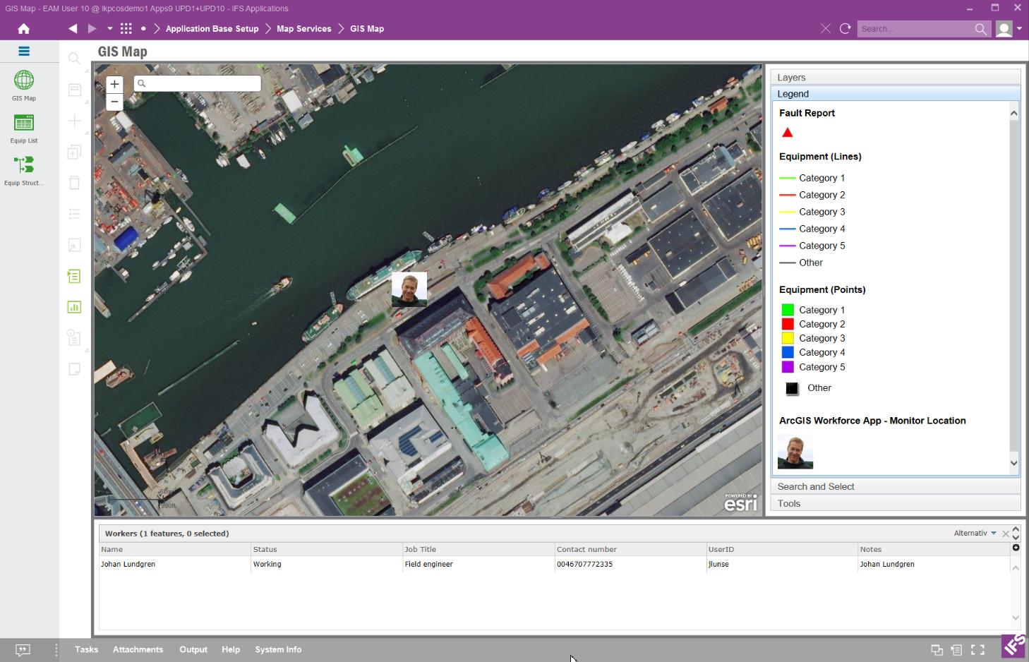
The Workforce app works fine. It automatically reports the last know location. It creates a feature service with a layer that I can use. Here is a screenshot where I show the feature layer in IFS. I changed the symbol to use a picture.