- Home
- :
- All Communities
- :
- Products
- :
- ArcGIS Enterprise
- :
- ArcGIS Enterprise Questions
- :
- Re: csv format line requirement
- Subscribe to RSS Feed
- Mark Topic as New
- Mark Topic as Read
- Float this Topic for Current User
- Bookmark
- Subscribe
- Mute
- Printer Friendly Page
csv format line requirement
- Mark as New
- Bookmark
- Subscribe
- Mute
- Subscribe to RSS Feed
- Permalink
Hello everyone, I would like to ask a question. I need a csv format line data when conducting GA big data analysis. Does arcgis enterprise big data support csv line data? If it is supported, what are the requirements of the header field and what is the format?
- Mark as New
- Bookmark
- Subscribe
- Mute
- Subscribe to RSS Feed
- Permalink
Hi Guo,
CSV files are supported for big data file shares. You will just need a header, which will represent your field names. Take a look at the following help document about formatting the folder structure:
Get started with big data file shares—Documentation | ArcGIS Enterprise
- Mark as New
- Bookmark
- Subscribe
- Mute
- Subscribe to RSS Feed
- Permalink
Hi guomimi,
A bit more information (and some questions) in addition to jskinner-esristaff's reply.
GeoAnalytics supports points, lines, polygons and tables formats for big data file shares. There isn't a strict requirement for the headers, but the headers are used when you generate the manifest to try and automatically determine which fields represent geometry and/or time. So if you want to add a header, I would recommend a single row, name it with headings that makes sense, don't have a space in the header names, and if you have time or geometry fields name them time or geometry.
When you register the manifest GeoAnalytics will do a best guess to figure out the geometry field and format. If you have something a bit more complex, you may need to edit the manifest yourself.
What version of Enterprise are you using, and how are you line geometries stored in the CSV? WKT? something else?
Looking forward to seeing how that goes,
Sarah Ambrose
Product Engineer, GeoAnalytics
- Mark as New
- Bookmark
- Subscribe
- Mute
- Subscribe to RSS Feed
- Permalink
I'm sorry, probably I didn't describe it clearly.I know that GeoAnalytics supports dot-lines and tables, I mean the title of the csv format that represents line data or polygon data. Please see attachment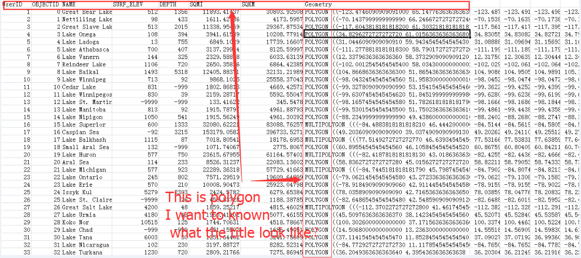
- Mark as New
- Bookmark
- Subscribe
- Mute
- Subscribe to RSS Feed
- Permalink
you have the geometry highlighted in black for Lake Onega
but I suspect that isn't what you are looking for either
- Mark as New
- Bookmark
- Subscribe
- Mute
- Subscribe to RSS Feed
- Permalink
Hi GUO MEILING,
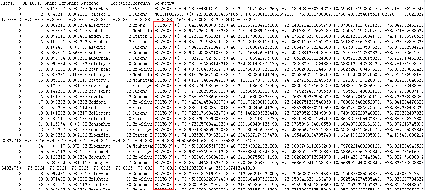
That csv should work as is. When you register the big data file share, the generation process will identify the field as the geometry, because it's labelled as "Geometry" in your table. Is that not working for you?
If it's not, can you please confirm your folder structure of the datasets in your big data file share? And what the manifest for this dataset looks like.
With that information, we can figure out if there is a problem.
Thanks,
Sarah
- Mark as New
- Bookmark
- Subscribe
- Mute
- Subscribe to RSS Feed
- Permalink
I have a csv of point,it woks.This is a csv of polygon,It didn't woks.so I guess if there is a problem with the header?
Perhaps our way of thinking is not the same as the form of presentation, so I feel that we have had some difficulties in communication. But still thank you very much for your patience.

- Mark as New
- Bookmark
- Subscribe
- Mute
- Subscribe to RSS Feed
- Permalink
Hi guomimi,
The way it is set up should currently work - you do not need to change your headers. Can you please either tell me what the manifest shows when you try and register it? Or send a sample of the data (just the first 20 lines or so) to [email protected], and let me know what version you are using (ArcGIS 10.6?)
Thanks,
Sarah
- Mark as New
- Bookmark
- Subscribe
- Mute
- Subscribe to RSS Feed
- Permalink
The Enterprise version is 10.5
- Mark as New
- Bookmark
- Subscribe
- Mute
- Subscribe to RSS Feed
- Permalink
Thanks GUO MEILING,
Please let me know when you are able to answer the questions above. Either:
A. What the manifest looks like when you are registering it. In addition, what happens when you manually pick the geometry field and try and run a tool using that.
or
B. Are able to send a sample of the manifest.
Once you're able to provide that information, we can begin trouble shooting.
Looking forward to it,
Sarah