- Home
- :
- All Communities
- :
- Products
- :
- ArcGIS Enterprise
- :
- ArcGIS Enterprise Questions
- :
- Re: Configuration for Arcgis for Maritime: Server
- Subscribe to RSS Feed
- Mark Topic as New
- Mark Topic as Read
- Float this Topic for Current User
- Bookmark
- Subscribe
- Mute
- Printer Friendly Page
Configuration for Arcgis for Maritime: Server
- Mark as New
- Bookmark
- Subscribe
- Mute
- Subscribe to RSS Feed
- Permalink
I am having trouble with the initial configuration of Arcgis for Maritime on our new install of ArcGIS Enterprise 10.6.1. I am following the steps here: Configuring ArcGIS for Maritime: Server—Mapping and Charting Solutions for Server Installation Guide...
It fails and creates an error report.dmp at step 15 when I try and restart the service with the Maritime Chart Service enabled in the capabilities.
I assume it fails because I need to set the service to run on low isolation, but when I follow these steps for doing that Setting Maritime Chart Service properties—Documentation | ArcGIS Enterprise I don't have an option to Edit under Supported Operations. How can I set the service to low isolation in 10.6?
- Mark as New
- Bookmark
- Subscribe
- Mute
- Subscribe to RSS Feed
- Permalink
Thanks for reporting a failure on trying to restart the service with Maritime Chart Service enabled in the capabilities. Happy to troubleshoot this issue. Please follow below workaround step to resolve this issue with 10.6.1 and let us know if this issue still occurs.
- The workaround is to have the dataset path set correctly and ensure that there is data in the datasets folder.
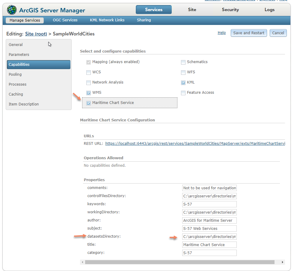
- Please Install ‘MappingandChartingServer1061Patch3.msp ’from https://support.esri.com/en/download/7687 and follow upgrade steps to have latest changes.
- Mark as New
- Bookmark
- Subscribe
- Mute
- Subscribe to RSS Feed
- Permalink
Thanks for the response. We are only using this extension to deploy product on demand via our server infrastructure, and not for maritime products either, so we don't have any S-57 data to put in the datasets folder. Is this the correct approach when trying to set up PoD?
- Mark as New
- Bookmark
- Subscribe
- Mute
- Subscribe to RSS Feed
- Permalink
Hi Jill,
The maritime PoD requires the use of S-57 datasets. These datasets provide the map content, and are delivered to PoD via the Maritime Chart Service, so they essentially go hand-in-hand. You cannot have a Maritime PoD without S-57 datasets.
If you are looking for a PoD that does not require the use of maritime data, then you can use the Civilian Topographic Mapping PoD, which instead uses a geodatabase to provide the map content.
- Mark as New
- Bookmark
- Subscribe
- Mute
- Subscribe to RSS Feed
- Permalink
Hi Craig,
I guess I should explain what I am actually trying to do is use the Defence Mapping for Server to create PoD using the defence mapping templates. The only PoD setup information I could find in the documentation was in ArcGIS for Maritime so I thought that was the approach to take, beacuse it was all installed as part of the Mapping and Charting Solutions for Server. So I guess a better question is: how to I set up Product on Demand using Defence Mapping templates?
- Mark as New
- Bookmark
- Subscribe
- Mute
- Subscribe to RSS Feed
- Permalink
Hi Jill,
I am with the Defense Mapping team. If you have Esri Production Mapping for Server and Esri Defense Mapping for Server installed, you should have a DeploymentGuide.pdf located at C:\Program Files\ArcGIS\EsriDefenseMappingServer\Server10.7\Applications\ProductOnDemand. This document will take you through the process of setting up the application for Defense Mapping.
Please feel free to contact me with any specific questions at [email protected].
Thanks,
Jeremiah Moore