- Home
- :
- All Communities
- :
- Products
- :
- ArcGIS Enterprise
- :
- ArcGIS Enterprise Questions
- :
- Cached services appear at all scales but not lim...
- Subscribe to RSS Feed
- Mark Topic as New
- Mark Topic as Read
- Float this Topic for Current User
- Bookmark
- Subscribe
- Mute
- Printer Friendly Page
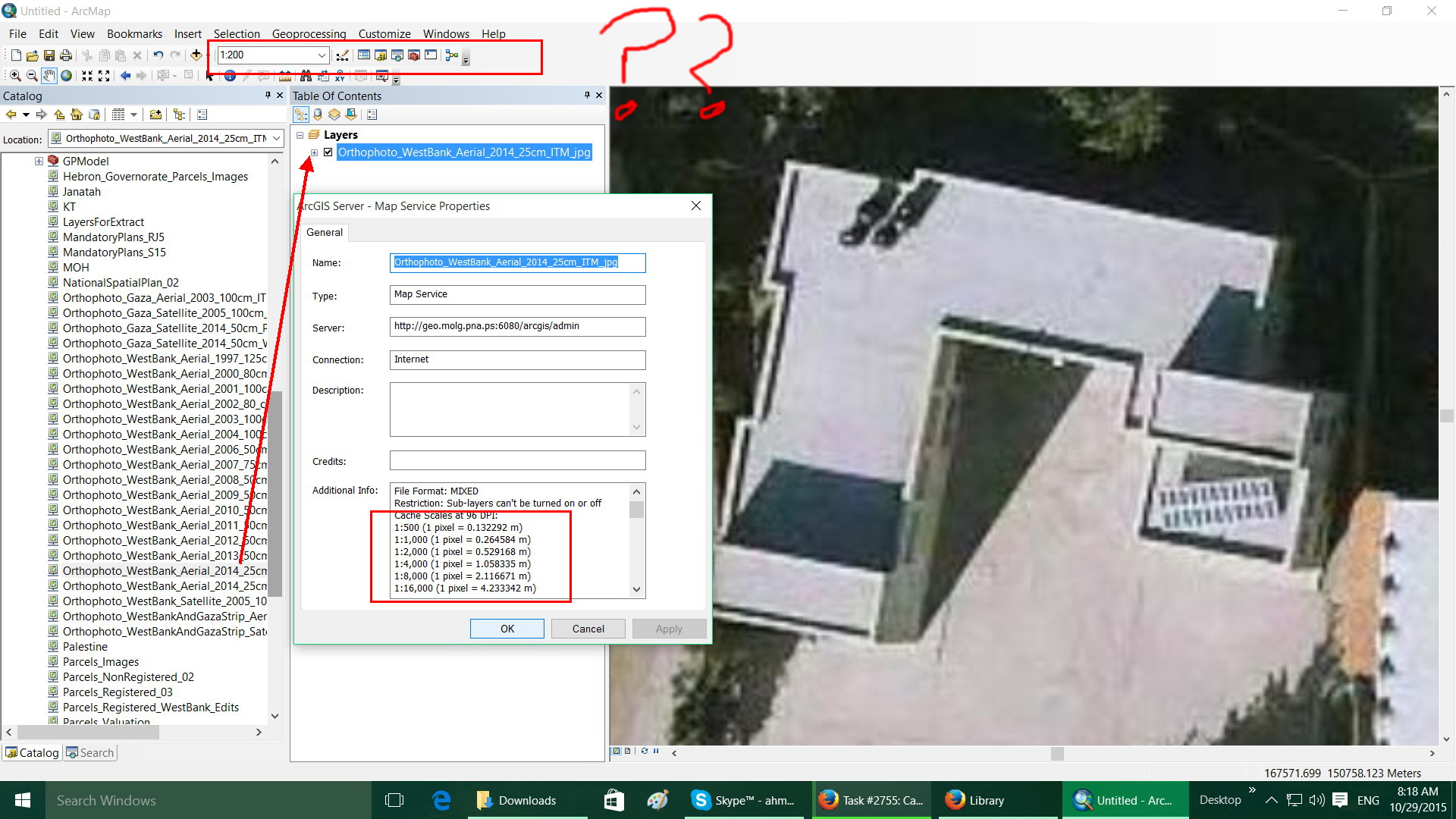
Cached services appear at all scales but not limited to the cache scales
- Mark as New
- Bookmark
- Subscribe
- Mute
- Subscribe to RSS Feed
- Permalink
Cached services appear at all scales but not limited to the cache scales
Hello All,
Can anyone give an explanation why the Cached services appear at all scales but not limited to the cache scales, for example I have an MXD file that was published and then cached on scales between 2000000 to 500, but why I can zoom to the scale 200? Also the service is cached at the scale 1000 and then 500, why I can view or zoom to 800 or 700 or whatever are these scales cached or displayed form the service without caching??!
Best Regards,
Ahmad
- Mark as New
- Bookmark
- Subscribe
- Mute
- Subscribe to RSS Feed
- Permalink
ArcGIS Desktop will keep zooming in on the cache level tile between levels, unless you set your zoom scales to match that of the service cache levels. You will see that there is some pixelation between cache levels, because the layer is only cached at specified zoom levels.
To change the zoom levels in ArcMap, click on the scale dropdown and select <Customize This List>. The resulting dialog box allows you to load specified zoom levels.
- Mark as New
- Bookmark
- Subscribe
- Mute
- Subscribe to RSS Feed
- Permalink
Hi FC Basson,
But why ArcGIS Desktop will keep zooming in on the cache level tile between levels ! Form where it loads the tiles between the cached scales?
Many thanks,
Ahmad Saleh
- Mark as New
- Bookmark
- Subscribe
- Mute
- Subscribe to RSS Feed
- Permalink
ArcMap is designed to do this since typically, if you are using ArcMap you do not want a blank map when between cached scales when zooming in and out....especially if editing. It will interperlate between the scales. So the "why" is because it is designed that way to give the Desktop user the flexibility and features they need when viewing/editing.
The scales do come into play if using for web mapping for example.
- Mark as New
- Bookmark
- Subscribe
- Mute
- Subscribe to RSS Feed
- Permalink
Hi Rebbecca
“It will interpolate between the scales”, is these interpolated scales cached or not? I know that they are not cached, but they really behave as they are cached “Tiled”. As you zoom to them the image behave as it’s cached at that scale –the image is loaded quickly as tiles- which is weird for me. I know that this question seems as a luxury, but I have curiosity in how the program work.
Many thanks,
Ahmad Saleh
- Mark as New
- Bookmark
- Subscribe
- Mute
- Subscribe to RSS Feed
- Permalink
Hi Ahmad,
Sorry, I really don't know the behind the scenes technical workings of how it does it, but my guess is it's pretty much the same as if you zoom into a photo. It us not improving the image as much as it us just showing it at a different scale? I may be wrong about that, but I don't think it goes to the raw data for display (and if it does, hopefully some one will correct me).
In any case, the da game that it draws like it is cached in ArcMap (i.e.fast) is a good thing. If you service allows the user to cache locally, if they revisit the same area again, it should be even faster since it will be on their machine.
As a side note, keep in mind that when printing with a cached basemap, it will not necessarily be "what you see is what you get". Unfortately it's been a while since I've printed with the has emails (someone else creates the maps now), but I remember that, let's say on scene you are at a scale 1:200 ( keeping it simple) and have cached scales of 1:100 and 1:300. On screen it may look good, and or moving the window slightly, or zoomin in/out may improve it. I'm not sure how/when it decides to show an image interpolated from either cache....but when printing, it may be the other scale. Sometimes, moving the extent over a couple meters changes to outcome.