- Home
- :
- All Communities
- :
- Products
- :
- ArcGIS Enterprise
- :
- ArcGIS Enterprise Questions
- :
- Re: “build overviews” for a mosaic generates black...
- Subscribe to RSS Feed
- Mark Topic as New
- Mark Topic as Read
- Float this Topic for Current User
- Bookmark
- Subscribe
- Mute
- Printer Friendly Page
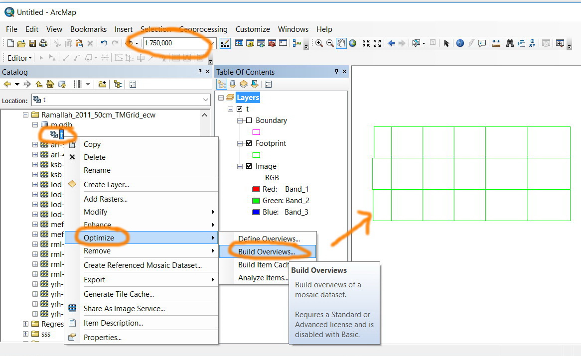
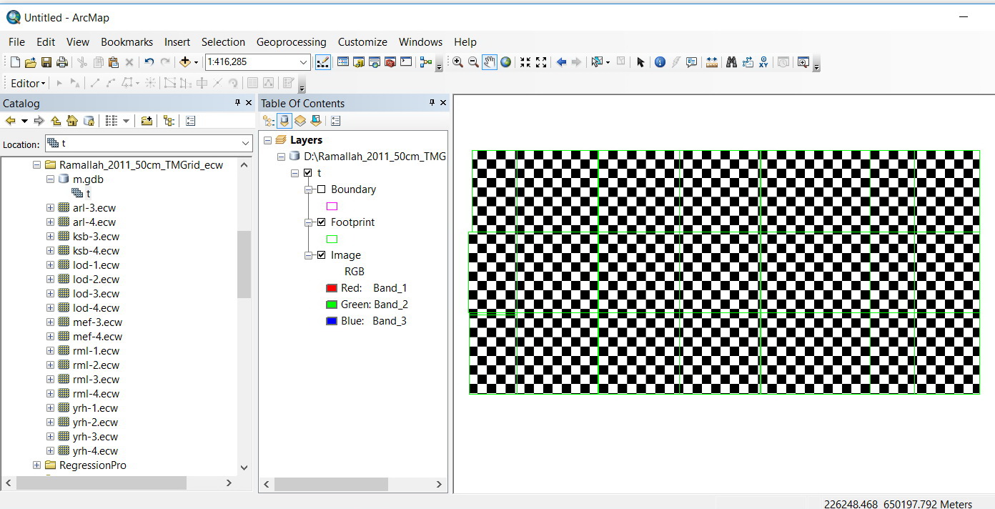
“build overviews” for a mosaic generates black\while tiles
- Mark as New
- Bookmark
- Subscribe
- Mute
- Subscribe to RSS Feed
- Permalink
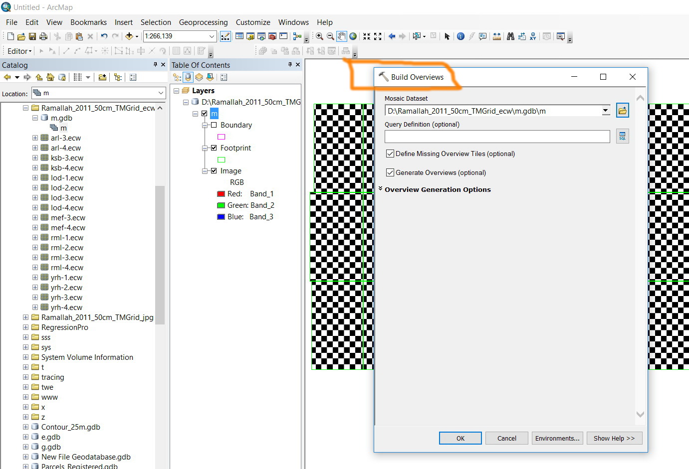
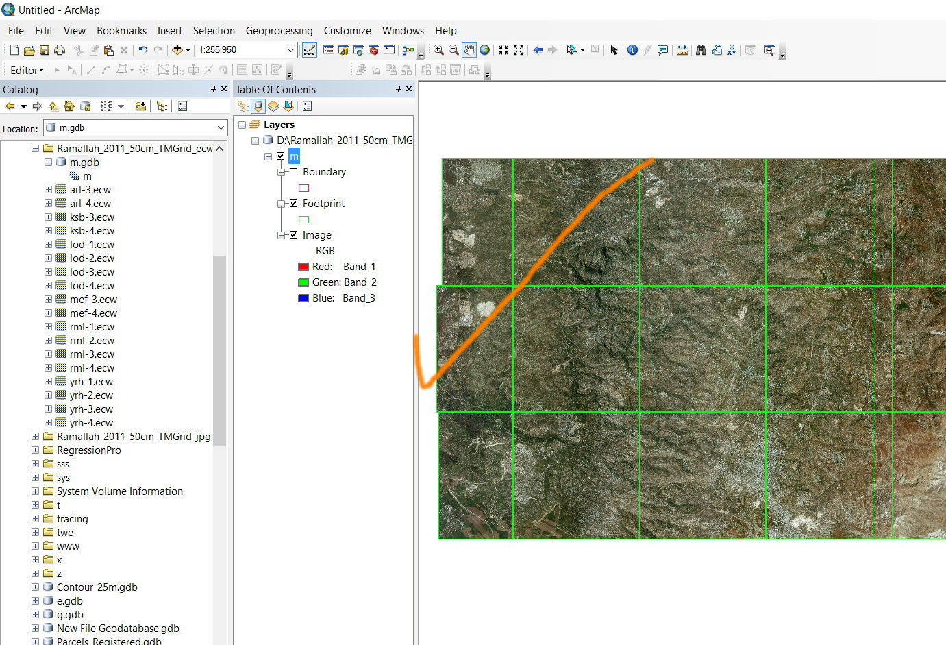
Applying “build overviews” for a mosaic generates black\while tiles,
For example, in the screenshots below, in order to let the mosaic appear in all scales, the “build overviews” is applied. However, this generates black\while tiles.
How this might be resolved?
Thank you
Best
Jamal
Jamal Numan
Geomolg Geoportal for Spatial Information
Ramallah, West Bank, Palestine
Solved! Go to Solution.
- Mark as New
- Bookmark
- Subscribe
- Mute
- Subscribe to RSS Feed
- Permalink
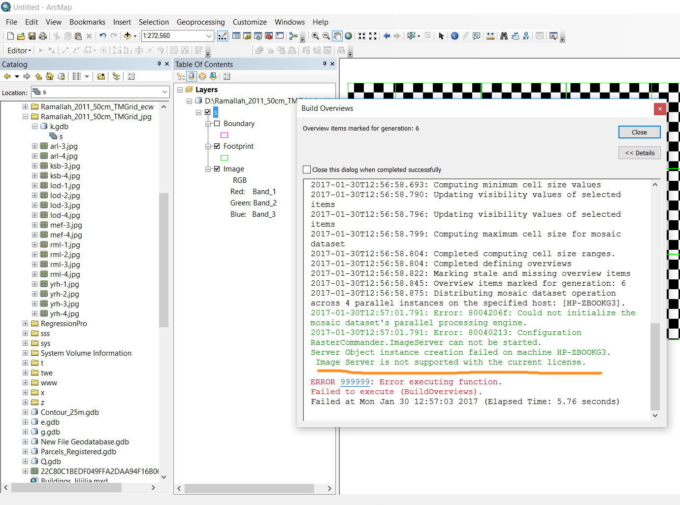
Sorry. I just observed that the “build overviews” ends with error.
Do I really need a server license to apply the “build overviews”?
Jamal Numan
Geomolg Geoportal for Spatial Information
Ramallah, West Bank, Palestine
- Mark as New
- Bookmark
- Subscribe
- Mute
- Subscribe to RSS Feed
- Permalink
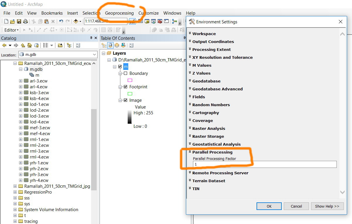
Hi
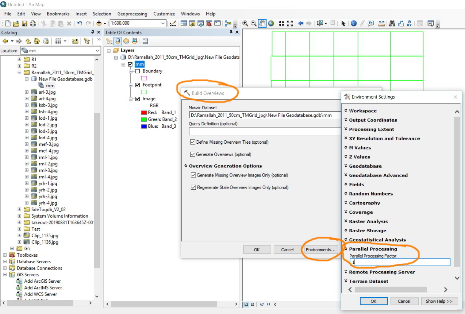
No you really dot need a server license, try to go to geoprocessing menu > Environments then go to Parallel processing set the parallel processing factor to 1. Then try to build the overviews again.
.png)
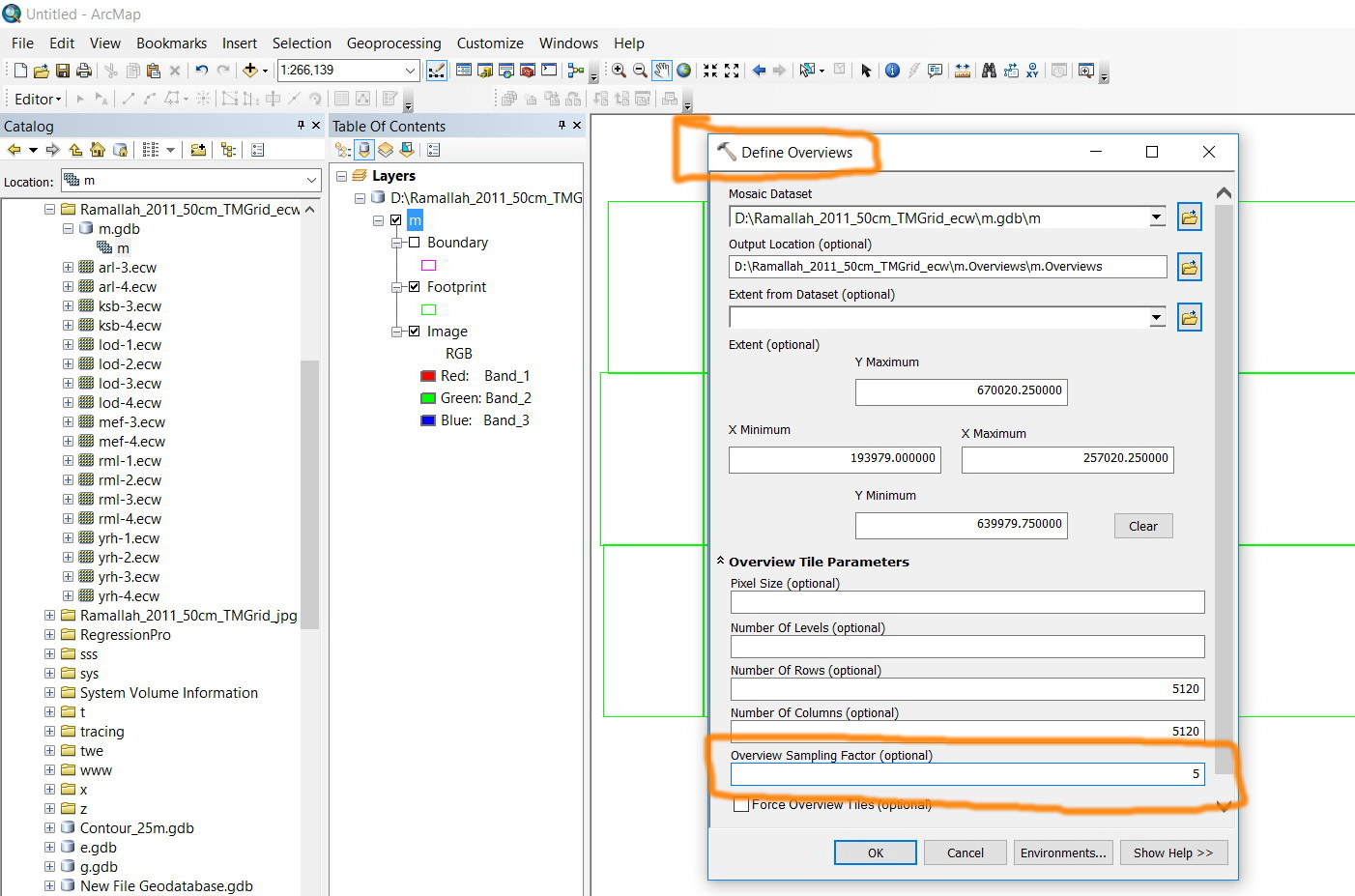
please be aware that you need to build the mosaic overviews when you change the overview sampling factor from 3 to 5, this is related for my previous answer and has nothing to do with the server license issue.
Thanks
- Mark as New
- Bookmark
- Subscribe
- Mute
- Subscribe to RSS Feed
- Permalink
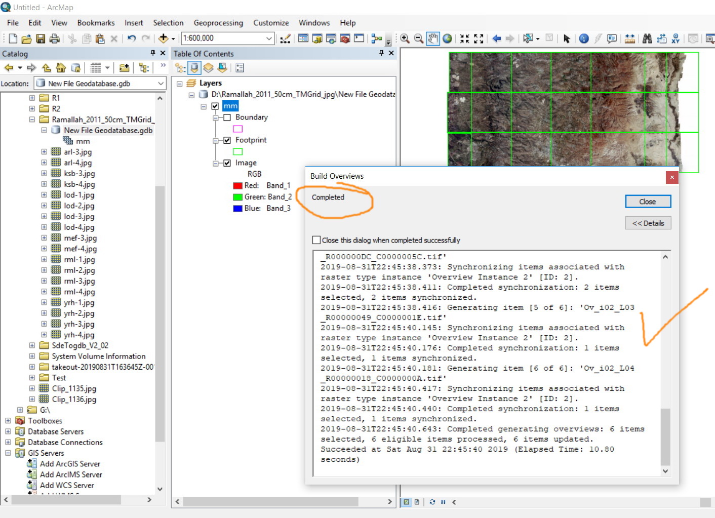
I have tested the issue with your data and its working fine with me when stetting the parallel processing factor to 1
.png)
thanks,
ahmad
- Mark as New
- Bookmark
- Subscribe
- Mute
- Subscribe to RSS Feed
- Permalink
Thanks Ahmad. It works as a charm.
Jamal Numan
Geomolg Geoportal for Spatial Information
Ramallah, West Bank, Palestine
- Mark as New
- Bookmark
- Subscribe
- Mute
- Subscribe to RSS Feed
- Permalink
This works fine in ArcMap 10.6.1
Jamal Numan
Geomolg Geoportal for Spatial Information
Ramallah, West Bank, Palestine
- Mark as New
- Bookmark
- Subscribe
- Mute
- Subscribe to RSS Feed
- Permalink
I also get this checkerboard visualization but for a different reason. My raster is stored on a server share but on my desktop, I connect to it via a letter drive connection (eg. E:/). My apps and services connect to the server address (eg. //10.1.1.2/data) so after I've added my rasters, I need to "Repair Mosaic Dataset Paths" using the geoprocessing tool and give it the server path.
- « Previous
-
- 1
- 2
- Next »
- « Previous
-
- 1
- 2
- Next »