- Home
- :
- All Communities
- :
- Products
- :
- ArcGIS Enterprise
- :
- ArcGIS Enterprise Questions
- :
- Re: ArcGIS Server 10.7.1: What is the best practic...
- Subscribe to RSS Feed
- Mark Topic as New
- Mark Topic as Read
- Float this Topic for Current User
- Bookmark
- Subscribe
- Mute
- Printer Friendly Page
ArcGIS Server 10.7.1: What is the best practice to improve the performance of a versioned geodatabase feature class?
- Mark as New
- Bookmark
- Subscribe
- Mute
- Subscribe to RSS Feed
- Permalink
- Report Inappropriate Content
ArcGIS Server 10.7.1: What is the best practice to improve the performance of a versioned geodatabase feature class?
I couldn’t figure out the best practice to improve the performance of a versioned geodatabase feature class.
Jamal Numan
Geomolg Geoportal for Spatial Information
Ramallah, West Bank, Palestine
- Mark as New
- Bookmark
- Subscribe
- Mute
- Subscribe to RSS Feed
- Permalink
- Report Inappropriate Content
Are you working with branched or traditional versioning?
- Mark as New
- Bookmark
- Subscribe
- Mute
- Subscribe to RSS Feed
- Permalink
- Report Inappropriate Content
Traditional! but what if it's branched?
Jamal Numan
Geomolg Geoportal for Spatial Information
Ramallah, West Bank, Palestine
- Mark as New
- Bookmark
- Subscribe
- Mute
- Subscribe to RSS Feed
- Permalink
- Report Inappropriate Content
Hi Jamal
I think if you are going to use map/feature services, you might need to have a look at branch versioning.
Editing and Administration with Branch Versioning – It’s Showtime!
Regards,
Bing
- Mark as New
- Bookmark
- Subscribe
- Mute
- Subscribe to RSS Feed
- Permalink
- Report Inappropriate Content
Hi Jamal,
to answer your original question
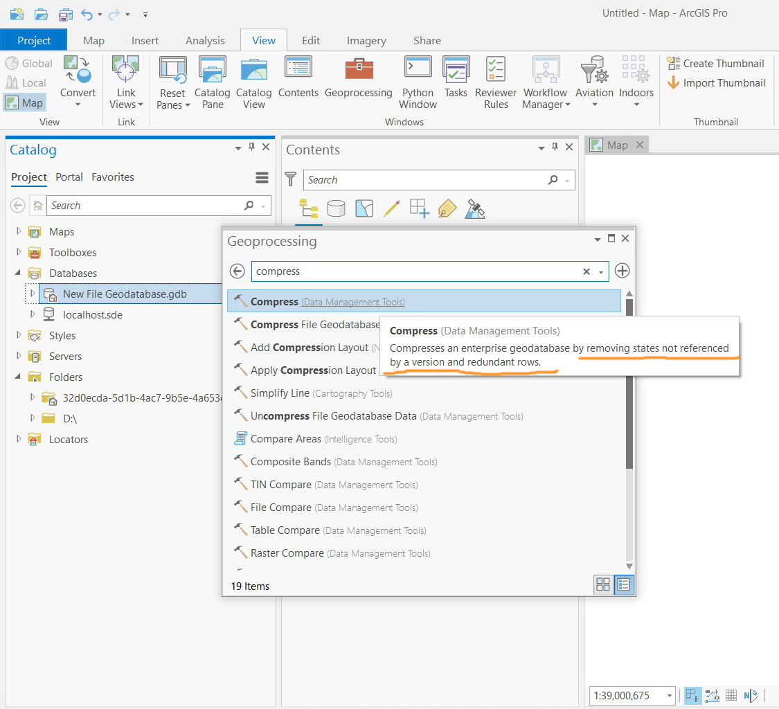
hands down the most important thing you can do to keep the performance optimized for your traditionally versioned geodatabase is to introduce a regime of reconcile, compress and rebuild statistics. (ideally as a scheduled python script)
If you dont do this, the state_lineage tree that determines the number of internal datatabase queries (between the sde_states, sde_state_lineage and the base+A&D tables that make up the versioned feature class) that are required to return the "current" value of your feature classes can become enormous, particularly if the class is being edited frequently.
I have seen sites where there was no compress happening for months and once performed, queries dropped from minutes to sub-second.
- Mark as New
- Bookmark
- Subscribe
- Mute
- Subscribe to RSS Feed
- Permalink
- Report Inappropriate Content
Many thanks David for the help.
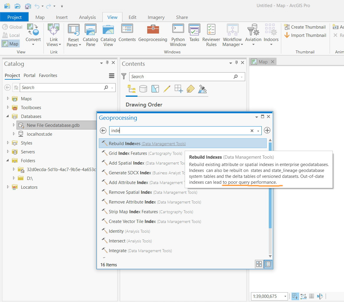
How about “rebuild indexes” tool? Has it something to do with enhancing the performance of the a versioned feature class?

Jamal Numan
Geomolg Geoportal for Spatial Information
Ramallah, West Bank, Palestine
- Mark as New
- Bookmark
- Subscribe
- Mute
- Subscribe to RSS Feed
- Permalink
- Report Inappropriate Content
Here is the recommend workflow David references: Recommended traditional version administration workflow—ArcGIS Pro | Documentation
Here is the script to run the process: Using Python scripting to batch reconcile and post traditional versions—ArcGIS Pro | Documentation
In my experience running all the tools in the order above for both the SDE and Data Owners schemas are beneficial for performance.
- Mark as New
- Bookmark
- Subscribe
- Mute
- Subscribe to RSS Feed
- Permalink
- Report Inappropriate Content
Thanks George
I couldn’t figure out which tools are doing what!
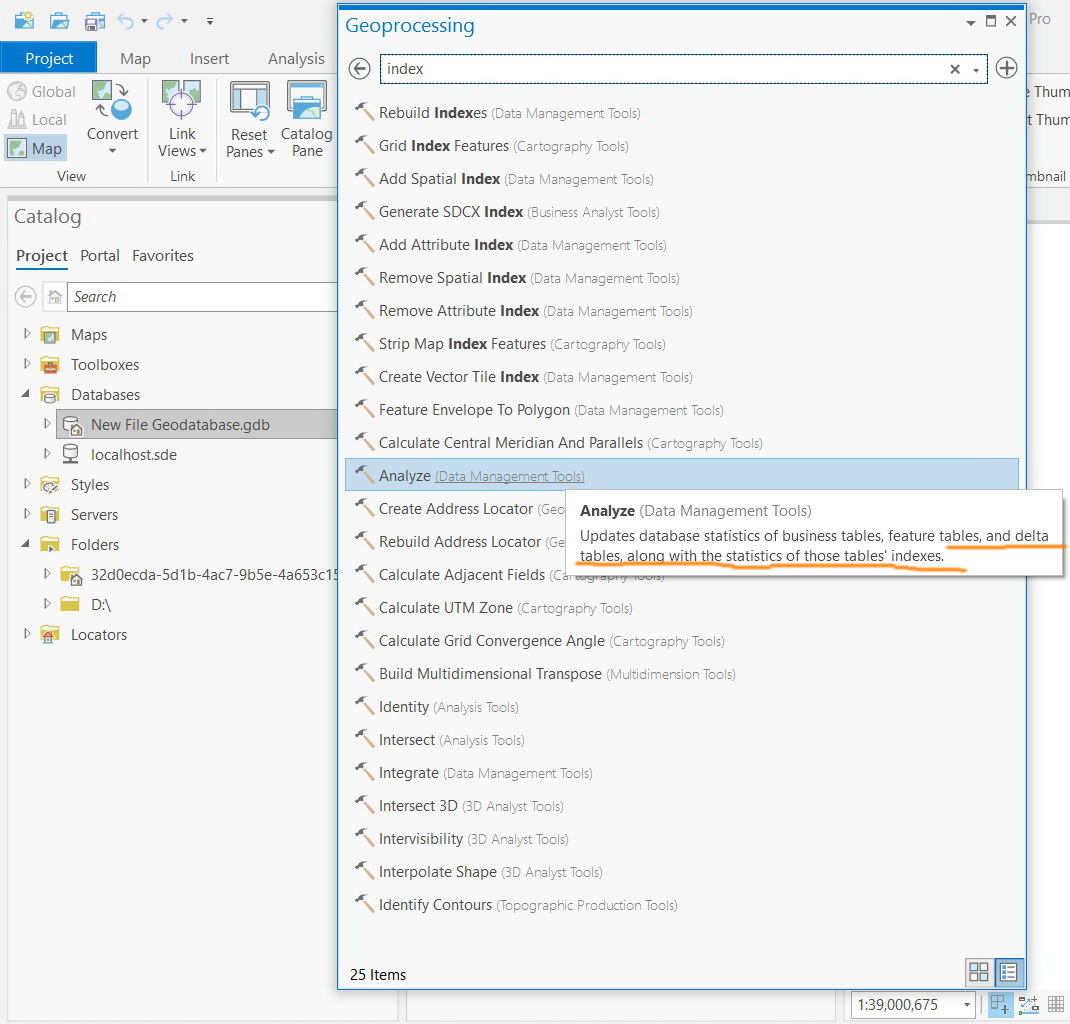
Which tools are used to improve the display performance? As I got from the material, this is the function of analyze, and compress
Which tools are used to improve the query performance? This is the function of “rebuild indexes” tool
Am I right?
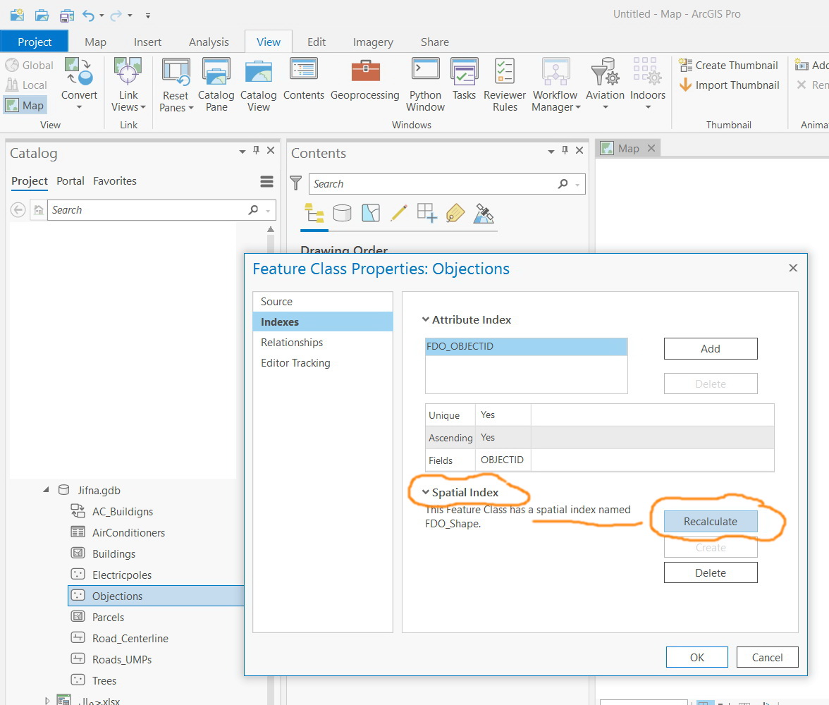
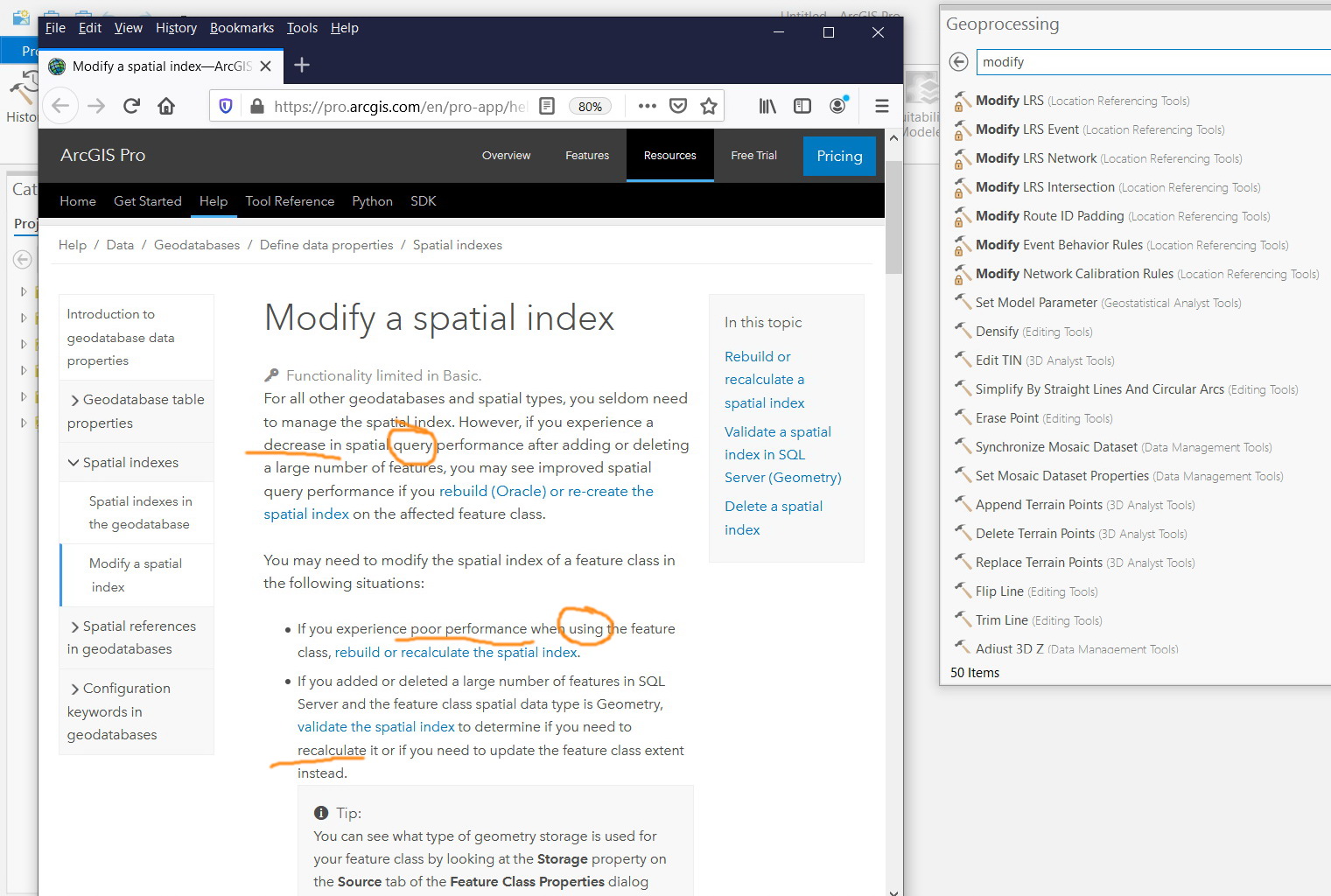
But how the “rebuild indexes” tool is different from “recalculate spatial index”? is the “recalculate spatial index” available as Geoprocessing tool?
Jamal Numan
Geomolg Geoportal for Spatial Information
Ramallah, West Bank, Palestine
- Mark as New
- Bookmark
- Subscribe
- Mute
- Subscribe to RSS Feed
- Permalink
- Report Inappropriate Content
Rebuild indexes also rebuilds attribute indexes, if present. I think that all of the tools together improve performance. There are times when a single tool (indexes or statistics) will improve the performance but hard to know when. If you keep the maintenance up-to date then that is the best performance you can get.
Recalculate Spatial Index - Modify a spatial index—ArcGIS Pro | Documentation
Now note that there may be other causes of poor performance besides the Enterprise Geodatabase, i.e. server / network / client issues.
- Mark as New
- Bookmark
- Subscribe
- Mute
- Subscribe to RSS Feed
- Permalink
- Report Inappropriate Content
Sure I see.
Is it more accurate to say that compress and analyze are for improving display performance while “rebuild indexes” are for improving query performance?
Jamal Numan
Geomolg Geoportal for Spatial Information
Ramallah, West Bank, Palestine